Alert
Alerts
Randonnée - les étangs du girmont


IGN cards


Description
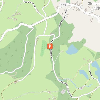
Access: From Remiremont, take the Val-d'Ajol road and after 2 km, turn left towards Girmont-Val-d'Ajol. Parking: Park in the large car park near the courtyard.
Distance: 10 km / Duration: 3 h 30 / Difference in height: 250 m / Marking: green ring.
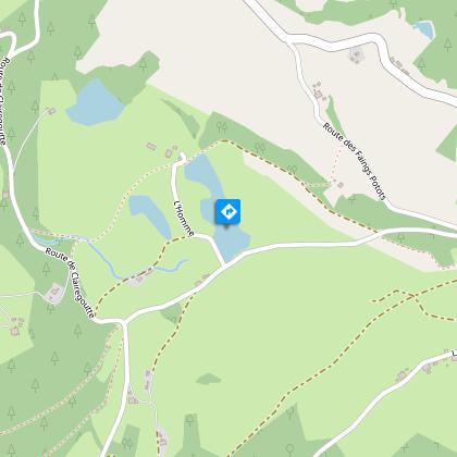
1) Start from the information panel in the centre of Girmont-Val-d'Ajol. For 1 km, follow the small road that passes in front of the Saint-Vallier inn (large plantation of Vosges bluets visible from the terrace).
2) Turn left and take a gentle slope to the ponds of Corfaing located on the plateau. Towards the farm, go round the last pond on the left and keep to the edge of the forest (view of the ponds).
3) Cross the road, the path continues along the edge. Follow a new road on the right for 200m. Turn left onto a gravel path that enters the forest. The path follows a fence, bends at right angles and then bends further to the right as it descends slightly to a new road (picnic area).
4) Cross the road and follow a carriageway that runs at an angle. After the pond dam (Houillon pond), turn left. Cross the dam of a second pond in the middle of the woods and continue on the right-hand path between two hedges. Take a wider path on the right.
5) Turn left after 500m, at the junction with the signposted circuit n°21. Walk along the pond of La Mollière (former peat bog). Possibility of an immediate return to the village by the tarmac road (not signposted).
6) Go down to the right just after a chalet and follow the edge of a forest to cross the Géhard stream (log bridge sometimes slippery or damaged by floods). Head for the bottom of the valley and take a very short steep path on the right, crossing a road. The path stays flat for a while before plunging over the Géhard waterfall.
7) After visiting the waterfall, head back towards the village, following the tarmac road for 800m and then an often wet path to the left up the hill. Finally a last stretch of road and the village bell tower appears straight ahead.
Technical Information
Altimetric profile
Starting point
Points of interest

Additional information
Producteur de la donnée
Ces informations sont issues de la plateforme SITLOR - Système d’Information Touristique - Lorraine
Elles sont synchronisées dans le cadre du partenariat entre Cirkwi, l’Agence régionale du Tourisme Grand Est et les membres du comité technique de Sitlor.
Contact
Tel : 03 29 62 23 70
Email : remiremont@otrp.fr
Data author
