Alert
Alerts
Randonnée - le Saint-Mont par le vieux Saint-amé
Description
Access: From St-Etienne-lès-Remiremont, at the roundabout in the centre, towards the mobile police station.
Parking: Park in the car park near the mobile police station.
Distance: 6 km / Duration: 2 h 30 / Difference in altitude: 350 m / Signs: blue easel, red ring, red triangle.
From the Gendarmerie Mobile in Saint-Étienne-lès-Remiremont, take the road upwards. At the first intersection, turn right onto the road marked with a blue signpost, which runs alongside the houses. Once you reach the car park, take the left-hand path into the forest, then 50m further on, turn right onto the path that climbs up.
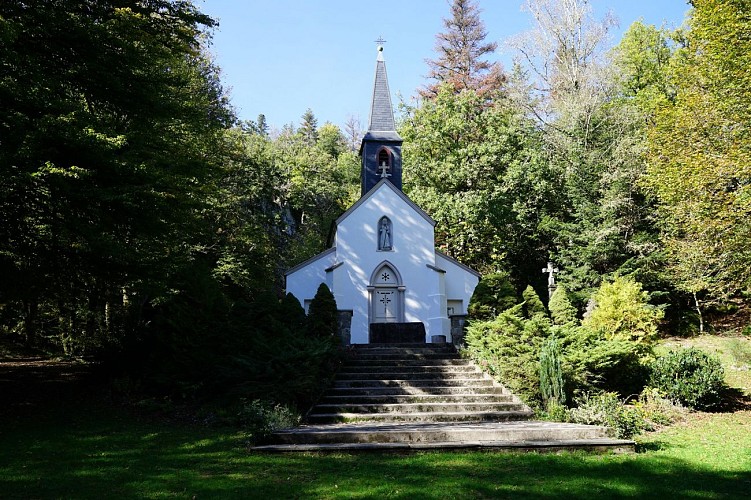
Continue on this path following the blue signpost. It is a nice path that runs alongside a logging road. Then, when you reach the logging road, go straight ahead (a little further on, don't hesitate to make a slight detour via the Haute borne!) The path then becomes relatively flat until you see a sign indicating the upcoming arrival at the chapel of old Saint-Amé. At the sign, go down to the right. Be careful on the way down, the path is rocky and steep but the chapel is worth it! Once there, you can take advantage of the tables and benches to rest before the ascent to the Saint-Mont.
To continue the walk, go along the chapel on the left and then pass in front of the Saint-Amé cave to join a path that is always marked with a blue easel. The climb is a bit steep and rocky too: be careful!
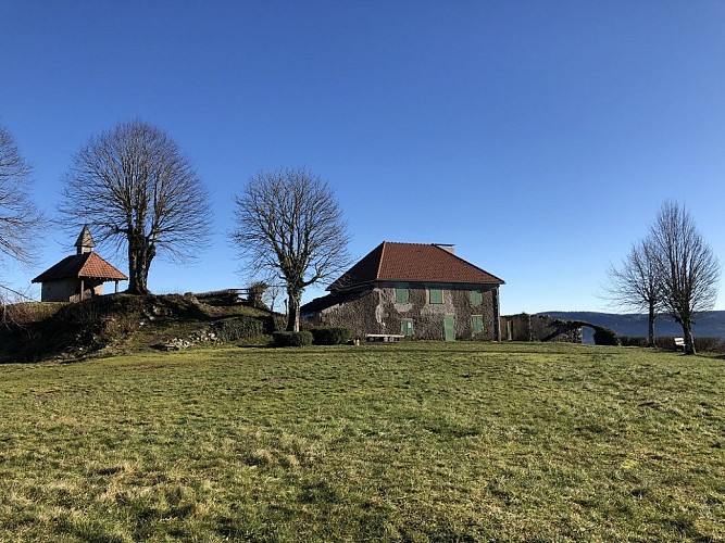
Once you have reached a grassy flat, at the level of a carriage road, turn right, go through the barrier and continue on this road until the next crossroads, turn left to reach the Saint-Mont, passing in front of the archaeological excavations. Once at the Saint-Mont, enjoy the 360° view and the facilities on site.
To go back down, cross the Saint-Mont site, and take the access road by car towards the Pont des fées. Stay on this path for a few metres, then quickly turn left along a path that is always marked with a blue easel. A little further down, follow the path on the right to reach the Pont des fées and cross it.
At the carriage road, turn left following the red ring. Stay on this path for just over a kilometre until you reach an intersection with another path. From here, turn left onto a pretty path marked with a red triangle, which descends into the forest and then joins the road. Take the road for a short while on the left towards the Saint-Romary estate.
When you arrive at the estate, turn right and walk past the restaurant along the right-hand side to join a path, still marked with a red triangle, which leads down to the Miraumont waterfall. After the waterfall, continue on the path that runs alongside the stream and joins the road. Take this road which leads back to the gendarmerie, to the starting point.
Technical Information
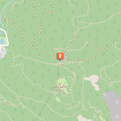
Altimetric profile
Starting point
Points of interest


Additional information
Producteur de la donnée
Ces informations sont issues de la plateforme SITLOR - Système d’Information Touristique - Lorraine
Elles sont synchronisées dans le cadre du partenariat entre Cirkwi, l’Agence régionale du Tourisme Grand Est et les membres du comité technique de Sitlor.
Contact
Tel : 03 29 62 23 70
Email : remiremont@otrp.fr
Data author
