Alert
Alerts
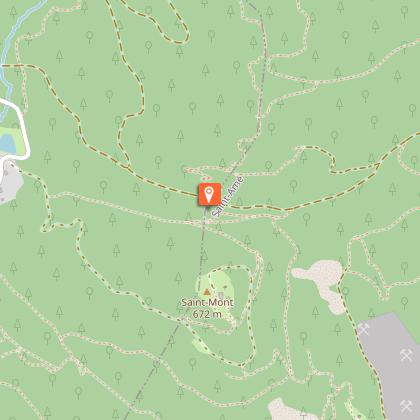
Randonnée - sentier des carrières

Description
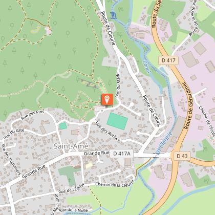
Access: From Remiremont, go to Saint-Amé. In the centre of the village (opposite the church), turn left, pass the town hall and go to the stadium.
Parking: Park in the stadium car park.
Distance: 10 km / Duration: 3 h / Ascent: 350m / Signs: red ring.
Take the path along the car park towards the stadium. At the disabled parking spaces, turn left. The first red ring marker is there, and you start to walk around the old Miroir au Merle pond. At the end of the pond, cross the bridge to the left and take the path that climbs into the forest opposite. Follow the markings which vary between path and small road until you reach a relay antenna.
Pass in front of the relay antenna, to join the path marked out opposite. A little further on, leave the path and take the road to the next crossroads with the road.
At this crossroads with the road, it is possible to make a left turn to the Monroche viewpoint (climbing site). On the spot: picnic table. To continue the walk: turn right onto the marked path that climbs up. Pass a small quarry and a viewpoint. Continue on the path that goes to the right for about 1km to end up at the large quarry, take time to admire the view. There is a covered picnic table. To leave, continue on the path straight ahead.
At the next big crossroads with a path, turn left downhill. Then, a little further down at the crow's feet, continue to follow the road downhill on the right, always following the red ring markings.
At the crossroads at the bottom of the road, turn right onto the road which very quickly becomes a carriageway. 100m further on, turn left for a smaller path that goes down into the forest. Be careful, the path is rocky!
Opposite a small quarry below, leave the path for a nice mossy path in the forest on the left.
At the intersection of the paths after the descent, opposite a fence, turn right and then right again 50m further on to go along a dry pond. At the end of the path, again at an intersection opposite a quarry, turn left. When you reach the active quarry, go straight on along it. Stay on the road to the right: be careful if you are walking during the week, the quarry is still in operation, there is a lot of traffic, especially lorries which serve the quarry which is still in operation.
Stay on the road for another 300m or so and leave it for a path that goes left into the forest. The path soon becomes a footpath on the right. Continue to follow the markings along the houses. The path alternates between a road and a footpath, which leads to the stadium car park along the housing estate.
Technical Information
Altimetric profile
Starting point
Points of interest


Additional information
Producteur de la donnée
Ces informations sont issues de la plateforme SITLOR - Système d’Information Touristique - Lorraine
Elles sont synchronisées dans le cadre du partenariat entre Cirkwi, l’Agence régionale du Tourisme Grand Est et les membres du comité technique de Sitlor.
Contact
Tel : 03 29 62 23 70
Email : remiremont@otrp.fr
Data author
