Alert
Alerts
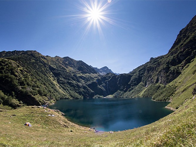
LES CHEMINS DE LA LIBERTÉ (OPUS N°3) : DES GRANGES D'ASTAU AU REFUGE DU PORTILLON


Description
"The paths of freedom are routes that were used by around 90,000 people during the Second World War: resistance fighters, Allied pilots, Jews and those refusing to participate in the STO (compulsory labour service). By attempting to reach Spain, they all hoped to escape the Nazis who threatened their very existence.
Haute-Garonne Tourisme and the association ""Chemins de la liberté par le Comminges et le Val d'Aran"" invite you to discover these historic routes while hiking."
The third part of this walk, which began at Port de Balès (see *The Paths of Freedom*: Opus Nos. 1 and 2), from Les Granges d’Astau to Lac du Portillon. Please note that from Lac d’Espingo onwards, you are entering high-mountain terrain, and we strongly advise against undertaking this hike alone if you are not experienced. Some sections of the route may be snow-covered even late in the season, and guidance from a qualified mountain guide is essential. To contact them: www.pyrenees31.com/randonnees.
By taking this route via the Port de Balès, you’ll be following in the footsteps of André Bon. This escapee was smuggled to Saléchan station via Toulouse thanks to the French Resistance network, an early ‘helper’ who played a part in the escape of at least 700 people.
Like André Bon, who made it all the way to Benasque in Spain, thousands braved the dangers of the mountains in the hope of finding freedom beyond the peaks of the Pyrenees.
A dangerous and gruelling human endeavour, this arduous crossing claimed the lives of more than 2,200 people, victims of the mountains or of Nazi troops.
To you who are following in the footsteps of these unsung heroes – the escapees, the smugglers, the networks of helpers, the anonymous individuals who contributed to the rescues, many of whom never returned… Do not forget them!
To find out more about the history of these fugitives and their smugglers: the “Chemins de la liberté par le Comminges et le Val d’Aran” association.
Technical Information
Altimetric profile
Starting point
Points of interest


Additional information
Elevation gain
1830 (High)
Detailed stages
1 - From the Granges d'Astau car park, take the path towards Lac d'Oô, which you will reach after about an hour's walk.
2 - When you see the Oô refuge, stay on the left-hand path to pass some rocky steps to the left of the lake and continue along the lake.
3 - The path continues in a series of switchbacks overlooking Lac d'Oô. Leave the GR10 on your left and continue to reach a valley that will take you to a ridge above Lac d'Espingo.
4 - The Espingo refuge is on the right. From here, less experienced hikers should turn back. You will pass a few well-equipped mountaineers on their way to the Portillon refuge, where they will spend a short night before setting off to tackle one of the 3,000-metre peaks around Luchon.
Services at the starting point
Car parking
Start and end town
OÔ
Contact
Tel : 05 61 95 44 44
Email : olivetains@tourismehg.com
Data producer
Contact : HAUTE-GARONNE TOURISME / LES OLIVÉTAINS
Phone : 05 61 95 44 44
This information comes from the Haute-Garonne Departmental Tourism Network and is synchronized as part of the partnership between Cirkwi and Haute-Garonne Tourisme.
Data author
