Alert

Alerts

To see around
See more
Open
Close
Show
Show
Show
Show
Show
Show
Show
Show
Show
Show
Show

Oups... It would appear that Cirkwi does not have permission to use your location.

Presentation
Description
Map
Points of interest
Ratings and reviews
See around

35 - LE RU D'ENFER

Description

A veritable natural curiosity nestling above the Gouffre d'Enfer.
At the end of the Lis valley, on your left, you can see the Portillon hydroelectric power station, built in 1941.
Did you know that the water turbined in this plant comes from the Portillon lake at an altitude of over 2,500m in the neighbouring valley? The water is transported to the turbines via an 8km underground gallery and a penstock (above the plant).

Starting from the car park in the Lis Valley, to the right of the waterfall, trail no. 35 climbs up to the right to the chasm. The path then continues to the Ru d'Enfer. You can descend via the Pré de l'Artigue and the beech forest to complete a loop.

Technical Information

Walking
Difficulty
Medium
Duration
4h
Dist.
7.6 km
Show more

Altimetric profile

Starting point

Parking de la Vallée du Lis , 31110   CASTILLON-DE-LARBOUST
Lat : 42.7361608Lng : 0.55587686

Points of interest

image du object

LA VALLÉE DU LIS

10 km from Luchon, on the road to Superbagnères, the Vallée du Lis is the starting point for many picturesque walks. The stream that runs through it, the Lis, is a tributary of the Pique. Contrary to what one might imagine, the Vallée du Lis does not take its name from the flowers that adorn it every June. Its correct spelling, ‘Batche dera Lit’ (Vallée de la Lit), means ‘Avalanche Valley’. From this magnificent spot, surrounded by high mountains, a range of walks of varying difficulty await you. Just a few metres past the car park, the Cascade d’Enfer is one of the most beautiful waterfalls in the Pyrenees. Further on, after an hour’s walk, you reach the Gouffre d’Enfer. Continuing on, the Ru d’Enfer is an impressive outcrop carved out of the rock by the water. The more adventurous can try their hand at canyoning under the guidance of a guide. Walks towards the Pré de l’Artigue will delight walkers. More experienced hikers can take the circuit around the lakes (Lac Vert, Lac Bleu, Lac Charles and Lac Célinda). The Lis Valley is also the starting point for hikes to the high peaks around Luchon. This is particularly true of the Pic du Maupas (3,109 m), which is notable both for its panoramic views and for the superb climbing routes it offers on its south, west and north faces. Above the Lis Valley, in the Crabioules massif, mines were in operation at the start of the 20th century. Originally, the ore (lead, zinc and blende) was sorted on site and then transported down on the backs of mules. An aerial cableway with skips was later installed, enabling larger-scale mining operations. The ore was then processed at the valley’s ore-washing plant, the ruins of which can still be seen today opposite the inn. Mining operations ceased in 1914, as operating costs had become too high to ensure optimal profitability. Human activity in the valley is evident in the presence of the hydroelectric power station. Water from Lac Bleu and Lac du Portillon flows through the tunnels and the penstock that can be seen descending from the mountain, powering the turbines. With a head of 1,419 metres, this penstock is the longest in France. A cable car used to provide access from the valley floor to the top of the penstock, but it was dismantled to reduce operating costs and visual impact. EDF now carries out the necessary maintenance work by helicopter. Hiking in the mountains, even at low altitudes, requires a certain knowledge of the environment and a great deal of caution. Remember to contact the relevant professionals and check the weather forecast before setting off. In winter, the numerous avalanche couloirs overlooking the Lis Valley mean you must be extra vigilant.

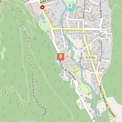
Avenue de Vénasque 31110 BAGNERES-DE-LUCHON
- OFFICE DE TOURISME PYRENEES 31 -
Consulter

Additional information

Detailed stages

1 - Start at the bottom of the Lis Valley. Take the track in front of you, passing the houses, and head towards the Cascade d'Enfer, a magnificent waterfall (altitude 1,170 m).
2 - As you approach the waterfall, you will see the start of the shared trails marked 35 and 36 on your right. The climb under the hazel trees is pleasant, with regular switchbacks. Higher up, you will enter a coniferous forest. Continuing on your way, you will cross a stream, which can be problematic at the beginning of the season due to snowmelt at high altitudes.
3 - A little further on, the slope levels out and even descends to a first bridge.
4 - Go to the promontory for a superb view of the Gouffre d'Enfer. Continue climbing and cross the stream again on the upper bridge. You will come to the junction with the path that leads to the Crabioules Mines. Continue straight ahead, leaving the path on your right. At the Ru d'Enfer, walk along the flat stones to admire the gorges. Descend by the same path to the Gouffre d'Enfer.
5 - A little further down, you can either go back down the same path or turn right towards the Artigue meadow.
6 - The path is almost flat and very pleasant. Through the gaps in the trees, you can admire the view of the Lis valley. Just before the meadow, a metal footbridge allows you to cross the stream and reach the Artigue meadow (1,404 m).
7 - Cross the meadow following the path – leave the trail on your right leading to Lac Vert and continue straight ahead towards the valley.
8 - The path then descends steadily through beech trees and you will easily reach the place where you parked your vehicle.

Dates

From 2026-04-01T00:00:00 From 2026-11-29T00:00:00

Elevation gain

670 (Medium)

Start and end town

CASTILLON DE LARBOUST

Contact

Tel : 05 61 79 21 21
Email : inof@pyrenees31.com
Website : www.pyrenees31.com

Data producer

Contact : HAUTE-GARONNE TOURISME / OFFICE DE TOURISME PYRÉNÉES 31
Phone : 05 61 79 21 21

This information comes from the Haute-Garonne Departmental Tourism Network and is synchronized as part of the partnership between Cirkwi and Haute-Garonne Tourisme.

Data author

Ratings and reviews

To see around
See more
Open
Close
Show
Show
Show
Show
Show
Show
Show
Show
Show
Show
Show
Caution!
We have no information on the difficulty of this circuit. You may encounter some surprises along the way. Before you go, please feel free to inquire more and take all necessary precautions. Have a good trip! 🌳🥾