Alert
Alerts
Type of practice
Walking
Presentation
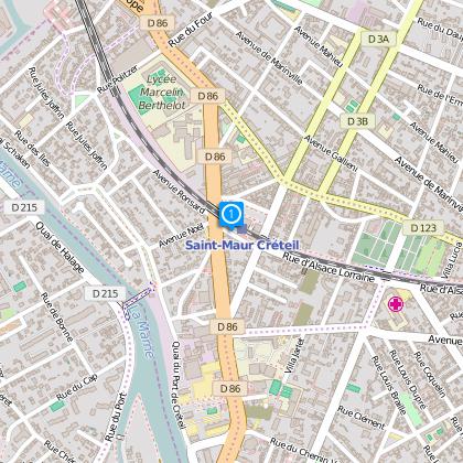
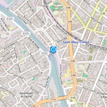
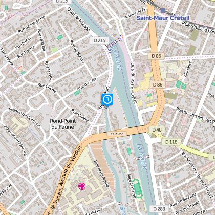
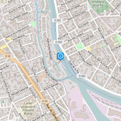
Map
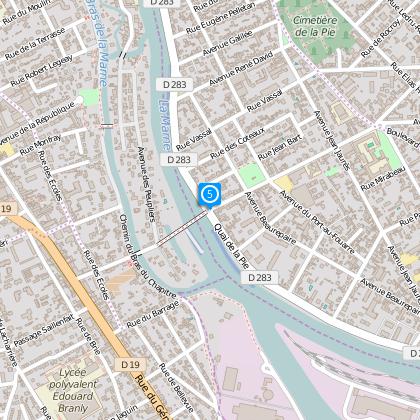
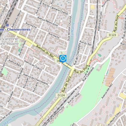
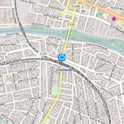
Steps
Cirkwi brief's
Ratings and reviews
See around
The Marne: islands in the city

The Cirkwi brief
Explorez la Boucle de Saint-Maur: Une Odyssée Fluviale
The charm and preserved heritage of the islands within the loop of the Marne in Saint-Maur-des-Fossés offer an exceptional urban escape. This itinerary, curated by Tourism-val-de-marne, wanders through the heart of the city to uncover serene islands accessible only by foot. The absence of motorized boats creates a tranquil atmosphere, perfect for those who seek peace away from the bustling city life. Imagine gliding on calm waters in an electric catalante or gently rowing a canoe, with only the sound of oars touching the water. It's an idyllic setting that combines the thrill of exploration with the tranquility of nature.
Technical Overview: Navigate Saint-Maur
Spanning 9.9 kilometers, this walking route begins from the RER Saint-Maur-Créteil station, weaving through the city to explore its insular heritage. The altitude fluctuates slightly between 31 to 45 meters, providing a relatively flat terrain suitable for walkers of all levels. The positive altitude change is minimal, from 66 to 61 meters, ensuring an easy stroll. This route, entirely dedicated to pedestrian traffic, showcases the pristine islands of the Marne, emphasizing a peaceful journey without the disruption of motorized boats, making it an accessible and enjoyable experience.
Seasonal Tips & Safety Recommendations
Embarking on this journey across the Boucle de Saint-Maur, it's important to be well-prepared for each season. Spring and autumn offer cool, comfortable climates ideal for walking, while summer presents an opportunity to enjoy the verdant surroundings in full bloom, though do remember to carry water and sun protection. Winters might be chilly, adding a serene beauty to the landscape, but ensure you're dressed warmly. Regardless of the season, maintaining safety by adhering to marked paths and wearing appropriate footwear is crucial. Always check weather forecasts before setting out, as conditions can significantly affect your experience.
Discover Saint-Maur's Historical Richness
Saint-Maur-des-Fossés, nestled within the Val-de-Marne department, stands as a testament to evolving French urbanity while retaining its historical essence. The insular regions along the Marne River, integral to this itinerary, reflect a unique blend of natural beauty and human heritage that has been preserved through the centuries. Their existence offers a glimpse into the leisure and lifestyle of past populations, highlighting the area's significance in urban development and leisure culture in France. Exploring these islands and their surrounding territories offers insights into the enduring charm that continues to define the region.
Weather Patterns & Ideal Visiting Times
Val-de-Marne Climate Insights
The region surrounding Saint-Maur-des-Fossés generally experiences a temperate oceanic climate. Expect moderate temperatures year-round, with slight variations. Winters are cool, averaging around 5°C, while summers tend to be mild and pleasant, with average temperatures hovering around 20°C. Precipitation is evenly distributed throughout the year, ensuring lush, green landscapes regardless of the season. The most favorable time to visit, for those seeking to enjoy walking and outdoor activities, is from late spring to early autumn, when the weather is most conducive to exploring the natural and historical beauty of the area.
Automatically generated.
Technical Information
Walking
Difficulty
Not specified
Dist.
9.9 km
Type of practice
Walking
Show more
Altimetric profile
Starting point
94100
Saint-Maur-des-Fossés
Lat : 48.80627Lng : 2.47186
Steps
Data author

proposed by
Tourisme-val-de-marne
13-15 rue Gustave Eiffel 94000 Créteil France
Ratings and reviews
To see around