Alert
Alerts
Crossing the Bornes in gentle mode - Stage 4: Refuge de Lessy > Refuge de la Pointe Percée

Description
Another varied stage with a reasonable distance and altitude difference, between alpine meadows and mountains of character.
This fourth stage, starting from the Lessy refuge, will take you to the Pointe Percée refuge.
This day will be punctuated by crossings of alpine pastures, lapiaz and exceptional views of the surrounding peaks.
Take advantage of this stage to make a detour and climb to the summit of the Aiguille Verte du Chinaillon (2045m), which offers a spectacular panorama.
The Pointe Percée refuge is the highlight of this fourth day.
Technical Information
Altimetric profile
Starting point
Points of interest

Date and time
- From 01/06/2026 to 30/09/2026
- From 01/06/2027 to 30/09/2027
Additional information
Contact
Email : secretariat@cafannecy.fr
Website : http://www.cafannecy.fr
Open period
From 01/06 to 30/09.
Subject to favorable snow and weather conditions.
Updated by
Conseil Départemental de la Haute-Savoie - 07/04/2026
hautesavoiemontblanc-tourisme.com/
Report a problem
Environments
Mountain view
Panoramic view
Mountain location
Type of land
Not suitable for strollers
Topo guides and map references
Map references :
Map IGN TOP 25 3430ET - LA CLUSAZ
Location complements
Access (on foot):
Refuge de Lessy (1760m) - Refuge de Gramusset (2164m)
arte IGN Top 25: 3430 ET
Reception complements
Whichever hike you choose to do, remember to take a rucksack packed with cereal bars, plenty of water, sunglasses, sun cream, a basic first aid kit, as well as suitable clothing according to the season and the weather forecast.
Tricky passages
Delicate passage equipped with chains just before the Col de l'Oulettaz.
Guidebook with maps/step-by-step
Departure point: Refuge du Lac de Lessy 1770 m
1/ From the Lac de Lessy, the stage is labelled "Refuge de la Pointe Percée". We start with a short morning climb to "Sous le Buclon", a little pass between Le Buclon and the Aiguille Verte du Chinaillon. Follow the path that cuts through the slopes below the summit of the Aiguille Verte, but it would be a shame not to climb to the top (beautiful views).
2/ At "Sur le Freu", the path drops steadily through the alpine meadows, passes at the foot of the lapiaz of Roc des Tours, and reaches "Les Bouts" via the chalets and Cuillery, with their typical Aravis architecture.
Option if you need to refuel: At "Bassins de Samance", follow "Le Chinaillon par Samance" to reach Le Chinaillon and its shops. (Outside July and August, only "Le cellier du Chinaillon" is open; bread shop). Then follow signs for Refuge de la Pointe Percée to the Parking des Bouts, passing the old Venay bridge.
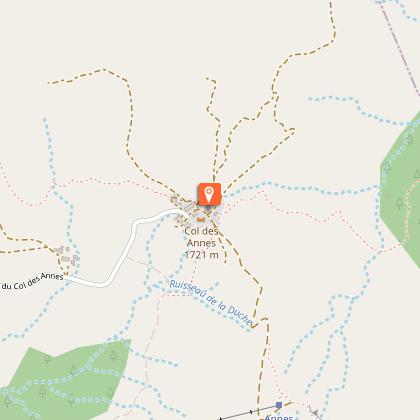
3/ Continue up a long road to the "Maroly d'en bas" chalets, then along the L'Almet ski lift, to reach "la Clef des Annes". The Col des Annes is at 0.20 hrs (refreshment area). There's just 400m to go up to reach the Pointe Percée refuge via the Crête de l'Oulettaz, then on through some amazing lapiaz.
Animals
No. Pets are not allowed.
Data author
