Alert
Alerts
Crossing the Bornes by gentle means - Stage 3: Plateau des Glières > Refuge de Lessy
1 alert on this circuit
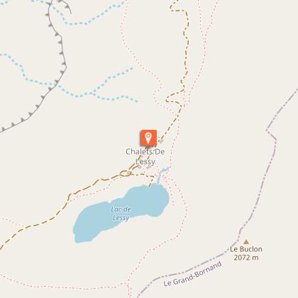
LESSY LAKE:
Visitor alert
Swimming, campfires and open-air fires during the day and at night, and the use of stoves and barbecues are prohibited.
Camping is prohibited on the site. Only tented bivouacs in a designated area are permitted, and only when the Refuge de Lessy is open.

Description
This is an unusual stage, as we start by descending into the Borne valley at Entremont, and then make the long ascent to Lac de Lessy. A little more distance than the day before, and a little more ascent.
This third stage, starting from the Plateau des Glières, takes you to the Lessy lake and refuge.
You'll make your way through the Borne valley, passing the site of Montriévray, a heroic battleground during the attack on the plateau in March 1944, before arriving at Entremont.
Finally, you'll reach the Col de la Forclaz, where you'll be treated to an exceptional view of the Lac de Lessy, a natural site that is home to an important pastoral activity.
The Lac de Lessy and its refuge, nestled in the foothills of the Pic de Jallouvre, are the high point of this day.
Swimming in Lac de Lessy is forbidden, as its fragile ecosystem must not be disturbed!
Technical Information
Altimetric profile
Starting point
Points of interest
Date and time
- From 01/06/2026 to 30/09/2026
- From 01/06/2027 to 30/09/2027
Additional information
Open period
From 01/06 to 30/09.
Subject to favorable snow and weather conditions.
Updated by
Conseil Départemental de la Haute-Savoie - 07/04/2026
hautesavoiemontblanc-tourisme.com/
Report a problem
Environments
Lakeside or by stretch of water
Mountain view
Mountain location
Close to GR footpath
Contact
Email : secretariat@cafannecy.fr
Website : http://www.cafannecy.fr
Type of land
Not suitable for strollers
Location complements
Access (on foot):
Plateau des Glières (1425m) - Refuge de Lessy (1760m)
Map IGN Top 25 3430 ET - LA CLUSAZ
Topo guides and map references
Map references :
TOP75032 - ARAVIS RANGE - BAUGES MASSIF
TOP 25 IGN 3431 OT - LAC D'ANNECY
TOP 25 IGN 3430 ET - LA CLUSAZ
Reception complements
Whichever hike you choose, remember to take a rucksack packed with cereal bars, sufficient water, sunglasses, sun cream, a little first aid kit as well as appropriate clothing according to the season and weather forecast.
Guidebook with maps/step-by-step
Start: Plateau des Glières 1425 m
1/ Following the signs for "Entremont", first reach the northeastern end of the Plateau by following the GR96 (end of the tarmac road leading up from Petit Bornand). Follow the GR96 along a path that climbs a little, then descends along a large meadow on its right-hand side. The path joins the road below, then leaves it on the right towards the Montriévray site, the site of a heroic battle during the attack on the plateau in March 1944. Start the long descent along the path, which then descends steeply, with many twists and turns, to reach Entremont after skirting the Borne river.
2/ Follow the signs for "Lac de Lessy", first following the road, then an alpine track that leads to the Chalets de Mayse (refreshment area). The track becomes steeper and leads to the Col de la Forclaz, from where you can easily reach Lac de Lessy and the refuge.
Animals
No. Pets are not allowed.
Data author
