Alert
Alerts
GR®5 Alpes (1): Saint-Gingolph - Bise (La Chapelle d'Abondance)


IGN cards


Description
The GR©5 is one of the most prestigious hiking routes in France. This linear route goes from Saint-Gingolph to the Bise pass. Beyond Bise pass you can follow it to Nice.
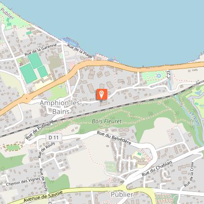
This itinerary takes you to the heights of Saint-Gingolph and the village of Novel, the smallest commune in Haute-Savoie with about 50 inhabitants.
On the way, magnificent views of the high lake, the Swiss coast and the Vaud Alps await you.
You will reach the chalets and the lake of Neuteu and then the Col de Bise situated at 1915 m altitude, where you can admire your ascent and enjoy the breathtaking view of Lake Geneva and the Jura!
You will reach the alpine hamlet of Bise, which is part of the Chablais Geopark network and nestles at the foot of the Cornettes de Bise, a Natura 2000 reserve. Its chalets, with their preserved architecture, include a restaurant as well as a refuge, freshly renovated in 2017.
In contact with the herds of cows and goats, you will not be able to resist the cheeses sold directly by the producers, including the Abondance cheese for which the region is famous!
Technical Information
Altimetric profile
Starting point
Points of interest


Date and time
- From 30/04/2026 to 30/11/2026
Additional information
Open period
From 30/04 to 30/11 daily.
Accessible outside the snowy period and depending on the weather conditions. Please check with the Tourist Office beforehand to find out the current access conditions. Recommended season: spring - summer - autumn.
Updated by
Office de Tourisme Leman Mountains Explore - 24/11/2025
leman-mountains-explore.com
Report a problem
Environments
Lakeside or by stretch of water
Forest location
Lake view
Mountain view
Station district
Close to a public transportation
Village centre
Close to pleasure port
Village 2 km away
Close to GR footpath
Contact
Phone : 04 50 73 60 72
Email : info@ot-peva.com
Website : https://leman-mountains-explore.com
Type of land
Stone
Ground
Hard coating (tar, cement, flooring)
Grit
Location complements
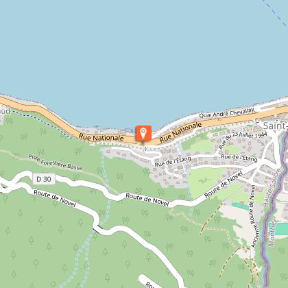
Starting point: Saint-Gingolph, quai André Chevallay
Topo guides and map references
Topo guides references :
On sale in the tourist offices of the pays d’Évian and vallée d'Abondance.
Map references :
TOP 25 N°3528 ET Morzine Massif du Chablais Les Portes du Soleil
Reception complements
If you want to start the GR5 or ViaRhôna in Saint-Gingolph, and are looking to leave your vehicle parked for several days, the commune of Saint-Gingolph France offers you a system of badges in 3 formulas (10 days, 20 days, 30 days). Information on www.st-gingolph.com/stationnement-itinerance
Guidebook with maps/step-by-step
0/ Departure point: Saint-Gingolph, quai André Chevallay
1/ Leaving Saint-Gingolph, you head for the heights towards the "Novel" valley. The path initially follows the D30 road, then an old road. Follow the path past the Oratoire, then climb along the "Morge". Cross the road and continue uphill.
2/ At the hamlet of Novel, drive through the village past the hotel and church. Continue along the road, then the path that cuts all the switchbacks. Reach the intersection with the GR® Balcon du Léman. Follow the GR®5 signs to "La Planche (parking)". Cross the parking lot and take the path, crossing a torrent.
3/ At the T junction, turn left towards "les chalets de Neuteu" (1681 m). Here you'll find Lac de Neuteu.
4/ Follow a steep path to the "Col de Bise" at 1915 m on your left.
5/ At the col, head for the "Chalets de Bise", on a steep descent with a few hairpin bends at the start, finishing on a wide track to the Bise site.
Animals
Yes. Pets are only allowed on a lead as you will be in a nature reserve.
