Alert
Alerts
Type of practice
Walking
4h45mn
Presentation
Description
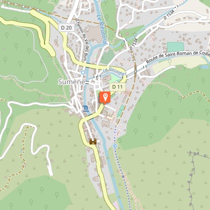
Map
Steps
Ratings and reviews
See around
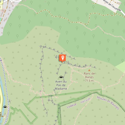
The Ranc de Banes path
Description
A challenging hike to the Ranc de Banes, between cliffs, caves and lapiaz, above the Rieutord valley.
A challenging hike to the Ranc de Banes, between cliffs, caves and lapiaz, above the Rieutord valley.
Technical Information
Walking
Difficulty
Not specified
Duration
4h45mn
Dist.
7.3 km
Type of practice
Walking
4h45mn
Show more
Altimetric profile
Starting point
Avenue de la Gare
,
30440
Sumène
Lat : 43.979418Lng : 3.717703
Steps
Additional information
Updated by
Office de Tourisme Sud Cévennes - 09/03/2026
sudcevennes.com/
Report a problem
Open period
All year round.
Contact
Phone : 04 67 81 01 72
Email : contact@sudcevennes.com
Type of land
Stone
Grit
Not suitable for strollers
Animals
Yes
Data author

proposed by
Office de tourisme Sud Cévennes
Ratings and reviews
To see around