Alert
Alerts
Hiking route : Hike on Tessens mountain and Combe Bénite ridge with a night in a refuge
Description
Discover Tessens mountain!
Technical Information
Altimetric profile
Starting point
Date and time
- From 15/06/2026 to 30/09/2026
- From 01/10/2026 to 14/06/2027
- From 15/06/2027 to 30/09/2027
- From 01/10/2027 to 14/06/2028
Additional information
Updated by
Office de Tourisme de la Grande Plagne - 21/04/2026
www.la-plagne.com
Report a problem
Environments
Mountain view
Mountain location
Tips
The La Plagne Vallée Tourist Office has suggestions for itineraries of varying difficulty with overnight stays in a refuge. You take these routes under your own responsibility. Don't hesitate to book a guide to ensure your safely.
Possibility of going in either direction
Open period
From 15/06 to 30/09 daily.
Supervised refuge.
Reservation obligatory.
From 01/10 to 14/06 daily.
Refuge open but not supervised.
Inform the keeper.
Type of land
Stone
Grit
Ground
Contact
Phone : 04 79 55 67 00
Email : info.vallee@la-plagne.com
Website : https://www.la-plagne.com/la-plagne-vallee
Facebook : https://www.facebook.com/laplagnevallee/
Reception complements
Paths may be narrow and steep-sided.
Not recommended for people prone to vertigo or young children (under 10 years).
TRAIL
Guidebook with maps/step-by-step
DAY 1:
Set off from Le Chapieu, take the path going towards La Combe, cross the small bridge over the Nant de Tessens. At "Quatre Chemins", go towards Roche de Janatan. Admire the view at Roche de Janatan.
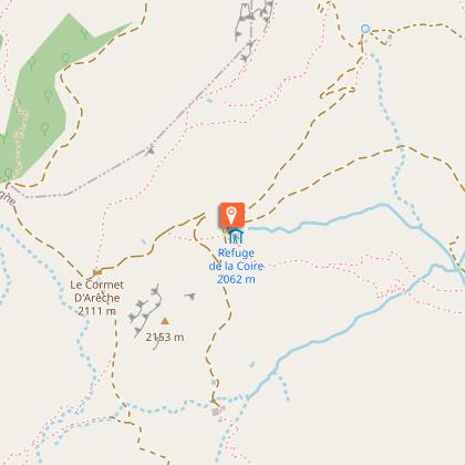
Then, follow the ridge to "Pointe du Col" then to Col de la Légette, Les Mouilles, Chalets des Veaux and Col des Tufs Blancs. Continue along Col des Génisses and Col de la Grande Combe to reach Le Cormet d’Arêches and La Coire refuge.
Make the most of your night in the refuge to recharge your batteries and enjoy a convivial moment.
The first day covers 11.2km and 930m elevation gain.
DAY 2:
For the second day, set off from La Coire refuge going towards Pointe de Combe Bénite via Col de Corne Noire. Take the track that winds up towards Crêt du Rey passing the Chalets du Cormet. Take the path to the right leaving Lac de la Gouille on your left. Continue towards the ridges in the direction of Col de Corne Noire then take the path that climbs to the ridge going towards La Pointe de Combe Bénite. Please note: steep-sided section!
Come back down via Lac de Guio, then follow Pra Plan passing under La Messe ridge. Continue towards La Rochassière and Le Chapelet to get back to Le Chapieu.
The second day of your escapade covers 11km and 550m elev. gain / 900m descent
Animals
No
Data author
