Palet Pass (Col du Palet)
Description
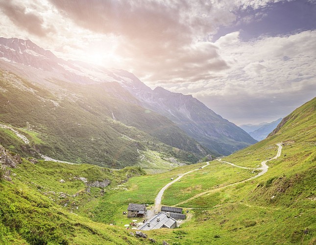
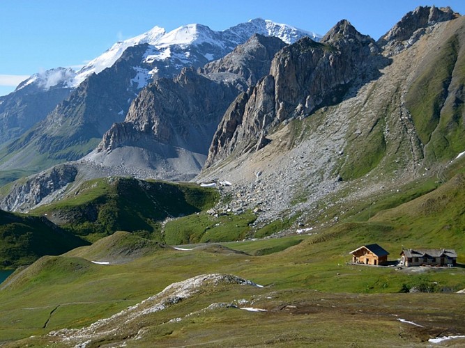
Explore the Vanoise National Park and take in the beauty of the unique landscape. Follow this route through La Glière, the Chalet du Plan du Sel and the Col de la Croix des Frêtes, while skirting the Vanoise glaciers.
Departure : Champagny Le Haut, parking Le Laisonnay d'en bas
Arrival : idem
Duration : 4h one way. Count 7 hours of walking in total.
Itinerary to the Glière refuge: green level (moderate - from 5 years old).
Itinerary to the Col du Palet: red level (difficult). Col du Palet refuge at 10mn : sleeping, meals, drinks - tel : 04 79 07 91 47
Caution, dogs are not allowed!
To be noted: The glaciological trail
To enable you to observe the glaciers, the itinerary between the Laisonnay and the Chalet du Grand Plan has been equipped with eight numbered markers along the path. Full explanations are given in a booklet entitled "Discovering the glaciers of Champagny en Vanoise", a real discovery tool, sold at the Tourist Office.
Technical informations
11 km
|
1206 m
105 m
| |||
Altimetric profile
Starting point
Points of interest
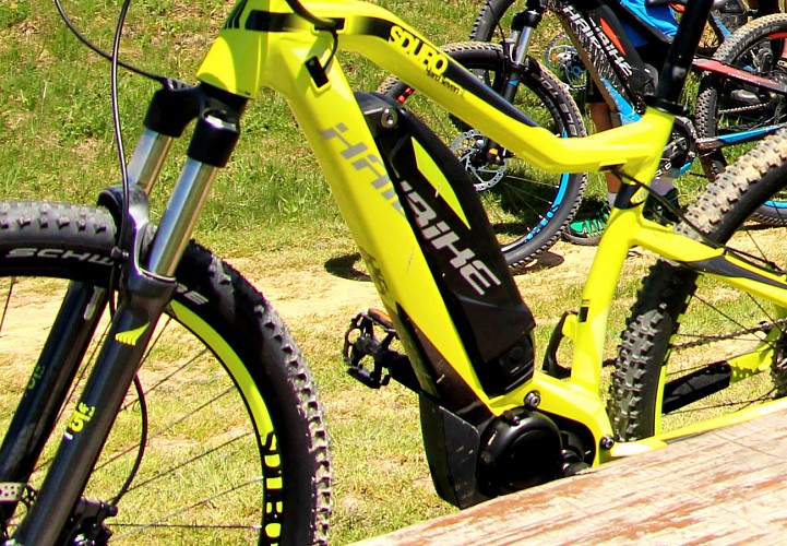
E-MTB loading spot - Refuge Glière
Possibility to recharge an electric bike on a socket. On request to the hut keeper
Col du Palet mountain hut
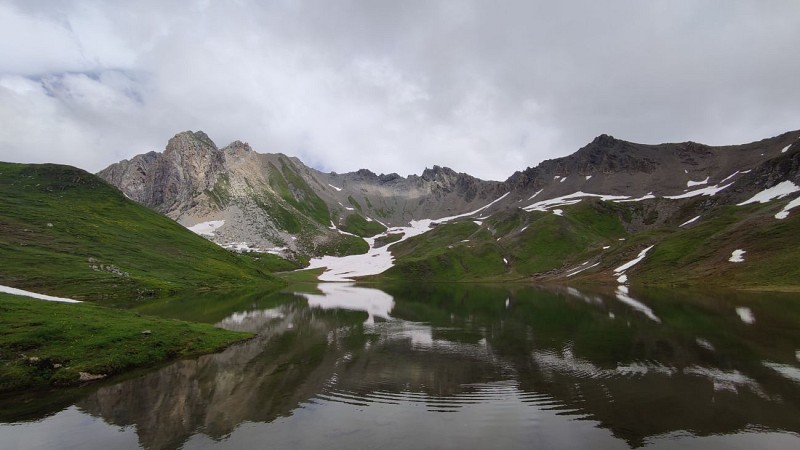
Overlookink a small mountain lake, this refuge of the Vanoise national park, on the GR5 and the Tour de la Vallaisonnay, proposes a great site seeing on the 3 highest peaks of Savoie.

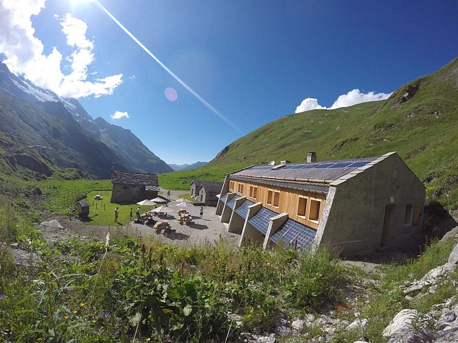
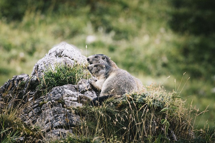
Refuge la Glière
The refuge is guarded from 20/06 to 15/09/2020. Caretaking's end date to be confirmed. In the heart of the Vanoise national park, the guardian welcomes you in an old sheepfold rehabilitated in 1985. Just above the refuge, is the dry lake of La Glière. A lot of marmots. Country lunch, traditional lunch and dinner.Typical refuge (dormitories and rooms for 4 people) but comfort with toilets and hot showers. Outside periods of guarding, the refuge is partially open (12 beds). - Selective waste management and sorting. - Soundproof gas generating set. - Heating with wood stove. - Voltaic photo boards. - WC In this place isolated from everything, without modern energy means, we make every effort to offer you a simple but quality restoration. We use a maximum of local, regional products. Some also come from organic farming. In order to quench your thirst or to warm you, enjoy our selection of hot and cold drinks. If hunger takes you, do not panic, on request we will prepare varied omelettes, mixed salads, plates filled with regional products, soups, cheeses, cold meats. And if gluttony brings you here, let us make you taste our sweet tarts, Savoy cake, pancakes, white cheeses. All desserts are homemade. Starting point 1: Parking Laisonnay at the foot of the north face of the Grande Casse: Panorama, Aiguille de l'Epéna. 1h30 walk. Starting altitude: 1560 m. Arrival altitude : 2010 m. Drop: 450 m. Difficulty: None. Starting point 2: Peisey-Nancroix-Refuge de Rosuel, duration 8h, + 1100m drop - 600m. Crossing of the Grassaz pass with snow at the beginning of the season. Ski touring (knives are required). Not recommended in winter, very avalanchey, no sun, very cold. - IGN map: 3633 ET Tignes, Val d'Isère and 3532 ET, les Arcs, La Plagne, 3534 OT to 1/25 000. Didier Richard at 1/60000. Coach parking in Laisonnay. Possibility to ride, on horseback, with a donkey, mountain bike, joëlette, alpine skiing and touring, 4x4 only for rescue. Snowshoers, be careful of avalanches and when walking downhill on sloping terrain. Half day excursion: - Lake of the Echines: 1h30, + 400m drop, chamois, panorama. - Alpine chalet "Plan du sel": 1h, + 250m drop, cows processing, manufacture of beaufort. Day hike: - Tour du Vallaisonnay: 8h, + 600m drop - 1000m, panorama, wild animals. - Col du Palet: 3h, + 700m drop, flowers, chamois.
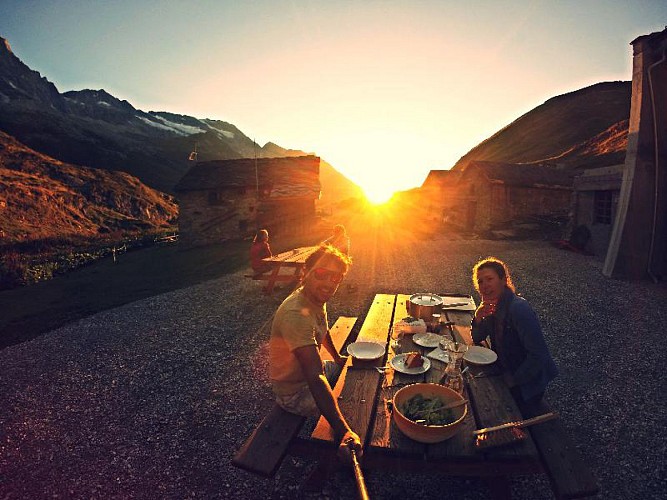
Restaurant/refuge de la Glière
In the heart of Vanoise National Park, the guardian welcomes you to an old sheepfold refurbished in 1985. Just above the refuge is the dry lake of Glière. Lots of marmots. Traditional mountain meal, lunchtime and dinner.Continuous food service: Tartiflette and green salad from the vegetable garden. (Only served with demi-pension) Lunch, "repas de la Glière": Raw ham, Beaufort cheese, potatoes, omelette, green salad. Throughout the day: Crêpes with blueberry jam, old-style tartlettes and white cheese.
Vanoise national Park
The Vanoise National Park created in 1963 due to the disappearance of the ibex is the oldest national park in France. It offers a majestic space between the Maurienne and Tarentaise, guardian of fauna and flora carefully preserved.It runs an incomparable variety of scenery with its 53 000 hectares and 500 km of trails. The Vanoise National Park comprises two zones: the central zone and peripheral zone. The central area called "Coeur de parc" has a special attention as the protection zone. It is subject to specific rules. The peripheral zone covers 28 communes. It has a common border with the Italian National Park of Gran Paradiso. Twinned since 1972, they collectively cover an area of 1250 km2, the largest protected area in Europe.
Date and time
- From 01/05/2024 to 01/11/2024
- From 01/05/2025 to 01/11/2025
Additional information
Updated by
Office de Tourisme de la Grande Plagne - 18/04/2024
www.la-plagne.com
Report a problem
Guidebook with maps/step-by-step
0/ From the Laisonnay car park (1560m), take the tarmac road for 300m; after the bridge, first turn left onto the track which then goes to the right, towards the Glière refuge (1996m). From time to time, a path allows you to cut the track (signs).
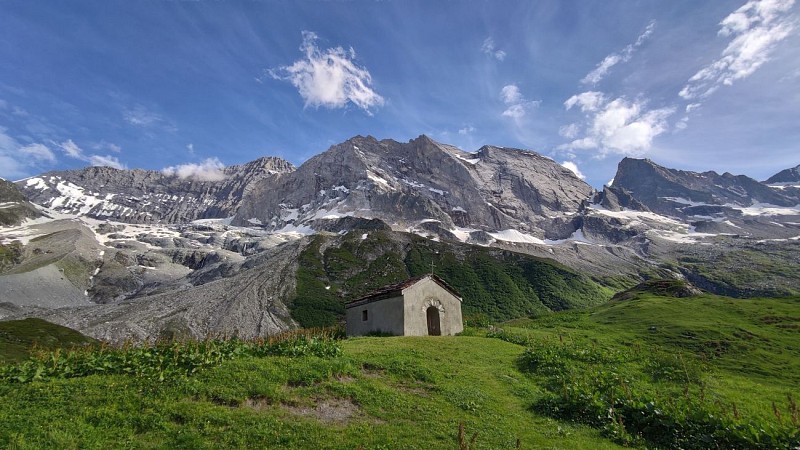
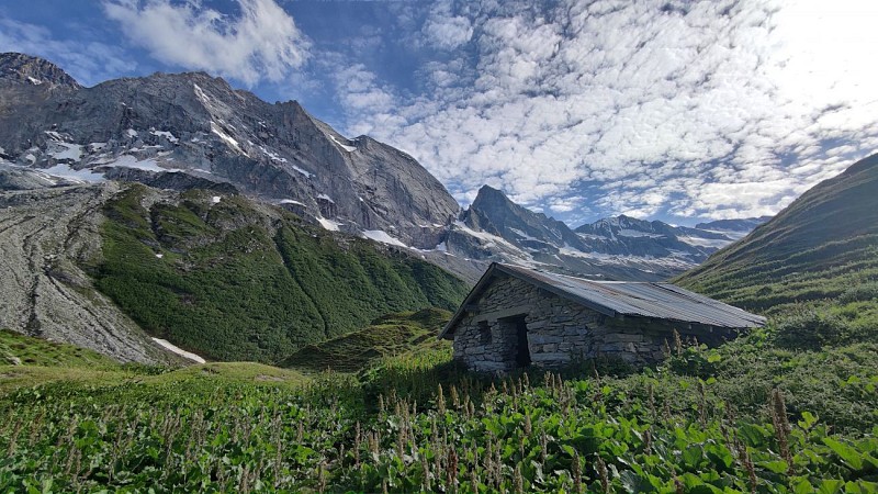
1/ From the refuge, retrace your steps to get back on the track that climbs to the chapel and the lake. On the left, a fairly steep path rises up and joins the track above; you quickly reach the Plagne mountain pasture; you pass below the Plan du Sel chalet where Beaufort cheese is made, the "Prince of Gruyères" which has a registered designation of origin.
2/ The itinerary continues on a path that crosses under the Grand Plan chalet; it rises slowly up the Combe du Grand Plan (East) to reach the Col de la Croix des Frêtes, which it reaches (alt. 2647m).
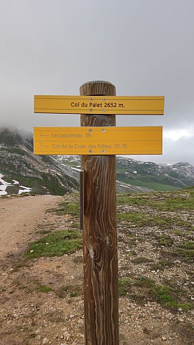
3/ From there, by crossing, we reach the Col du Palet (alt. 2652m) in 15 minutes.
This pass allows you to switch to the GR5, to the resort of Tignes, located 1h20 away.
Return : By the same route.
Tips for the photographer
Many marmots up to the Glière Refuge
Open period
From 01/05 to 01/11.
Subject to favorable snow and weather conditions.
Contact
Phone : 04 79 55 06 55
Email : info.champagny@la-plagne.com
Facebook : www.facebook.com/champagnyenvanoise?sk=wall
Data author
