Alert
Alerts
Tour des Chapelles - Itinéraire de randonnée
Description
On this itinerary, which combines hiking and heritage, you'll come across several chapels from different eras and with different histories. This area, rather low in altitude, is accessible soon after winter thanks to its privileged exposure and sunshine.
An itinerary that combines hiking and heritage, and on which you'll come across several chapels from different eras and with different histories.
This area, relatively low in altitude, is accessible soon after the winter season thanks to its privileged exposure and sunshine.
What to see / What to know :
Each chapel had its own raison d'être. Saint Roch's chapel was built in 1565 following a plague epidemic. It is the oldest chapel in Jarrier. The 18th-century Saint-Antoine chapel is dedicated to the protection of livestock.
Technical Information
Altimetric profile
Starting point
Points of interest

Additional information
Updated by
Office de tourisme Intercommunal Cœur de Maurienne - 08/07/2025
faceausud.com/montagnicimes_webgl/
Report a problem
Guidebook with maps/step-by-step
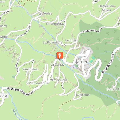
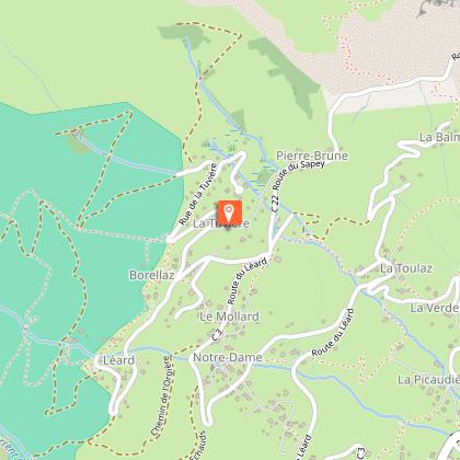
Departure: Car park at Saint-Pierre church 1/ From l'église Saint-Pierre, head towards Combe des Moulins, passing close to the cemetery and following the RD 78D for 100m. 2/ From Combe des Moulins, climb the path to the hamlet of La Pécaudière. 3/ From here, turn left towards the hamlet of Varcinière and continue towards Chapelle Saint-Roch (round-trip viewpoint). 4/ From here, continue uphill towards Chapelle Notre-Dame, passing through the hamlet of Bormat and Pont des Essarts. 5/ From Chapelle Notre-Dame, head towards Chapelle Saint-Antoine, passing through the hamlets of Le Mollard and La Tuvière. 6/ From here, turn right and follow the path down towards Chapelle Saint-Antoine and the hamlet of La Toulaz. Continue towards Chapelle Saint-Bernard and the hamlet of Les Hérouils along a track and then a balcony path. 7/ At the hamlet of Les Hérouils, take the fieldside path down to the tarmac road, follow it for 150m then take the path that cuts through the hairpin bends towards Chapelle Saint-Bernard. 8/ After the chapel, continue down the winding path. When you reach the road, turn right and follow it for 50m. 9/ Return to Jarrier (Chef-lieu) up the path and through Le Cruet.
Open period
All year round daily. Subject to favorable weather.
Contact
Phone : 04 79 83 51 51
Email : info@montagnicimes.com
Website : montagnicimes.com/
Data author
