Plan d'Amont Dam Circuit

Description
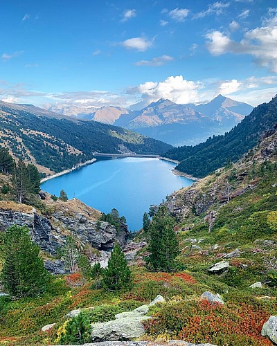
Enjoy a walk along this terraced path, eyes drawn to the hypnotising colours
of the lake. Feel the serenity as you cross the sunny alpine pastures and
clearings. Hike right into the Vanoise National Park. You'll feel like you're
a million miles from home!
If you love views of landscapes dramatically falling away from you, then every
step of this hike will be a delight. The artificial lake, twinkling like a diamond
in its case, attracts your eyes every time you look up towards the horizon.
Whatever the season, the colours cast a magic spell. Even the marmots'
little cries of alarm won't take your attention from the satin-smooth surface.
This water basin in the high-altitude grasslands plays a crucial role in storing
water for the neighbouring valley. Like its downstream counterpart, Plan
d'Amont's hydroelectric dam is used, among other things, to power ONERA's
international wind tunnel, a flagship aerospace research project that tests
model aircraft and rockets.
At La Fournache refuge, take a rest as you imagine all those seasoned
mountaineers heading towards Pointe de Labby or Dent Parraché, majestically
rising up above you to a height of over 3,500 metres above sea level.
Technical Information
Altimetric profile
Starting point
Points of interest
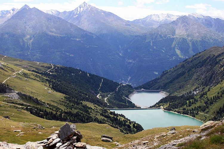
Dams of Plan d'Amont and Plan d'Aval
Built between 1945 and 1956, these two dams are built into the Hydroelectric Complex Haute-Maurienne and participate in particular filling the reservoir of Mont Cenis. They are located near the National Park of the Vanoise.Fed by mountain torrents, the Plan d'Amont and Plan d'Aval dams ensure the operation of the valley's power stations. Plan d'Amont dam: this is a concrete gravity dam, 350 m long, made up of cells and buttresses, supported on the glacial lock which obstructs the valley. It holds 8,000,000 m3 of water, twice the volume of the Plan d'Aval, and collects all the water from the Saint-Benoît, thus capturing the catchment basin delimited by the Rateau d'Aussois, the Col de la Masse, the Pointe de l'Echelle, the Col d'Aussois, the Pointe de Labby and the western buttresses of the Dent Parrachée. The water is turbined in a small power station called "Plan d'Aval", hidden at its foot, at the bottom of the talweg, before being discharged into the Plan d'Aval reservoir. They are also an opportunity for a nice walk or a nice fishing trip. Public domain
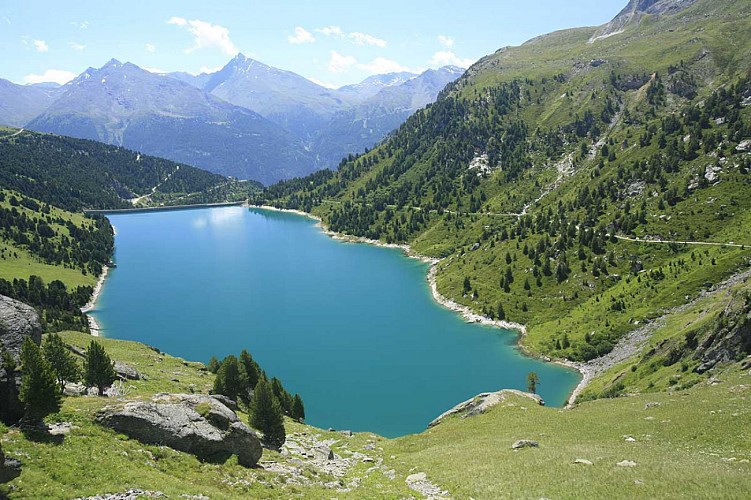
Plan d'Amont lake
Waters "turquoise" of Plan d'Amont (2 078m) are a delight for the eyes. Surrounded by majestic mountains, it's a perfect starting point for many tours and hikes in the national park of Vanoise.The lake of Plan d'Amont (public domain) offers fishermen beautiful "fario" and "rainbow" trout.
Date and time
- From 15/05/2024 to 15/10/2024
- From 15/05/2025 to 15/10/2025
Additional information
Updated by
Communauté de communes Haute Maurienne Vanoise - 06/05/2024
www.cchautemaurienne.com
Report a problem
Guidebook with maps/step-by-step
To guide you in the field, consult the "step-by-step" directional diagram provided in pdf.
Open period
From 15/05 to 15/10.
Subject to favorable snow and weather conditions.
Contact
Phone : 04 79 05 99 06
Email : info@hautemaurienne.com
Website :
www.haute-maurienne-vanoise.com
www.cchautemaurienne.com/transports-collectifs-sur-le-territoire
Data author
