Alert
Alerts
Walking tour of the Les Herbiers loop
IGN cards


Description
Woody fragrances and the certainty of a cool walk accessible to all. A
typical walk through the forest in Valfréjus, that you can do again and
again whatever your age. It's the perfect chance to get acquainted with
the GR5, a circuit cherished by countless hikers.
Do you know the Charmaix torrent?
Very persistent, it springs from an altitude of 2,500 metres and flows straight
from the Sainte-Marguerite lakes to near the Thabor refuge, sometimes
as a stream, sometimes as a torrent. It seems to take pleasure in rushing
down, eroding, carrying everything in its path, as it goes through the Losa
and Lavoir dams all the way to the alpine hamlet of Herbiers to refresh you
– even reaching the Tavernes lodge!
There's no doubt about it, you're at one of greatest historical sites of
hydroelectricity in Haute Maurienne Vanoise…
And if luck, along the torrent, is with you, you might see a few trout lurking
about the stream. Open your eyes and... be patient! These shy creatures like
hide among the stones on the riverbed.
Technical Information
Altimetric profile
Starting point
Points of interest


Date and time
- From 15/05/2026 to 15/10/2026
Additional information
Open period
From 15/05 to 15/10 daily.
Subject to favorable snow and weather conditions.
Updated by
Communauté de communes Haute Maurienne Vanoise - 23/12/2025
www.cchautemaurienne.com
Report a problem
Environments
Mountain view
Mountain location
Close to a public transportation
Near shuttle stop
Contact
Phone : 04 79 05 99 06
Email : info@hautemaurienne.com
Website :
https://www.haute-maurienne-vanoise.com
http://www.cchautemaurienne.com/jy-vais-en
Type of land
Rock
Stone
Ground
Suitable for all terrain strollers
Not suitable for strollers
Location complements
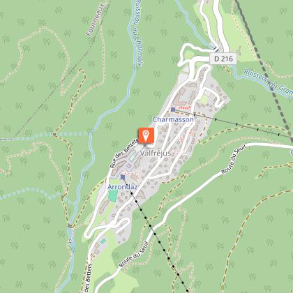
By bus: Line line 1 - Tourist Office stop
By car: Park in the parking lot in front of the Valfréjus Tourist Office.
Topo guides and map references
Topo guides references :
Map and booklet "Haute Maurienne Vanoise. 120 walks and hikes - 36 trail routes. For all levels" (sold for €12 in Tourist Offices) - Green route n°2
Map references :
Map IGN 3535 OT - Névache Mont Thabor
Reception complements
The duration of hiking trails is calculated using reference paces: 300 m/h ascent, 500 m/h descent and 4 km/h on the flat.
As hazards may occur at any time on the routes, the GPX tracks provided are not contractual. They are given for information only. Riders use them at their own risk, depending on their level of technological proficiency and their understanding of the terrain.
Animals
Yes. Out of respect for wildlife, please keep your dog on a lead.
Data author
