Alert
Alerts
Tour des Vaches Rouges (departure from Puy-de-Dôme)

Description
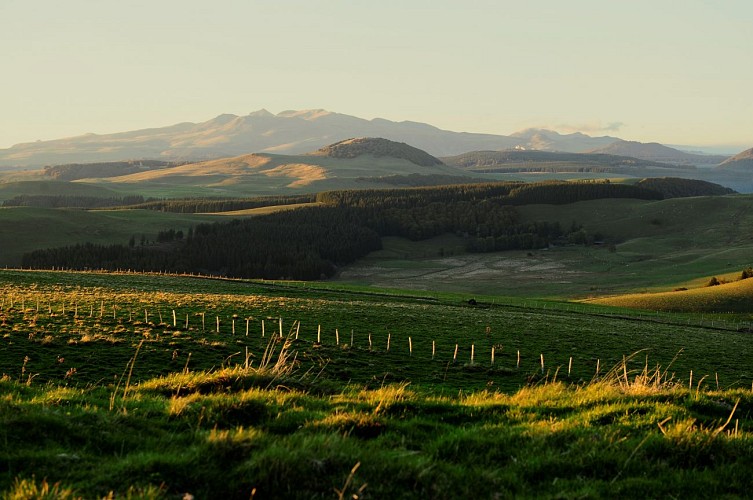
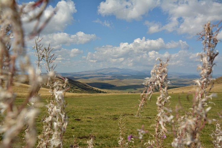
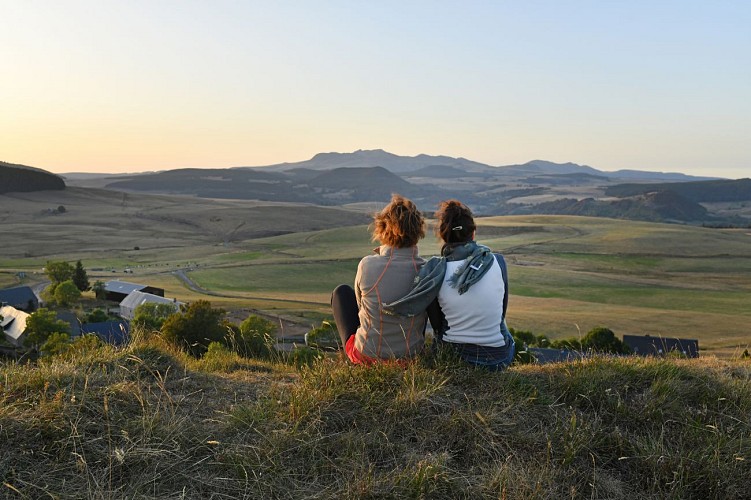
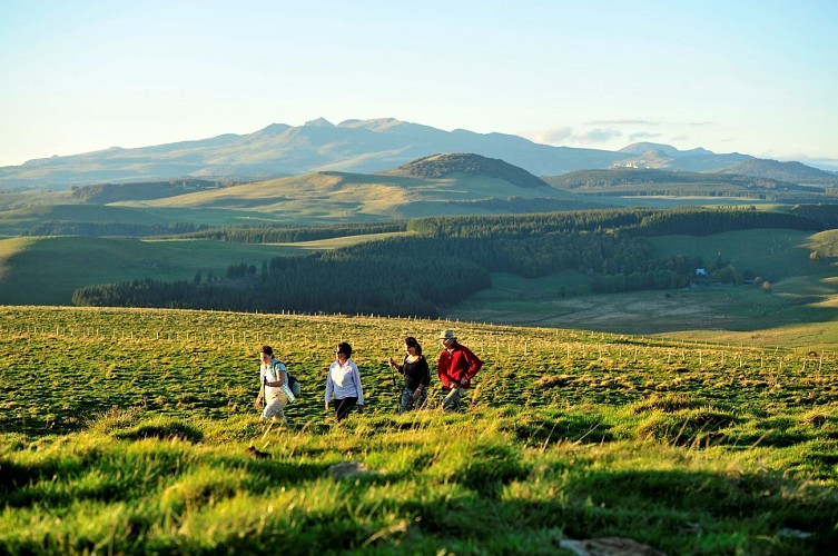
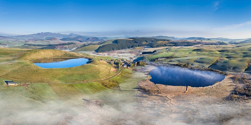
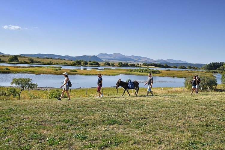
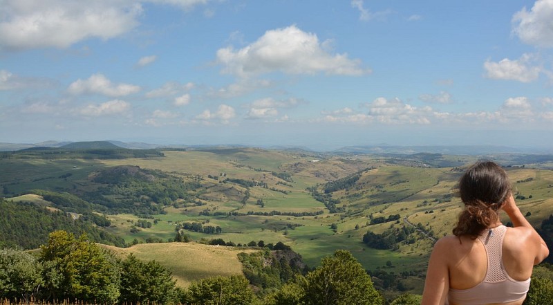
The Tour des Vaches Rouges, which can be completed in 8 or 11 days, is a magnificent hiking itinerary set in the unspoilt Cézallier highlands between the Monts du Cantal and the Massif du Sancy, with breathtaking views.
Technical Information
Altimetric profile
Starting point
Additional information
Distinctions
Listed PDIPR
Tips
- High pasture plateaus of the Massif Central.
- View of the Chaîne des Puys, the Sancy massif and the Cantal mountains.
- Cirque glaciaire du Joran et d'Artout.
- Sagnes Nature Reserve and La Godivelle peat bog.
- Signal du Luguet (1551 m).
- Rich Cézallier heritage.
- Village architecture, churches, fountains, washhouses, bread ovens and vernacular heritage.
- Orthodox monastery (La Traverse).
Updated by
Conseil départemental du Puy-de-Dôme - 10/07/2026
www.puydedome-tourisme.com/
Report a problem
Environments
Lakeside or by stretch of water
Mountain view
Mountain location
Village -2 km away
Waterside
Pond within 5 km
In a nature reserve
Presence of livestock and guard dogs
Open period
Open from May to October.
Contact
Email : randopdipr@puy-de-dome.fr
Location complements
Égliseneuve-d'Entraigues is 65 km southwest of Clermont-Ferrand.
Type of land
Stone
Ground
Grit
Reception complements
For your own safety, always take a bottle of water, a hat, warm clothing and footwear suitable for walking.
Depending on weather conditions, certain itineraries are not recommended in bad weather (fog) or are not practicable, or even forbidden, during the winter season.
Bivouacs: during summer time, tents must be pitched after 8 p.m. and dismantled by 8 a.m. The bivouac site must be located at the edge of the forest, excluding the slopes, craters and summits of volcanoes, unless otherwise indicated on the site. The agreement of the landowner must be sought.
Open-air fires are permitted in specially designated areas. Otherwise, all fires are prohibited within 200 m of the edge of a wood or forest, or under the terms of a prefectoral decree.
The use of portable gas stoves is nevertheless tolerated, in a setting that is as safe as possible (stable, away from flammable materials, etc.).
Stay on marked trails. Respect private property.
Bring your own rubbish bags for picnics, snacks and other waste, and use the containers available at most parking lots.
Do not disturb wildlife.
Don't pick flowers, as many are protected (even those that seem very ordinary or common).
Guidebook with maps/step-by-step
Stage 1 - Égliseneuve-d'Entraigues - Brion
Distance: 16 km
Time: 5 h 15
Altitudes: 941 m / 1,277 m
Cumulative elevation gain: 610 m
Departure point: Place du Lavoir parking lot, Egliseneuve-d'Entraigues (near the cemetery and Le Chalet Familial B&B).
(Contact Mairie 04 73 71 90 13)
Departure - Go towards the post office and join the D128. Follow it in the direction of Espinchal as far as the bridge over the Rhue.
1 - Follow the road up to the left, then at a sharp right-hand bend, turn left and climb a path through the woods. At the houses, continue left uphill (V1: view of the Sancy massif). At the road, go left and 100 m after La Clide, take a right-hand path for 80 m to a barrier. Turn right, then go through a 2nd barrier. Continue straight ahead, following the fence. Go through a 3rd gate (V2: view of the Cantal massif), then a 4th. Continue until you reach a road.
2 - Turn right into Redondel, then left. Continue along the path (V3: views of the Cantal and Sancy massifs) until you come to a barrier. Go through it and descend into the valley along the fence until it forks to the right. Continue straight ahead. Go through a 2nd fence and down into the woods. Cross the stream and continue as far as the Marquis cross. Go straight on to Espinchal. At the first crossroads in the village, turn right, then immediately left (P1: fountain).
3 - Just after the church, turn right down the road. At the crossroads, cross the bridge and turn left onto the road leading to Sandalouze. Go through this village and continue for 800 m on the road, which becomes a wide path. Continue along this path (V4: view of the Sancy and Puy de Dôme) to Lac d'En-Haut at La Godivelle, then descend through the village (P2: fountain and church) to the bridge (Lac d'En-Bas is on the right, 20 min downhill).
4 - Stay on the main road, pass the cemetery and after 600 m, take the track on the left. Cross a stream and go right into the forest. At the end of the wood, continue straight ahead. At the crossroads, turn left. At the next junction, turn right along a wide gravel path (V5: view of the Brion hillock). At the T junction, turn right. In Brion, just before the road, turn right. At the top of the village, go around the foirail on the right to the signpost near the last buron (20 min AR, 360° view from the top of the motte féodale).
Stage 2 - Brion - Anzat-le-Luguet
Distance: 17 km
Time: 5 h 15
Altitudes: 1,113 m / 1,345 m
Cumulative elevation gain: 405 m
Departure point: Brion "Le Foirail" in Compains
Start - From the signpost on the Brion foirail, near the information panels, go straight ahead (20 min AR, 360° view from the top of the motte féodale), then immediately descend 250 m on the road to a grassy path.
1 - Turn right onto this path between 2 fences. At the T-junction, turn right, then immediately left. At a road, go straight up a wide track. At the T-junction, turn right. At the road, go left. At the crossroads in Jassy, go right, cross the bridge and take the main road for 2 km to the fork at the entrance to Boutaresse. Turn left onto a small road. At the watering hole, go right for 120 m to the junction with the alternative route to Pradiers.
2 - Turn left onto a passageway that soon reaches a road. Turn left and follow this road for 400 m. Turn right onto a track leading back to the road. Follow the road for 50 m, then turn right onto a wide track. After an S-curve, continue uphill on the left. Reach a road. Turn left, then right as far as the parking lot at the entrance to Parrot.
3 - Turn left after the parking lot and follow the road towards Le Buffier. At a ruined house, take the path on the left. After a right-hand bend (V1: view from Forez to La Margeride and the Mézenc), continue downhill (V2: view of the cirque d'Artoux), then cross a stream. At the fork, turn left and climb up to a road. Cross the road and turn left onto the wide track. Go through the village of Le Luguet as far as the chapel (picnic table).
4 - Go right down the road, then take the 2nd path on the right. At the T-junction (large boulder), go left down to the road, turn right and then immediately left. Follow the Anzat-le-Luguet church to the signpost near the parking lot.
Variant n°1 - Puy-de-Dôme Go towards Ardes-sur-Couze
Distance: 24 km
Time: 7 hrs 30 mins
Cumulative elevation gain = 420 m
Departure point: Brion-Bas. At the Berger Transhumance hut (artwork "Horizons Sancy 2017") on the access road to the foirail, 30 m from its junction with the RD 36.
Departure point: Go down towards the RD 36, cross it and continue straight ahead. Leave a track on your right. Cross the stream on a pontoon bridge and rejoin the path. Continue as far as La Cabane. Take the D126 (towards Ardes-sur-Couze) for 20 m, then the D142 (towards Rentières). 30 m before a right-hand bend, turn left up the track towards the wind turbines. Go through the barrier on the right and reach wind turbine number 1 (view of the Rentières valley). Go through a 2nd barrier and, 150 m further on, a 3rd at road level. Follow the road to the left, until you reach the metal barrier at the ferme du Coq on the right.
1 - Go through it and continue along a wide panoramic path, leaving a 2nd field of wind turbines on your left. At the first intersection, just before the 3rd field of wind turbines, continue right on a balcony overlooking the Rentières valley. Go through a village (Zanières) and at its exit, turn left onto a wide track. Stay on the main path. Reach a road. Turn left as far as the left-hand bend.
2 - Turn right on a wide downhill track to a crossroads. Go right, staying on the main track. At the edge of a village (Rentières), turn right and pass by a tower. At the fork, go left. Follow the couze d'Ardes to a road. Follow the road to the left for 400 m, then turn right onto a path that crosses the couze d'Ardes. Cross a stream on the right and take a steep path leading to a road. Follow this to the left until you reach a hamlet (Chalagnat).
3 - Turn left onto the downhill track. Ignore a path rising to the right, continue into the woods and leave another path to the right (rising to the ruins of Château de Mercoeur). After the theme marker, go downhill and turn right at the intersection. Continue as far as the entrance to Ardes-sur-Couze. Turn left down the main street, cross the Place du Foirail, walk alongside the covered market hall and 200 m further on, turn right into Rue du Regard. Turn left onto Avenue Maréchal Leclerc to reach the vacation village.
Back to Anzat-le-Luguet
Distance: 24.5 km
Time: 7 h 45
Cumulative elevation gain = 1,130 m
Departure point: vacation village (Av. du Maréchal-Leclerc)
Departure point: From the vacation village of Ardes-sur-Couze, head towards the rescue center, turn left into rue Maréchal Leclerc, then right into rue du Regard. Turn left up rue du Commerce, cross Place du Foirail and continue. At the crossroads, turn right onto chemin de Gannat. Wind your way up and, at the intersection, turn left. Pass a theme marker and climb a stony path. Leave the path leading up to the ruins of Château de Mercoeur on your left and continue straight ahead through the woods to the road.
1 - Follow the road to the left. Pass through Chalagnat and continue on the road (view of the Rentières valley/Aigle rock) to the last hamlet (Granges). At the end of the bend, take the path to the right (view of the Strougoux caves). Cross a stream. At the fork, continue uphill to the left (possibility of descending to the right as far as the Sainte-Pezade chapel, 15 min AR, picnic table). Leave a path on the right. At the next fork, turn left and climb up to a road at the entrance to a village (Mazoires). Turn left, pass the church on the right and 150 m further on, turn right onto a wide track. Ignore all side roads until you reach a T-junction.
2 - Go left up the forest road to an intersection at the edge of the forest. Turn right. At the 2nd Canadian crossing, turn left. Leave a track on the right (view of the Margeride). Follow the edge of the forest to a small hunters' watchtower. 20 m after the watchtower, turn left, then left 2 more times, until you reach a T-junction (point 1245 m).
3 - Go right. At the crossroads of 4 paths, continue straight on to the Parrot parking lot (after leaving the woods, panoramic view of the cirque d'Artout, Signal du Luguet, Sancy massif, puy de Dôme and Chaîne des Puys).
NB: At this point, the variant ends; you return to the "Tour des Vaches Rouges" circuit.
4 - From the parking lot, turn left and follow the road towards Le Buffier. At a ruined house, take the path on the left. After a right-hand bend (view from Forez to La Margeride and the Mézenc), continue downhill (view of the cirque d'Artoux), then cross a stream. At the fork, turn left and climb up to a road. Cross the road and turn left onto the wide track. Go through the village of Le Luguet to the chapel (picnic table).
Stage 3 - Anzat-le-Luguet - Laurie
Distance: 21 km
Time: 6 hrs.
Altitudes: 803 m / 1,135 m
Cumulative elevation gain: 721 m
Departure point: church parking lot, Anzat-le-Luguet
Start - From the signpost near the church parking lot, turn left and go straight downhill. After the cemetery, take the track on the left and join a road. Follow the road to the right. In Besse, turn right down the road. After the Besse tower (P1: 15th-century tower), at the farm, continue downhill on the track. Cross the La Bave stream (P2: ruin of a sawmill). Go straight up into the forest, ignoring the side paths, until you reach a road. Cross the road and continue uphill on the right to the edge of the forest.
1 - Turn left onto a wide track. At the T-junction, go right, past Combaliboeuf and after 200 m on the road, take the 2nd track on the right to Courteuge. Turn right, passing the dolmen.
2 - Go through the hamlet of Courteuge (dolmen on right and bread oven), downhill along the road.
3 - At the bend after the hamlet, take the large track on the right. At the crossroads, continue straight ahead (view of the "pays coupé" and the Margeride in the distance). Join the green PR from Combaliboeuf, and take a beautiful path down into the gorges on the hillside. After a fine descent, you reach Leyvaux at the bottom of the valley (old village and church with combed bell tower).
4 - Turn right at the town hall.
5 - At the Gorges d'Apcher crossroads, take the stony path on the left down to the bottom of the gorge. Cross the Apcher and Barthonnet streams, which meet at this point, via the footbridges, and climb up to an old mine entrance (deposits of ferruginous carbonate crusts deposited by a mineral water spring near the entrance).
Go up through the woods for about 900 m (very steep climb), and at the crossroads, go left. Continue straight ahead on this wide wooded track for about 1.9 km, ignoring all junctions. Reach the plateau and the village of Lussaud via the small road.
6 - Pass to the left of the church, then turn right opposite a barn gable, then left down a wide track. After a right-left hairpin bend, you come to a road (D 109). Turn right for 70 m. Cross a chicane and turn left down a path that crosses meadows and continues straight on to the bottom of the valley (follow the line of trees).
7 - At the bottom of the valley, cross a stream by the footbridge opposite, along the hedge, and climb up into the wood, along an earthy path which curves to the left before reaching a flat spot. Continue into the fir grove. At the level of a meadow, cross 2 fences 150 m apart and continue on a forest track through the beech grove. View to the left over the gorge and surrounding plateau.
8 - A large dirt track emerges. Follow it to the right and reach the plateau before reaching Anliac. Go through the hamlet, and at the end of the bend, leave the road to take the path on the left in front of the buildings. Turn right immediately after the 1st building, and follow an old track to a small road. Follow it to the left.
9 - Just before the end of the plateau, the TVR leaves the road for a good path on the right which crosses the plateau.
However, to reach the gîte de Laurie, stay on the road and descend into the village. The gîte d'étape and campsite are off the route, 1.2 km away: in Laurie, before reaching the church, take the lane on the left, then follow the track on the right which runs alongside a house. After a hairpin bend, cross the D109 road and follow the grassy path to the left. Cross the D109 again, then head up the local road that leads to the gîte and campsite.
Stage - 4 Laurie-Peyrusse
Distance: 20.5 km
Time: 6 h
Altitudes: 754 m / 1,134 m
Cumulative elevation gain: 811 m
Departure point: Laurie stopover gîte
It's possible to reach Peyrusse by taking the alternative route via Vèze, but you'll need to allow for an extra day's walk. The route is common up to point 7, then from point 8 onwards, follow the description of the variant to choose this option.
Departure - From the gîte d'étape, take the D109 back to the church square in Laurie; go up the lane opposite the church chevet, onto the route de Lussaud (D109). Follow this road up to the plateau.
1 - Take the 1st path to the left on the plateau (you'll find the TVR coming from Lussaud). Go straight on for about 800 m. At the fork, continue straight ahead, then turn left at an old track. Continue for 200 m.
2 - At the crossroads, turn right and stay on the main road for approx. 1.3 km. The path widens; continue along the axis of the France Telecom tower, which can be seen in the distance, then turn left to join a road (D 55).
3 - Follow this road to the left for approx. 100 m.
4 - Overlooking the hamlet of Foulières, go down to the right on a gravel and then grassy path. At an iron cross, turn right to reach the center of the hamlet. Continue downhill, then take the right-hand path.
5 - Continue on this wide track for about 1.7 km, ignoring all junctions.
6 - Cross the La Valette stream and turn left up a wide track through beech forest.
7 - At a flat spot, turn right onto a wide track that climbs up to the hamlet of La Bastide (view of the medieval tower of Colombine, built on an ancient feudal motte). Cross the hamlet and continue on the minor road. Cross the Vaurèze stream and climb up to a crossroads.
At the crossroads (point 8), you can take the alternative route via Vèze. In this case, follow the description of the Laurie-Vèze stage, then Vèze - Peyrusse.
8 - Turn left onto D 155 for approx. 350 m. Between the electricity transformer and the hairpin bend, take the path overhanging the road. Follow this good path for about 400 m, and you'll come back to the main road. Turn right and follow the D 155. Pass Escrouzet and continue downhill to the crossroads.
9 - Turn right onto the D9 towards Vèze. After approx. 100 m, take the left-hand track which runs parallel to the main road. Just before the Fournial mill (private property), take the grassy path on the far left which leads to an attractive stone bridge. Cross the Sianne and go up into the woods for about 1.2 km, staying on the main path. The path then crosses a clump of broom and skirts the meadows on your left. Continue for approx. 400 m.
10 - Find a large clearing and, at the track junction, turn left; continue uphill. Cross the meadow, which the track splits in 2, and continue into the woods. The track rises up through the fields, joining the plateau as far as the village of Bru.
11 - Turn right onto the D21 and follow it for about 100 m. At the large square, pass the water troughs on your right and take the small road opposite. Continue for approx. 250 m. Leave the road and take the path on the right that follows a line of fir trees. Rejoin the D 221. Turn right and follow the D 221 for approx. 80 m.
12 - At the next junction, turn left, then immediately leave the road to take a good path on the right through pastures. Continue on this good track for about 1.4 km. Find a hedge on your right. Go past it and, after another hedge, turn left. Continue for approx. 650 m and come to a crossroads.
13 - Turn right, then after approx. 30 m, turn left along the grassy path for approx. 400 m.
14 - At the crossroads, turn left again and head downhill until you come to a farm shed overlooking the hamlet of Valence.
15 - Turn left, and at the next junction take the small road to the right. Leave the hamlet. At the fork in the road (calvary), continue straight ahead.
16 - Just before the hairpin bend, take the pine-lined track opposite. The track descends through the woods. At the bottom, turn right at the intersection. Go along the cemetery on your left and reach Peyrusse.
Variant n°2 - Cantal
Go towards Vèze, then return to Peyrusse in 2 stages.
Distance: 33.5 km
Time: 9 h 35
Cumulative elevation gain = 420 m
Laurie - Vèze stage: 18.3 km - 5h15
Follow the description of stage 4 from the start to point 7.
8 - At the crossroads, turn right onto the D 155 for about 1.7 km to reach the village of Molèdes (medieval tower of Colombine built on an ancient feudal motte).
9 - In the village of Molèdes, turn left towards the church. After the fountain, turn right towards Fondevialle and Brèche de Giniol (Molèdes Romanesque church).
As soon as you leave the village, turn left up the grassy lane. You'll reach the road, which you'll follow for just over 500 m, climbing slowly.
10 - At the next crossroads, do not head for Fondevialle. Keep to the right and climb steadily for 1.5 km along the wide track towards the Giniol breach.
11 - At the pass (1,255 m) which marks the end of the main road (beautiful panorama opposite and view to the west of the Monts du Cantal), cross the fence and turn right to pass on the right-hand side of the fence, which you follow downhill. Pass a wetland area (spring and drinking troughs).
When you come to a grove of trees on the right (fences to cross), go left of the fence and downhill, following a row of ash trees to the Chanusclade farm (several electric fences to cross and a fence before the farm).
12 - Follow the track under Chanusclade farm, skirting the fence on the left; then head for a power line. Turn left (trees, fence to cross, concrete trough) to find and descend an old sunken track lined with hedges dotted with trees. You'll come to a large gravel track, which you take to the right. After approx. 400 m, join the D209.
13 - Turn left down to the hamlet of Moudet (stone fountain and tubs topped by a metal cross). On leaving Moudet, continue on the D209 to the hamlet of Aubeviou (beautiful fountain and large stone tubs). At the bread oven, turn left through the hamlet. Take an old, damp path down into the Sianne valley.
In a large sloping meadow, the path veers to the right and continues down an old, damp, tree-lined sunken path. Reach the hamlet of La Tour.
14 - Walk past the houses (a lovely flower-filled, landscaped area) and cross the stone bridge. After the bridge, take the path on the left that leads up into the woods. At the crossroads, turn right onto the D209. Turn left to reach the village of Vèze, 300 m away.
Vèze - Peyrusse stage: 15.3 km - 4 h 20
Start at Place de la Fontaine, go to the end of the square between the houses, turn left and leave Vèze on a small tarmac road for about 500 m.
1 - At the crossroads, cross the road (D9) and take the wide, tree-lined path opposite, not far from a farm shed. Turn left at the crow's-foot, then cross the ruisseau de La Meule before climbing up the hillside to the hamlet of Le Lac.
2 - At the lake, take the path immediately to the left of the gable of a house. This damp, tree-lined path reaches a meadow.
3 - Take the narrow path between the meadow and the wood, along the fence outside the meadow. Shortly afterwards, the path widens out in the beech forest, descending slightly on a wide right-hand curve. Arrive at a meadow in the middle of the woods (private property sign); cross it by a grassy track, and continue in the undergrowth down the very damp path.
4 - Cross the ru de la Jalle, before climbing up to a broom-lined path on the plateau.
After a right-hand bend, you come to the Romanesque chapel of Chastre (or Chanet). After visiting the chapel and soaking up the atmosphere, continue due south along the large carriage road.
5 - At the junction with the road leading to the hamlet of Chastre, turn left.
6 - At the crossroads with the hamlet of Béteil, continue downhill to the right. At the next crossroads (cross and water reservoir), go straight ahead and enter the hamlet of Feydit, which you cross in its entire length.
7 - In front of the cemetery, at the end of the road which curves around a bend, turn right down the path which is not very visible at first, but which soon becomes clear as you enter the woods. Wind down until you reach the bottom of the valley where the Bois Gravaize stream flows. Overlooking the stream, just before an area overgrown with ferns, cut off completely to the right and descend the steep slope to the stream.
8 - Cross the Bois de Gravaize stream at a ford and climb diagonally to the left; cross a stream and continue up through the woods. The path bends to the right and climbs steeper.
9 - After a steep incline on a faint track, you come to a large grassy path which you take to the right.
10 - After a bend to the right, you come to a large, attractive track which you take to the left, rising steeply at first, then gradually winding through the woods for about 1.5 km.
At the edge of the woods, the path winds its way through meadows; after a right-hand bend, you come to a small road leading up to the D21.
11 - Cross the D21 (route d'Allanche à Massiac); go straight ahead for 50 m, then take the left-hand turning to return to the D21 and turn right onto the small Primpérige road for approx. 400 m.
Leave the road at the bend and continue ahead on the grassy track lined with low stone walls for 300 m.
12 - At the crossroads, turn right down a wide gravel path towards the hamlet of Valence.
13 - After the farm shed, turn left, and at the next crossroads, take the small road to the right and leave the hamlet. At the fork in the road (calvary), continue straight ahead.
14 - Just before the hairpin bend, take the track opposite, lined with pine trees. The track descends through the woods. At the bottom, turn right at the intersection. Go along the cemetery on your left and reach Peyrusse.
Stage 5 - Peyrusse - Allanche
Distance: 12.4 km
Time: 3 h 30
Altitudes: 942 m / 1,200 m
Cumulative elevation gain: 390 m
Departure point: Car park at the entrance to the village under the town hall.
Departure point - At the heart of the village, take the Allanche - Peyrusse-Haut road; turn right before the church and follow the road (D 114); pass a lake and continue for 250 m.
1 - Leave the road (D114) and turn left onto a wide grassy path that climbs up through the woods to Peyrusse-le-Château - Peyrusse-Haut (view of Peyrusse and the surrounding "pays coupés").
Once in Peyrusse-le-Château, drive past a farmhouse, followed by other buildings, level with a median (water troughs), turn right and cross a large crossroads, heading for large farm sheds at the very end of the hamlet.
2 - Go up the large track on the left alongside a large building, then take the grassy path on the left which climbs towards the plateau as far as a fence (old path lined with low walls). View of Peyrusse-Haut castle. Cross the fence and turn right, between 2 fences, to a good path. Turn left down to a road.
3 - Take the road to the right and follow it for 250 m.
4 - At the crossroads, take the small road on the right towards Plavarenne-Vélonnière, and follow it for about 800 m.
5 - At the next crossroads, at the intersection with the road linking the hamlets of Gourt and Vélonnière, take the large track opposite for 100 m. At a widening, turn right onto an old track lined with low walls and trees, and pass through 2 successive gates.
6 - At the crossroads, turn left and cross the chicane. Continue straight ahead up a large sunken track (old stone walls) and, after passing through a gate, reach a small road. Follow this road for 1 km to the D114. At the crossroads, turn right and continue for 120 m along the softwood plantation that marks the Croix de Lampre pass (1,199 m).
7 - At the corner of the wood (gate), turn left onto a grassy track for about 750 m until you reach a cross-country path. View of the Planèze and Cantal mountains. Turn right and follow it for approx. 900 m. Pass a shed and continue to a crossroads. Take the large track on the left until you reach a small road.
8 - Go right up towards a large farm building; pass a cross at L'Hôpital, and continue to the D114 (at the entrance to Maillargues). Go straight ahead on a traversière which passes a detached house on the left; join a road and go up to the right. At a large communal area (bread oven), turn right onto a small road (D 309) and follow it for about 500 m.
9 - Leave it for a wide track on the left; pass a shed on the left, with a view of Allanche. Continue on this wide track for 1 km.
10 - At the next crossroads, turn left down towards Allanche. After the first houses (rue de Valmont), you come to a main street. Turn right into the village center via rue Saint-Eloi, place Saint-Jean and avenue de l'Abbé de Pradt.
Stage 6 - Allanche - Marcenat
Distance: 21.5 km
Duration: 6 h 15
Altitudes: 972 m / 1,233 m
Cumulative elevation gain: 625 m
Departure point: Parking place du Cézallier, Allanche
Start - From the Place du Cézallier, take the D9 towards Vernols - Salers and cross the bridge over the Allanche stream.
1 - Turn right onto the Chemin de la Roche Marchal and continue straight on to the hamlet of Bac (1.2 km). You'll pass the Arboretum, a theme park with picnic tables and benches.
2 - Turn right in front of the baker's oven, continue to the D 679. Pedestrian bridge - Bread oven - Cross and Virgin and Child in wall niche.
3 - Cross the RD 679 and go straight ahead, then after 50 m, take the track on the left (small stream below). Continue between meadows for approx. 750 m.
4 - At the fork in the road, turn left and then left again at the entrance to the Fouet-Haut woods. Cross it and, after the climb, return to a ridge. Continue straight ahead, then descend towards the hamlet of Piquemeule.
5 - Go past the Piquemeule barn (remarkable for its size) and take the large track on the right; cross the Allanche stream.
6 - At the fork, take the left-hand path upwards (views of the Monts du Cantal and the south-western slopes of the Cézallier).
7 - At the crossroads, keep right and return to the road (RD 39).
8 - Turn left as far as Pradiers (information panel - picnic table - church).
9 - From Pradiers church square, go down the small staircase, past the EDF transformer and down the street leading to the north end of the village; fork left, then right towards the last houses.
10 - Take this old track which veers off to the right, then cross 2 successive rus in 2 90° left-hand bends. Go up a track halfway up the slope lined with tall trees (view of the Monts du Cantal); continue due north (through 4 gates) to the hamlet of Courbières.
Cross an old stone bridge, and after a short climb to the left, reach the top of the hamlet. Turn right and continue uphill to a fork in the road.
11 - Turn left; pass a water tank, ignore a path to the right, and at the next fork turn right.
12 - At the edge of the wood, go through a gate; follow the plantation and continue straight ahead in the meadow for 200 m to a gate. Go through the gate and continue along the fence to a nearby 2nd gate. Follow the fence in the same direction to reach an old, perpendicular sunken track.
13 - Go up to the right for about 200 m, then at the fork in the road, turn left onto a good track leading to the meadow. Follow it to Rascoupet.
14 - At the hamlet, go straight on for 50 m. Turn left at the gable end of a large building, as far as Rascoupet-Bas. At the crossroads, turn left onto the small road for about 150 m to leave the hamlet.
15 - Turn right and follow the south-facing track along fields and meadows, keeping to the fence.
16 - Turn right (left, ferme des Prades - Lodging). At the end of the track, cross a small road (on the left, you can visit the La Roche basaltic flow site (classified as a sensitive natural area) in 20 min AR) and climb the track opposite to reach a road.
17 - Turn right and follow the road for about 850 m. At the crossroads, turn left at the farm and climb up to the hamlet of Greil. Follow a tarmac lane between 2 houses (fire hydrant) and continue up to a crow's-foot. Go straight on, and stay on this track until you reach a fence.
18 - Go through the fence and follow the track which heads level towards the buron de Marquisat (private property; cows grazing). When you reach the buron, cross an electric fence and follow the faint, level track heading north-west (a small stream runs parallel to and to the right of the track marked with large stones). Head straight for a partially buried reservoir on the other side of a fence. Follow the fence upwards, without crossing it, for over 100 m to reach a gate.
19 - Cross 2 successive fences (gates) and descend towards the Marquisat farm. Follow the road opposite.
20 - Just after reaching La Clède farm (crossroads), take the left-hand path. Pass a reservoir (bench) and descend towards the INRA facilities at La Borie.
21 - After the farm buildings, turn right onto a good track lined with tall trees. Follow it to Marcenat.
Stage 7 - Marcenat - Montgreleix
Distance: 14.8 km
Time: 4 h 15
Altitudes: 1,049 m / 1,273 m
Cumulative elevation gain: 555 m
Departure point: Parking place de Castellane, Marcenat
Start - From Marcenat's main street, descend
Proposed and managed by the Conseil départemental du Puy-de-Dôme - PDIPR.
Animals
No. Animals forbidden, even on a leash, crossing private property and pastures, herds at summer pasture,
Data author
