Alert

Alerts

To see around
See more
Open
Close
Show
Show
Show
Show
Show
Show
Show
Show
Show
Show
Show

Oups... It would appear that Cirkwi does not have permission to use your location.

Presentation
Description
Map
Ratings and reviews
See around

Arsine lake by the Crevasses Path

Arsine lake by the Crevasses Path_Villar-d'Arêne

IGN cards

3436ETR - MEIJE PELVOUX RESISTANTE PARC NATIONAL DES ÉCRINS
Editor : IGN
Collection : TOP 25 RÉSISTANTE
Scale : 1:25 000
17.20€
3535OTR - NÉVACHE MONT THABOR RESISTANTE COLS DU GALIBIER ET DU LAUTARET
Editor : IGN
Collection : TOP 25 RÉSISTANTE
Scale : 1:25 000
17.20€
3435ETR - VALLOIRE RESISTANTE AIGUILLES D'ARVES COL DU GALIBIER
Editor : IGN
Collection : TOP 25 RÉSISTANTE
Scale : 1:25 000
17.20€
3436ET - MEIJE PELVOUX PARC NATIONAL DES ÉCRINS
Editor : IGN
Collection : TOP 25 ET SÉRIE BLEUE
Scale : 1:25 000
13.90€
3535OT - NÉVACHE MONT THABOR COLS DU GALIBIER ET DU LAUTARET
Editor : IGN
Collection : TOP 25 ET SÉRIE BLEUE
Scale : 1:25 000
13.90€
3435ET - VALLOIRE AIGUILLES D'ARVES COL DU GALIBIER
Editor : IGN
Collection : TOP 25 ET SÉRIE BLEUE
Scale : 1:25 000
13.90€
TOP75005 - BRIANCONNAIS QUEYRAS
Editor : IGN
Collection : TOP 75
Scale : 1:75 000
9.80€
TOP75006 - MASSIF DES ECRINS OISANS CHAMPSAUR
Editor : IGN
Collection : TOP 75
Scale : 1:75 000
9.80€
TOP100D38 - ISÈRE GRENOBLE VIENNE PARC NATIONAL DES ÉCRINS PARC NATUREL RÉGIONAL DU VERCORS
Editor : IGN
Collection : TOP 100
Scale : 1:100 000
8.40€
TOP100D73 - SAVOIE CHAMBÉRY ALBERTVILLE PARC NATIONAL DE LA VANOISE PNR DU MASSIF DES BAUGES
Editor : IGN
Collection : TOP 100
Scale : 1:100 000
8.40€
202 JURA ALPES DU NORD
Editor : IGN
Collection : TOP 200
Scale : 1:200 000
6.80€
D38 ISÈRE
Editor : IGN
Collection : CARTES DÉPARTEMENTALES IGN
Scale : 1:150 000
5.90€
D04-05 ALPES-DE-HAUTE-PROVENCE HAUTES-ALPES
Editor : IGN
Collection : CARTES DÉPARTEMENTALES IGN
Scale : 1:150 000
5.90€
NR14 AUVERGNE-RHÔNE-ALPES RECTO/VERSO MASSIF CENTRAL
Editor : IGN
Collection : CARTES RÉGIONALES IGN
Scale : 1:250 000
6.80€
NR16 PROVENCE-ALPES-CÔTE D'AZUR
Editor : IGN
Collection : CARTES RÉGIONALES IGN
Scale : 1:250 000
6.80€
NR15 AUVERGNE-RHÔNE-ALPES RECTO/VERSO MASSIF ALPIN
Editor : IGN
Collection : CARTES RÉGIONALES IGN
Scale : 1:250 000
6.80€
EUROPE
Editor : IGN
Collection : DÉCOUVERTE DES PAYS DU MONDE IGN
Scale : 1:2 500 000
7.00€

Description

The first part offers beautiful views of the valley, the Meije Massif and the glaciers. Then, after a pleasant climb through the alpine pastures, the moraines and the lake surrounded by glaciers will show you the high mountains up close.

Start out on the "Crevasses" interpretation trail (Ecrins National Park information boards along the way), crossing first a lush, green mountainside then a steep, sometimes vertiginous mountainside.

At the junction where you join the GR54 trail , keep going forward, passing a small weather measurement station on your right.
A the next junction, shortly afte, ignore the path leading to the mountain huts and keep going on the GR54 trail. The path leads through a wide vale with alpine pastures before climbing the last switchbacks up to the Col d'Arsine. At the mountain pass, take a little path leading to the right through the meadows strewn with big rocks. Climb the terminal morain of the Arsine Glacier to reach the glacier lakes hidden behind.

Go back by the same path.

YOU ARE HIKING IN THE CENTRAL AREA OF THE ECRINS NATIONAL PARK. The Ecrins Massif is an exceptional environment with a rare natural, cultural and landscape heritage. To protect these riches, painted flags (blue – white – red) mark the central area where specific rules apply. Please follow the rules and regulations indicated by the icons on the information board.

Technical Information

Walking
Difficulty
Medium
Duration
7h
Dist.
21 km
Show more

Altimetric profile

Starting point

Col du Lautaret , 05480   Villar-d'Arêne
Lat : 45.033194Lng : 6.403288

Additional information

Updated by

Office de tourisme des Hautes Vallées - La Grave - La Clarée - L'Izoard - 12/09/2025
www.hautesvallees.com/la-grave/
Report a problem

Environments

Mountain view
Mountain location
Close to GR footpath

Topo guides and map references

Map references :
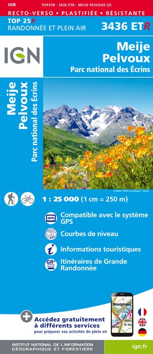
IGN topographic map 3436 ET

Location complements

Departure from the parking just before the Lautaret pass (when coming from La Grave)

Reception complements

This route takes you inside the Ecrins National Park; please respect the rules.

Tricky passages

Vertiginous passage on the Crevasses Path; To be avoided in wet weather and during thunderstorms.

Animals

No

Data author

Ratings and reviews

To see around
See more
Open
Close
Show
Show
Show
Show
Show
Show
Show
Show
Show
Show
Show
Caution!
We have no information on the difficulty of this circuit. You may encounter some surprises along the way. Before you go, please feel free to inquire more and take all necessary precautions. Have a good trip! 🌳🥾