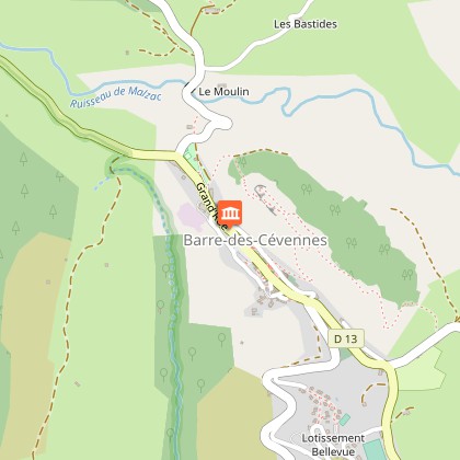
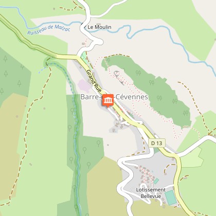
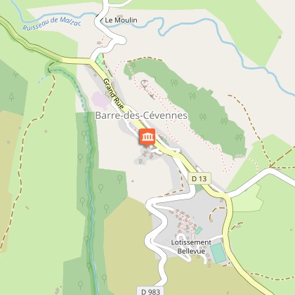
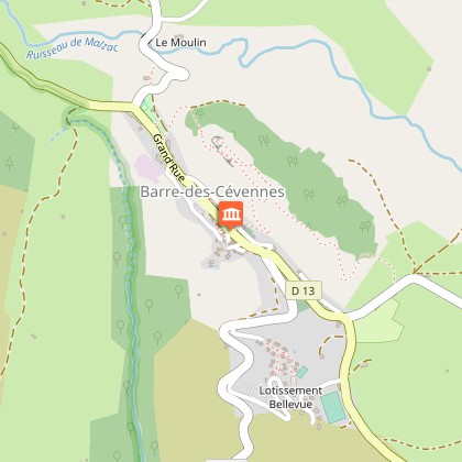
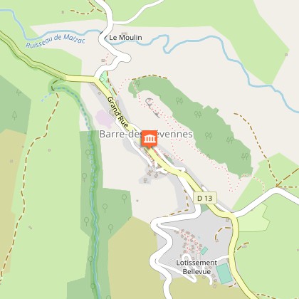
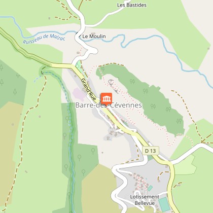
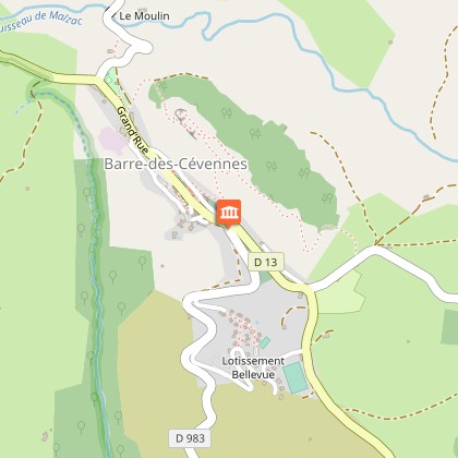
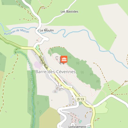
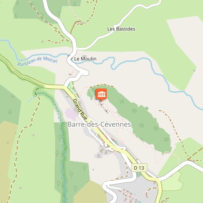
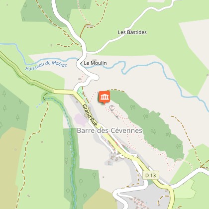
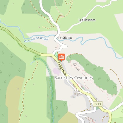
To see around
See more
Open
Close
Show
Show
Show
Show
Show
Show
Show
Show
Show
Show
Show

Oups... It would appear that Cirkwi does not have permission to use your location.

Description
Map
Points of interest
Ratings and reviews
See around

Barre-des-Cévennes

Vue sur Barre-des-Cévennes
Sentier de Barre-des-Cévennes
Credit : © Olivier Prohin

Description

This trail showcases the different aspects of Barre-des-Cévennes, from the lanes of the old village to the panoramic viewpoints.

A few clarifications:• A few dozen metres after Point 6, take the stairs on the right.• Between Points 9 and 10, the path may be closed by two barriers. Please be sure to close them again after yourself.• Steep uphill section after Point 13.•  At Point 16, do not climb the rocks – risk of falling. •  Steep downhill section after Point 18.

Technical informations

This circuit was updated on: 16/11/2022
3.7 km
2 h
125 m

Altimetric profile

Starting point

Lat : 44.2465361Lng : 3.6514907

Points of interest

image du object

Place de la loue (Hiring Square)

Marker 1This little square, located at the north-eastern entrance to the village, was where the “loue” (hiring) used to be held during the great spring and autumn fairs: shepherds, domestics and chestnut gatherers would sit on the parapet and hope for an employer to take them on. The village hosted 12 to 15 fairs every year. The spring and autumn ones could attract up to ten thousand people from neighbouring departments, but also from the Var, Vaucluse and Bouches-du-Rhône. This village-rue (one-road village) was protected at each end by a fortified gate. One of them, called the Florac Gate, stood near the Place de la Loue. It was destroyed in the early 19th century.

- Parc national des Cévennes -
Consulter
image du object

Théron Fountain

Marker 2Barre was built on the contact zone between sandstone and mica schist. Several springs and seeps emerge from this impermeable zone, which feed into the village’s fountains and garden wells. The oldest, the Théron Fountain, has been restored several times. The typical Barre house is generally taller than it is wide, probably to avoid encroaching on cultivatable land. On the ground floor would have been a shop, workshop, storage space, or the stable; on the first floor, the kitchen; and above that one or two bedrooms. At the very top, a hay loft would have been used to store hay and straw.

- Parc national des Cévennes -
Consulter
image du object

Wall plants

Marker 3Vegetation on walls has to overcome the lack of both soil and water. To persist under these conditions, there are three possible strategies:- spending the hardest season as seeds, as annuals do, e.g. thyme-leaved sandwort (arenaria serpyllifolia);- laying in water reserves, as succulent plants do, e.g. white stonecrop (sedum album);- drying out without dying, as lichens and mosses do. By breaking down the substrate, these also create a bit of soil for superior plants (those with flowers and therefore seeds: sandwort, stonecrop, etc.).

- Parc national des Cévennes -
Consulter
image du object

Place des écoles (Schools Square)

Marker 4“Schools Square” has changed name several times over the years. In the Middle Ages, it was known as PourcariéSqaure because it hosted the pig market. Later the market also opened up to oxen, horses and mules, and was therefore renamed the Fairground Square. It was the most important area of the fairs, where the largest sums of money changed hands. During the Protestant Camisard Rebellion (1702-1704), the square was protected by a large wooden palisade. During the 1789 French Revolution, the National Guard held arms drills here, and its name changed to Arms.

- Parc national des Cévennes -
Consulter
image du object

Place de la Madeleine

Marker 5The fountain dates from the 18th century. At the end of the 19th  century, the bust of Marianne – the personification of the French Republic – was added. At the same time, a poplar was planted by republican youth as a symbol of freedom. From here, you can see several bourgeois houses, which mostly date from the 17th and 18th centuries. They bear witness to the village’s thriving past, when it had some 20 voituriers (merchant-carters), who would drive their carts down to the plains laden with wool and chestnuts and return with salt, wine and oil. Under the houses' large porches, harnesses and carts were kept. During fairs, the seed market took place in these vaults and those of the town hall.

- Parc national des Cévennes -
Consulter
image du object

The Château

Marker 6Constructed in the 12th and 13th centuries, the Château was entirely rebuilt in the early 16th century. From 1710 to 1715, it was modified by the Lord of Barre, who had his coat of arms carved above the entrance. Two towers were also added at this time. During the 1789 Revolution, the coat of arms disappeared under vigorous hammer strokes. In the early 19th century, during an expansion, the main tower was removed.

- Parc national des Cévennes -
Consulter
image du object

The temple (Protestant church)

Marker 7Begun in 1823 and finished in 1826, this temple was Barre’s third. Its architecture is similar to that of all the temples built at this time. The first temple had been constructed in 1608 near the Catholic church, shortly after the arrival of Protestantism in the region. Only one of its stones still exists and can today be seen in the facade of a house on the main street, inscribed: “He who is of God hears the word of God – 1608”. In 1675 Protestants built a second temple below the village. It was destroyed on Royal orders in 1685 following the Revocation of the Edict of Nantes (which re-criminalised Protestantism), forcing Protestants to hold their religious gatherings in the mountains.

- Parc national des Cévennes -
Consulter
image du object

The Catholic church

Marker 8The church was probably built in the 12th century. Its barrel-vaulted nave is Romanesque in style. The original building was extended by several lateral additions in the Gothic style: in the 14th century, a chapel (north side) featuring the coat of arms of the Lords of Barre; in the 15th, three chapels on the south side. The church has been a listed building since 1931. In front of it is the Place de la Bladarié, which hosted the medieval seed market and, as of the 16th century, the sheep market.

- Parc national des Cévennes -
Consulter
image du object

Place de l'Orient

Marker 9Barre’s third fountain used to stand on this square, where the pig market was held from the 16th century onwards. At the entrance to the main road was the Cévennes Gate, dismantled in 1836 because it obstructed carts. The houses adjoining this Gate and the Florac Gate were requisitioned during the Camisard War to house the King’s soldiers. At the time, Barre was one of their main garrisons.

- Parc national des Cévennes -
Consulter
image du object

Ash trees pruned in the “tadpole” style

Marker 10No water runs in this little gully in the summer. You can see a large number of ash trees of a particular shape caused by regular pruning, called “tadpole”. Ash trees prefer relatively deep and humid soils, but locals have privileged it here over its direct rivals (willows, aspen, and hazelnuts). Celts and Germanic tribes already considered the ash a sacred tree, believing it to attract lightning and beneficial rains. Its hard and elastic wood is much appreciated in cabinet-making. It is also used for tool handles. The first skis were made of ash. Farmers use ash leaves as supplementary fodder for livestock.

- Parc national des Cévennes -
Consulter
image du object

Village de vacances (holiday village)

Marker 12Barre’s holiday village was built in 1971 by the association of local councils. It consists of 30 units and can accommodate 180 people. The impetus behind its construction was a re-orientation of Barre’s economy towards tourism.

- Parc national des Cévennes -
Consulter
image du object

Forest

Marker 15The landscape stretching eastwards is characterised by forest. Over 60% of the surface area is covered in woods, of which 40% are conifers. Many of the latter are species introduced by the Office National des Forêts (the body that manages state forests): European Black Pines and Nordmann Firs on the heights, Douglas Firs in the depressions. Scots Pines – an indigenous species which colonised former sheep pastures after they were abandoned at the end of the 19th century – are usually relegated to poor and thin soils. Only 20% of the wooded area is taken up by deciduous trees, essentially beeches, sessile oaks and birches.

- Parc national des Cévennes -
Consulter
image du object

Ruiniform rocks

Marker 16The Castelas, a butte, is a vestige of the area’s former limestone top layer. It has been cut off from the great Causses by erosion. It was settled in about 2500 BC by tribes from the scrublands of Languedoc. On the three rocks left by erosion are ten or so rectangular holes. They are believed to have supported the base of a wooden signal tower.

- Parc national des Cévennes -
Consulter
image du object

Rock plants

Marker 17These rocks offer a plant habitat comparable to stone walls, but plants have been established here for longer. Most shelter along fissures or shelves, where they can find a few minerals and organic matter, leaving the smooth rock faces to lichens. The dolomite rock has created particular soil conditions here, which are favourable to certain plants such as Kernera saxatilis. Erosion has created small cavities that shelter certain birds, such as the black redstart (phoenicurus ochruros) in summer and the alpine accentor (prunella collaris) in winter.

- Parc national des Cévennes -
Consulter
image du object

The watershed

Marker 18At the centre of the landscape, the river Malzac meanders through the relatively gentle relief and then flows into the Mimente in the Atlantic catchment area. Meanwhile the Grisoulle, on your left, is a tributary of the Gardon, which flows into the nearby Mediterranean, cutting abrupt slopes into the relief as it goes. The Grisoulle’s gradient is six times steeper than the Malzac’s. It is quite possible that in a few thousand years, the Grisoulle will capture the Malzac and profoundly alter the landscape. The little pass that separates them is the watershed, which also goes through the Castelas and Can Noire.

- Parc national des Cévennes -
Consulter
image du object

The Malzac valley

The erosion caused by the Malzac, weaker than that caused by the Griboulle, has left more land usable for crops and fields. This allows farmers to keep a few cow herds. The region’s climate, relief and soils force its inhabitants to base the local economy on agricultural and forestry activities of low productivity. At the same time, climatic and environmental variety generates a large range of plant and animal species, the source of abundant bio-diversity. The Cévennes National Park has worked hard to conserve this wealth by re-introducing some species that had disappeared: roe deer, stags, the Western capercaillie, beavers, and the griffon vulture.

- Parc national des Cévennes -
Consulter
image du object

Scree

Marker 19Limestone is made up of thin layers topped by thicker ones. Water penetrates into the rock’s interstices and, when it freezes, fractures it. The base layers are more fissured and therefore eliminated more quickly. That is how the overhangs you can see at three different heights were created. These rocky environments have an important ecological role because they are a refuge for certain species of plants (French-leaf sorrel) and animals (little owl). A little further down, some seeps support wetland vegetation: horsetails, hemp-agrimony. This is also a meeting-point for many butterflies (great banded grayling, marbled white), which are the only creatures that can reach the nectar deep inside hemp-agrimonies and plume thistles.

- Parc national des Cévennes -
Consulter
image du object

Place des Ayres (Threshing Square)

Marker 20So called because it used to be where most of Barre’s farmers came to thresh their grains using flails. This technique, known since Gallo-Roman times, was for a long time the most widely used.

- Parc national des Cévennes -
Consulter

Additional information

Departure

Public weigh-station (poids public) as you enter Barre-des-Cévennes

Arrival

Place des Ayres

Ambiance

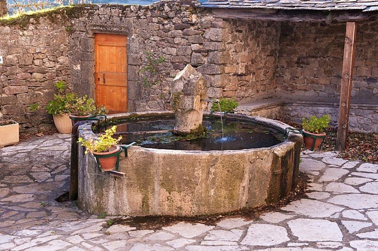
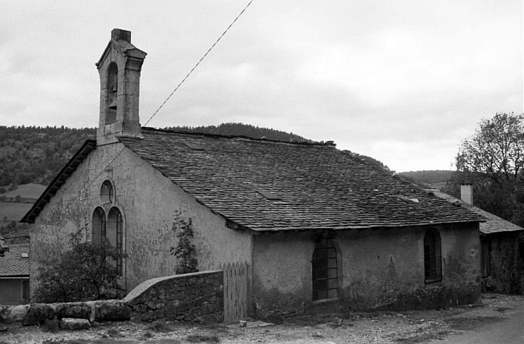
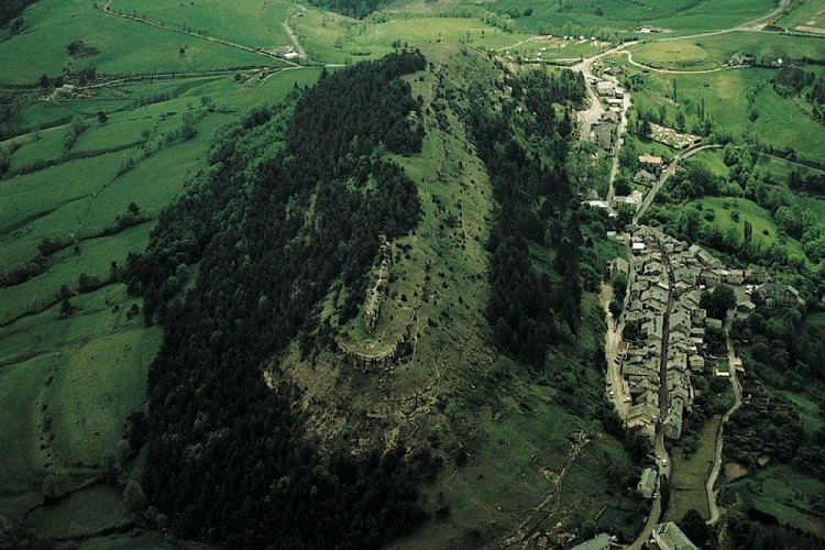
In the shelter of the Castelas, the facades of Barre-des-Cévennes line up, reminding us of its past as a rich and lively small town. In fact, the village is located at the very hinge of two different but complementary regions, and controls one of the most frequent crossing points between the Lower and Upper Cévennes. The trail leads you from gardens to fountains, from the temple (Protestant church) to the Catholic church, to the old fairgrounds and then onto the heights, where you can enjoy exceptional panoramic views onto the scenery of the Cévennes National Park.

Access

Barre-des-Cévennes on the D 907 and then D 9 from Florac; after Nozières hamlet, take the D 983 on the left.

Advised parking

On the right as you enter the village coming from the Col du Rey pass

Advice

This trail has rather steep slopes (60%) and cliff sections that are difficult for people with walking difficulties. Children must be kept under parents' supervision. Horse-riding or mountain-biking are not allowed on or adapted to discovery trails.

Data author

Ratings and reviews

To see around
See more
Open
Close
Show
Show
Show
Show
Show
Show
Show
Show
Show
Show
Show