To see around
See more
Open
Close
Show
Show
Show
Show
Show
Show
Show
Show
Show
Show
Show

Oups... It would appear that Cirkwi does not have permission to use your location.

Description
Map
Points of interest
Ratings and reviews
See around

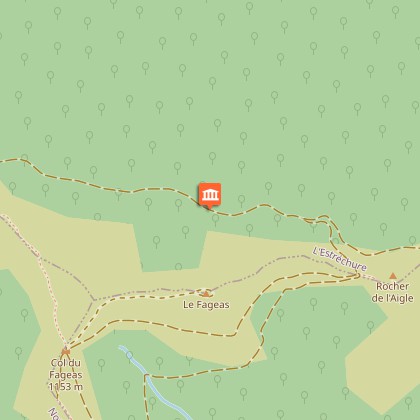
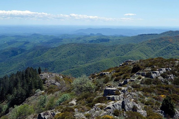
The Rocher de l'Aigle (Eagle's Rock)

Randonneur au col de l'Asclier
Vue panoramique
Credit : © Olivier Prohin

Description

This walk offers you a striking perspective onto the Vallée Borgne. Views stretch from the ocean to Mont Lozère and, on a clear day, perhaps even to the pre-Alps.

Start at the Col de l'Asclier pass. After the sheep bridge, take the forest track on the right towards La Cale (GR 61/67). Go past a stele and, at the signpost for La Cale, leave the GR 61 to take a path on the right to the foot of the Rocher de l'Aigle rock (optional there-and-back to the summit). Go downhill to the Col de Fageas (be careful on the scree) and return to the Col de l'Asclier on the GR6B.

Technical informations

This circuit was updated on: 16/11/2022
4.3 km
2 h 45 mn
236 m

Altimetric profile

Starting point

Lat : 44.0777688Lng : 3.7443721

Points of interest

image du object

The forestry track

On the first two kilometres, up to the Rocher de l'Aigle, you are on the forestry track opened in 1938. Where there are forestry tracks, there are state-owned forests, meaning forests managed by the French state and the Office National des Forêts so as to develop the area. The presence of so many beech trees and pines is a marker of the previous reforestation policy on the Aigoual massif and in the Cevenol foothills. A plaque has been erected at the Col du Fageas pass, further along this trail, in memory of Max Nègre (1880 – 1960), one of the project managers of this collective undertaking. From 1935 to 1939, he thinned out the forests planted since the end of the 19th century and opened up forestry tracks.

- Parc national des Cévennes -
Consulter
image du object

Rush-leaf narcissus

Come in spring – up to the end of April – to see the rush-leaf narcissi opposite the Rocher de l'Aigle. They grow in abundance on the limited surface area of the sheltered and south-facing stony slope. Often there is only one fragrant flower per plant. Do not pick them! Take a photo instead!

- Parc national des Cévennes -
Consulter
image du object

Panoramic views

Enjoy a superb 360° view! On the northern horizon, you can see the summit of Mont Aigoual and, on the valley floor, the hamlets of Les Millerines and L'Abric in the foreground and a part of the districts of L'Estréchure and Saumane in the middle distance. Further north, the village of St-Roman-de-Tousque is perched on the long corniche of the Cévennes. To the east, you can make out the city of Alès, Mont Bouquet and, in the distance, the “giant of Provence”, Mont Ventoux (1,912 m). On the southern horizon are two limestone hills: the Jumelles de Monoblet. Behind them, Coutach hill overlooks Sauve and Quissiac. The Pic Saint-Loup rises above it all with its 658 m. You can also see a stretch of coastline, with the salt marshes of Aigues-Mortes and La Grande-Motte just visible. Further west, the Roc Blanc rises next to the Pic d'Anjeau. And finally, just opposite you, Mont Fageas, the summit of the Liron range, on which you have been walking west-to-east for an hour already.

- Parc national des Cévennes -
Consulter

Additional information

Departure

Col de l'Asclier

Arrival

Col de l'Asclier

Access

From Les Plantiers in the Vallée Borgne, take the D 20 to the Col de l'Asclier pass.

Advised parking

Col de l'Asclier pass

Advice

Make sure your equipment is appropriate for the day's weather conditions. Remember that the weather changes quickly in the mountains. Take enough water, wear solid shoes and put on a hat. Please close all gates and barriers after yourself.

Data author

Ratings and reviews

To see around
See more
Open
Close
Show
Show
Show
Show
Show
Show
Show
Show
Show
Show
Show