Alert
Alerts
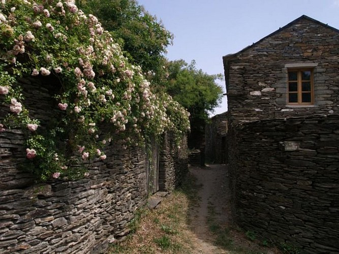
La Flandonenque
Description
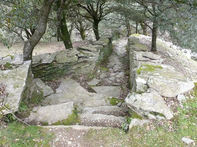
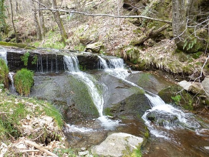
The sizeable valley in which the hamlet of Flandres stands is known as La Flandonenque and offers lush vegetation, hamlets steeped in history, and the Gardon de St-Germain-de-Calberte with its waterfalls and gours (natural basins).
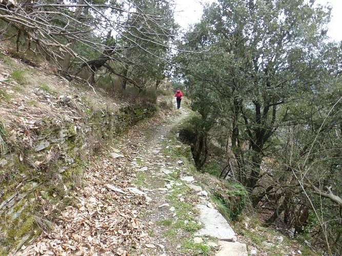
Start by following the dirt track (and stay on this main track). Then leave the track by heading right on L'Escaillou, a skidding track that goes uphill into the woods. At the second road, turn right to reach the hamlet of Flandres. As you leave Flandres, a path goes downhill on the right towards a mill, then joins up with the main track again, which takes you to Nozières. As you leave Nozières, go right at the last house and head for La Fare. The footpath becomes narrower for about 1.5 km. In a sharp bend, it meets a larger track. Turn left and enter La Fare by following the path between the houses. As you leave the hamlet, turn right. Follow the lane for about 100 m and turn left. In another small valley, the path curves to reach Le Vernet on the opposite slope. At Le Vernet, walk below the first house on the right, fork left and go through a barrier and then downhill through the meadow to a sheepfold. The path then joins a trincat (channel for diverting water) to reach a bridge. From the bridge, go up the slope in front of you to return to the starting-point.
Technical Information
Altimetric profile
Starting point
Points of interest

Additional information
Departure
Le Cros
Arrival
Le Cros
Access
In Saint-Germain-de-Calberte, take the road towards Lou Serre de la Can. After about 2 km, take the first turning on the right towards La Bernadelle / Le Cros.
Advised parking
Park where the lane exits the hamlet of Le Cros
Advice
Make sure your equipment is appropriate for the day's weather conditions. Remember that the weather changes quickly in the mountains. Take enough water, wear good shoes and put on a hat. Please close all gates and barriers after yourself.
Is in the midst of the park
The national park is an unrestricted natural area but subjected to regulations which must be known by all visitors.
Data author
