Alert
Alerts
Summer hike : les Aiguillettes
IGN cards


Description
This sublime hike, of average level, takes you in 1h30 to the top of the Aiguillettes, with incredible views all along the way.
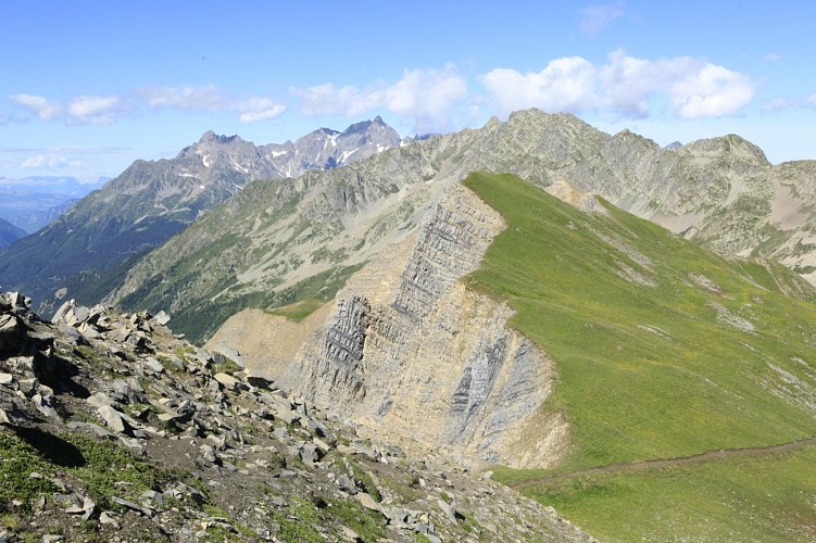
You will have the chance to get close to the geological folds which are unique in their shape and composition. An aerial atmosphere and yet without difficulty on this well-marked path. In the monthly bulletin of the Linnean Society of Lyon dated 1938, the chapter on the great excursions in Oisans began like this: "If there was one excursion that was eventful and full of unforeseen events, it was the one to the Sabot pass". In 2022, we could use the same adjectives for this path leading to the Aiguillettes. Indeed, this hike conceals many treasures that you will discover as you go along.
You will hear the marmots whistling, watch the slopes carefully, you will see them.
Marmots will whistle once to warn their community of an aerial danger, and several times to warn of a terrestrial danger such as a hiker or a fox, or a wolf that often passes through this area. You will often see griffon vultures circling the peaks. Be attentive, because during this hike, the fauna is present, on the ground, in the sky, in the distance.
Technical Information
Altimetric profile
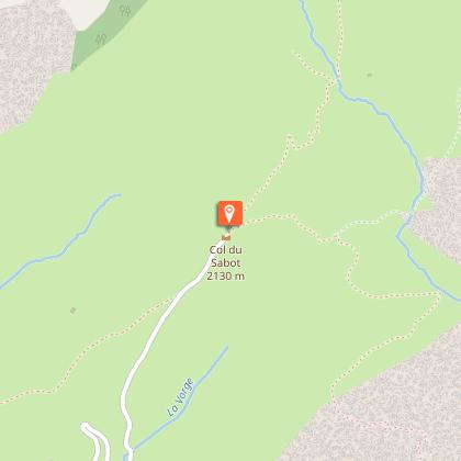
Starting point
Points of interest

Additional information
Environments
Mountain location
Updated by
Office de Tourisme de Vaujany - 12/06/2025
www.vaujany.com/fr/
Report a problem
Open period
From 01/06 to 31/10/2025.
Subject to favorable weather.
Contact
Phone : 04 76 80 72 37
Email : info@vaujany.com
Website : https://www.vaujany.com/fr/
Reception complements
Advice :
- Check the weather conditions before you leave.
- In case of emergency call 112.
- Adapt your clothing to the activity: bring good walking shoes, a windbreaker and a cap ....
- Bring snacks and water.
Animals
Yes
Data author
