Alert
Alerts
Type of practice
Walking
Easy
Presentation
Map
Steps
Cirkwi brief's
Ratings and reviews
See around
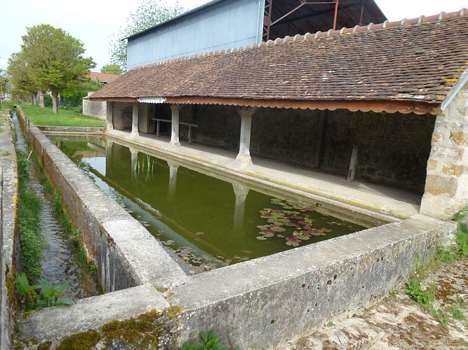
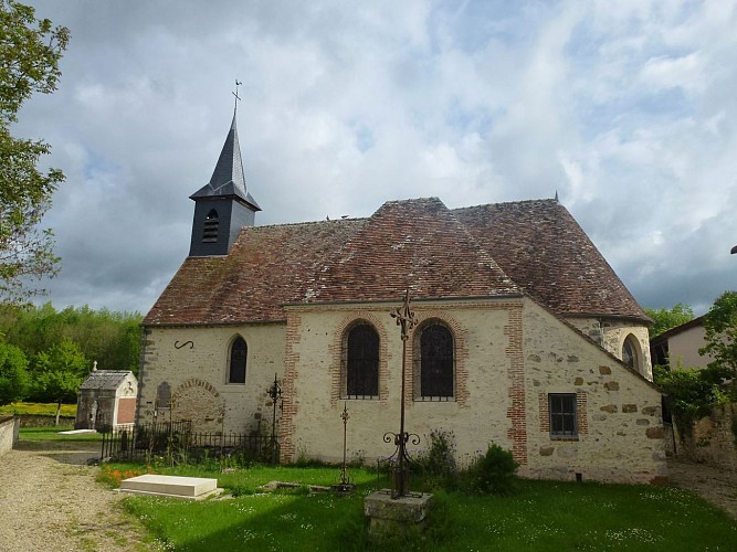
Luisetaines, the marsh of Auxence

Credit : ©ccbm
The Cirkwi brief
Discover Luisetaines: A Unique Hike Through Nature and History
The picturesque village of Luisetaines, nestled an easy 80km from Paris, is more than just a postcard-worthy French village. It's a gateway to the enchanting rural landscape of the Montois region. Offered by the Communauté de communes Bassée-Montois, this route invites wanderers to explore the serene marais of l'Auxence, the historical muse nestled beside the local church, and offers a unique stay with ayurvedic massages. Indulge in the natural beauty of rolling hills, dense woods, and sprawling fields, where each step echoes the harmonious blend of culture and tranquility.
Essential Route Insights
Covering a distance of 10.24km and navigating through altitudes ranging from 58 to 111 meters, the path presents a total positive elevation change of 154 meters. This journey offers an easy to moderate walking difficulty, accommodating both casual walkers and seasoned hikers looking to explore the scenic Montois district. The detailed technical analysis promises an engaging experience within the natural contours and cultural landmarks, making it an accessible adventure for those captivated by the rural charms of France.
Travel Tips for Every Season
Before embarking, consider the seasonal nuances of the Luisetaines region. Spring and Autumn are ideal, offering mild temperatures and less crowded paths. Ensure to wear comfortable walking shoes and carry water, especially during the warmer months. Winter visits can be magical, with crisp air and tranquil silence, but be mindful of shorter days. Always check local weather and heed any advice from the Communauté de communes Bassée-Montois for an enjoyable exploration.
Heart of The Montois Region
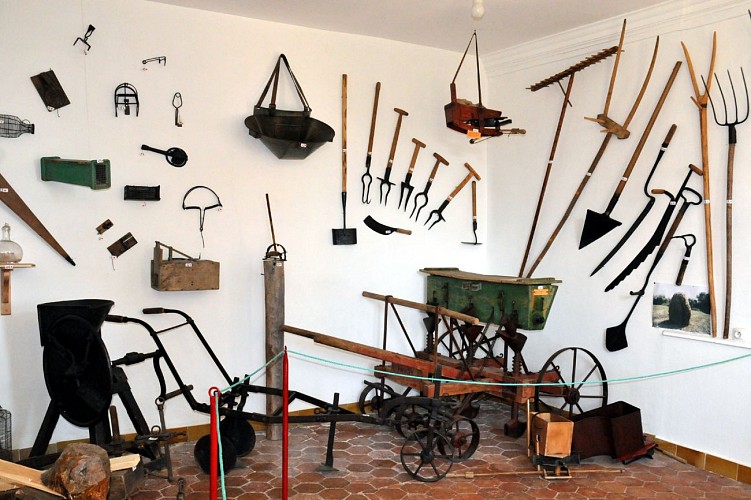
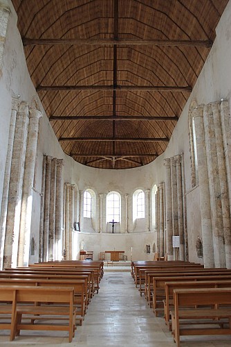
Luisetaines does not merely rest within the expansive Ile-de-France; it thrives as a testament to the enduring spirit of the Montois district. The village, with its proximity to historical marvels such as the church of Paroy and enriched landscapes like the marais de l'Auxence, weaves a rich tapestry of French history and culture. This journey is not just a walk through nature but a passage through time, revealing the layers of historical evolution that have shaped this verdant region.
Weather Patterns and Ideal Visits
The climate in Luisetaines is typically temperate, boasting warm summers and cool winters, which makes almost any season a good time to visit. However, to truly savor the natural beauty and cultural offerings, late spring to early autumn presents the most agreeable weather conditions. During these months, the countryside blooms with life, and mild temperatures make outdoor activities especially pleasant. Observing local weather trends can further enrich your travel experience, ensuring that your journey through Luisetaines is as comfortable as it is memorable.
The picturesque village of Luisetaines, nestled an easy 80km from Paris, is more than just a postcard-worthy French village. It's a gateway to the enchanting rural landscape of the Montois region. Offered by the Communauté de communes Bassée-Montois, this route invites wanderers to explore the serene marais of l'Auxence, the historical muse nestled beside the local church, and offers a unique stay with ayurvedic massages. Indulge in the natural beauty of rolling hills, dense woods, and sprawling fields, where each step echoes the harmonious blend of culture and tranquility.
Essential Route Insights
Covering a distance of 10.24km and navigating through altitudes ranging from 58 to 111 meters, the path presents a total positive elevation change of 154 meters. This journey offers an easy to moderate walking difficulty, accommodating both casual walkers and seasoned hikers looking to explore the scenic Montois district. The detailed technical analysis promises an engaging experience within the natural contours and cultural landmarks, making it an accessible adventure for those captivated by the rural charms of France.
Travel Tips for Every Season
Before embarking, consider the seasonal nuances of the Luisetaines region. Spring and Autumn are ideal, offering mild temperatures and less crowded paths. Ensure to wear comfortable walking shoes and carry water, especially during the warmer months. Winter visits can be magical, with crisp air and tranquil silence, but be mindful of shorter days. Always check local weather and heed any advice from the Communauté de communes Bassée-Montois for an enjoyable exploration.
Heart of The Montois Region
Luisetaines does not merely rest within the expansive Ile-de-France; it thrives as a testament to the enduring spirit of the Montois district. The village, with its proximity to historical marvels such as the church of Paroy and enriched landscapes like the marais de l'Auxence, weaves a rich tapestry of French history and culture. This journey is not just a walk through nature but a passage through time, revealing the layers of historical evolution that have shaped this verdant region.
Weather Patterns and Ideal Visits
The climate in Luisetaines is typically temperate, boasting warm summers and cool winters, which makes almost any season a good time to visit. However, to truly savor the natural beauty and cultural offerings, late spring to early autumn presents the most agreeable weather conditions. During these months, the countryside blooms with life, and mild temperatures make outdoor activities especially pleasant. Observing local weather trends can further enrich your travel experience, ensuring that your journey through Luisetaines is as comfortable as it is memorable.
Automatically generated.
Technical Information
Walking
Difficulty
Easy
Dist.
10 km
Type of practice
Walking
Easy
Show more
Altimetric profile
Starting point
26-32
Grande Rue
,
77520
Luisetaines
Lat : 48.46813Lng : 3.18062
Steps
Data author

Ratings and reviews
To see around