Alert
Alerts
Type of practice
Walking
Easy
Presentation
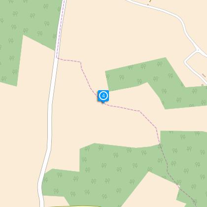
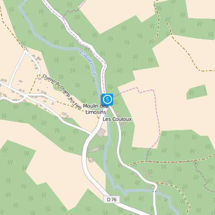
Map
Steps
Cirkwi brief's
Ratings and reviews
See around
The Auxence Valley

Credit : ©SI de Donnemarie
The Cirkwi brief
Discover the Hidden Gems of Little Switzerland in Brie
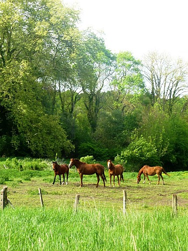
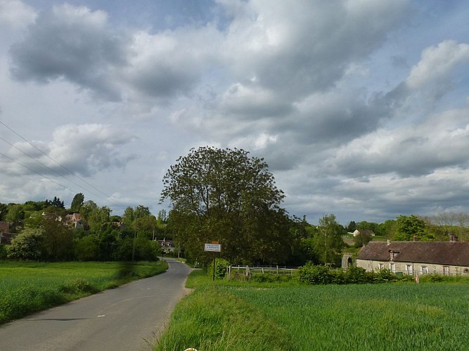
Nestled between the Brie plain and the Seine valley, the Montois region, affectionately dubbed "Little Switzerland of Brie," offers a treasure trove of natural and cultural wonders. This journey curated by the Communauté de communes Bassée-Montois will take you through an enchanting mix of fields, woodlands, and valleys, enriching your adventure with historical marvels such as charming churches and ancient washhouses. Marvelous panoramas await, promising an unforgettable ambiance suspended between the serenity of nature and the whispers of the past.
Technical Insights for Your Hike
The meticulously laid out itinerary spans approximately 12.74 kilometers, with a manageable ascent and descent both capped at 364 meters. This route traverses an elevation range from 76 to 137 meters, demonstrating a relatively modest yet engaging topographical diversity. Ideal for enthusiastic walkers, the path requires a basic level of fitness due to the varied elevation. Analyzing these specifics, one can conclude that this journey strikes a perfect balance between ease and challenge, making it suitable for most avid hikers seeking an immersive outdoor experience.
Seasonal Tips for Travelers
Embarking on this scenic route demands preparation. For summertime treks, lightweight clothing, sun protection, and ample water are key to combatting the heat. Spring and autumn, with their milder temperatures, are ideal for those wishing to enjoy lush landscapes or the vibrant hues of fall, albeit with added layers for cool starts. Winter calls for caution; sturdy boots and weather-appropriate gear are essential to navigate potentially slippery paths. Beyond attire, always inform someone of your hiking plans and estimated return, ensuring safety throughout your adventure.
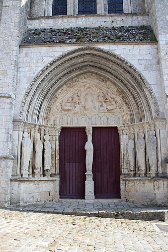
Exploring the Historical Heart of Brie
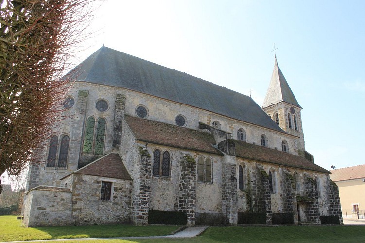
Diving into the rich tapestry that is the heritage of the Montois region reveals a history deeply intertwined with the landscapes of Brie and the Seine valley. Donnemarie-Dontilly, serving as the starting point, is a beacon of regional history enveloped by the natural beauty often likened to a miniature Switzerland. This area, characterized by its enchanting villages, architectural marvels like ancient churches, and traditional washhouses, underscores the unique cultural identity that has evolved over centuries within the Ile-de-France region, spotlighting the importance of preserving these natural and man-made landmarks.
Weather and Climate Guidelines
The Montois region enjoys a temperate climate, with distinct seasonal variations that influence the ideal times for visits. Spring and autumn offer the most pleasant weather for hiking, marked by moderate temperatures and reduced rainfall, making these periods optimal for exploring the outdoors. Winters, while generally mild, can occasionally present challenges with colder snaps and precipitation, potentially affecting trail conditions. Conversely, summer promises warmer days, suitable for those prepared for potentially higher temperatures. Considering these patterns, planning your visit during the milder transitional seasons is highly recommended for the most comfortable and visually rewarding experience.
Nestled between the Brie plain and the Seine valley, the Montois region, affectionately dubbed "Little Switzerland of Brie," offers a treasure trove of natural and cultural wonders. This journey curated by the Communauté de communes Bassée-Montois will take you through an enchanting mix of fields, woodlands, and valleys, enriching your adventure with historical marvels such as charming churches and ancient washhouses. Marvelous panoramas await, promising an unforgettable ambiance suspended between the serenity of nature and the whispers of the past.
Technical Insights for Your Hike
The meticulously laid out itinerary spans approximately 12.74 kilometers, with a manageable ascent and descent both capped at 364 meters. This route traverses an elevation range from 76 to 137 meters, demonstrating a relatively modest yet engaging topographical diversity. Ideal for enthusiastic walkers, the path requires a basic level of fitness due to the varied elevation. Analyzing these specifics, one can conclude that this journey strikes a perfect balance between ease and challenge, making it suitable for most avid hikers seeking an immersive outdoor experience.
Seasonal Tips for Travelers
Embarking on this scenic route demands preparation. For summertime treks, lightweight clothing, sun protection, and ample water are key to combatting the heat. Spring and autumn, with their milder temperatures, are ideal for those wishing to enjoy lush landscapes or the vibrant hues of fall, albeit with added layers for cool starts. Winter calls for caution; sturdy boots and weather-appropriate gear are essential to navigate potentially slippery paths. Beyond attire, always inform someone of your hiking plans and estimated return, ensuring safety throughout your adventure.
Exploring the Historical Heart of Brie
Diving into the rich tapestry that is the heritage of the Montois region reveals a history deeply intertwined with the landscapes of Brie and the Seine valley. Donnemarie-Dontilly, serving as the starting point, is a beacon of regional history enveloped by the natural beauty often likened to a miniature Switzerland. This area, characterized by its enchanting villages, architectural marvels like ancient churches, and traditional washhouses, underscores the unique cultural identity that has evolved over centuries within the Ile-de-France region, spotlighting the importance of preserving these natural and man-made landmarks.
Weather and Climate Guidelines
The Montois region enjoys a temperate climate, with distinct seasonal variations that influence the ideal times for visits. Spring and autumn offer the most pleasant weather for hiking, marked by moderate temperatures and reduced rainfall, making these periods optimal for exploring the outdoors. Winters, while generally mild, can occasionally present challenges with colder snaps and precipitation, potentially affecting trail conditions. Conversely, summer promises warmer days, suitable for those prepared for potentially higher temperatures. Considering these patterns, planning your visit during the milder transitional seasons is highly recommended for the most comfortable and visually rewarding experience.
Automatically generated.
Technical Information
Walking
Difficulty
Easy
Dist.
13 km
Type of practice
Walking
Easy
Show more
Altimetric profile
Starting point
14
Rue de la Porte de Melun
,
77520
Donnemarie-Dontilly
Lat : 48.47848Lng : 3.13079
Steps
Data author

Ratings and reviews
To see around