Alert
Alerts
Type of practice
Walking
Very easy
Presentation
Map
Steps
Cirkwi brief's
Ratings and reviews
See around
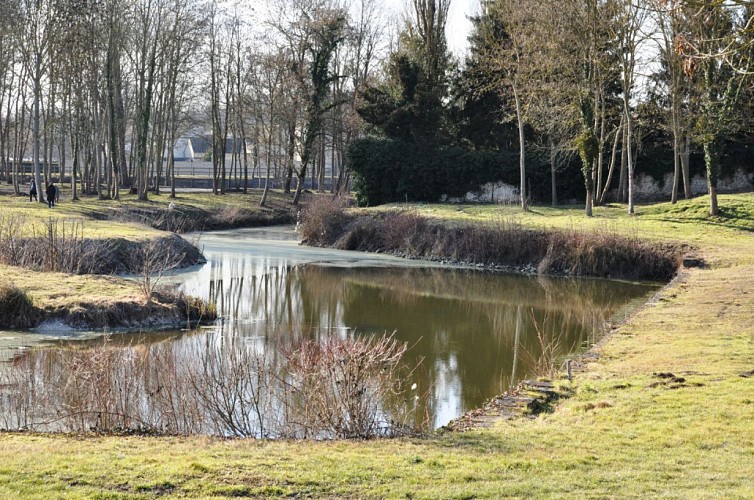
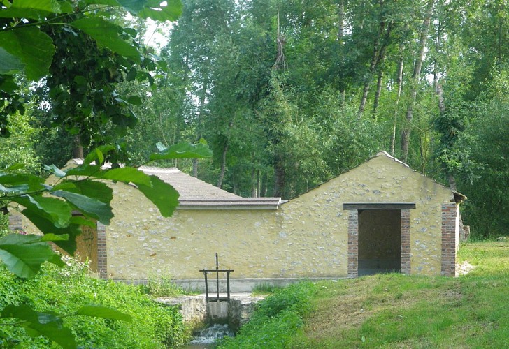
On the edge of the rû des Méances

Credit : ©ccbm
The Cirkwi brief
Discover the Scenic Trail by the Rû des Méances
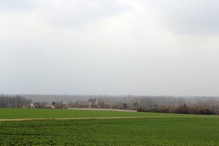
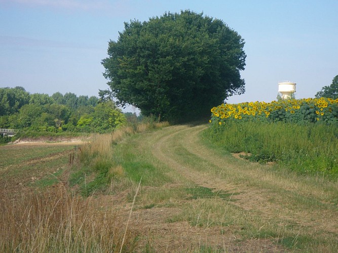
Nestled between Everly and Chalmaison, this picturesque walking trail is a treasure waiting to be discovered. As you embark on this journey, you are treated to expansive views of the Bassée valley, culminating in a serene rest by the historical lavoir of the rû des Méances. The trail is an invitation from the Communauté de communes Bassée-Montois to explore the unspoiled beauty and tranquility of this region. Allow yourself to be captivated by the natural splendor and the gentle whisper of history that echoes through the valley.
Brief Technical Overview of Your Walk
Spanning approximately 7.95 km, the trail from Rue de la Mairie in Chalmaison displays an elevation range with a minimum altitude of 57 meters and reaches a maximum of 133 meters. The route presents a positive elevation gain hovering around 135 to 136 meters, challenging walkers with its undulating terrain. Crafted by the Communauté de communes Bassée-Montois, it showcases the engineering thoughtfulness put into balancing accessibility with natural preservation.
Seasonal Tips and Safety Advice
Regardless of the season, always ensure you're prepared for the trail. In spring and summer, the path is lush and vibrant, perfect for bird watchers and nature lovers. However, wear suitable footwear to contend with potentially muddy sections. Autumn brings a spectacular display of changing leaves but shorter days mean carrying a flashlight is wise. Winters can be cold, and the path may be slippery; extra caution is required. Always notify someone of your itinerary, and ensure your mobile phone is fully charged.
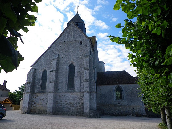
Exploring the Historical Bassée-Montois Area
The area of Bassée-Montois, encapsulating both Everly and Chalmaison, stands as a testament to a rich tapestry of history and culture. Situated in the Seine-et-Marne department, the region is a reflection of France's profound historical layers, from medieval times to the modern era. It's not just the scenic walks but the stories of the past that make this territory a remarkable place to explore. The trail itself, set by the captivating rû des Méances, invites wanderers not just to witness nature but to step into the historical narrative of the land.
Climate Insights and Optimal Visitation Times
The Seine-et-Marne region features a temperate climate, with mild summers and chilly winters. Spring (April to June) and autumn (September to November) offer the most temperate conditions for enjoying outdoor activities like hiking. These periods showcase the natural beauty of the area in full bloom and a kaleidoscope of fall colors, respectively. To experience the trail at its best, aim for these windows when the weather is at its most forgiving, and the landscape is vibrantly alive.
Nestled between Everly and Chalmaison, this picturesque walking trail is a treasure waiting to be discovered. As you embark on this journey, you are treated to expansive views of the Bassée valley, culminating in a serene rest by the historical lavoir of the rû des Méances. The trail is an invitation from the Communauté de communes Bassée-Montois to explore the unspoiled beauty and tranquility of this region. Allow yourself to be captivated by the natural splendor and the gentle whisper of history that echoes through the valley.
Brief Technical Overview of Your Walk
Spanning approximately 7.95 km, the trail from Rue de la Mairie in Chalmaison displays an elevation range with a minimum altitude of 57 meters and reaches a maximum of 133 meters. The route presents a positive elevation gain hovering around 135 to 136 meters, challenging walkers with its undulating terrain. Crafted by the Communauté de communes Bassée-Montois, it showcases the engineering thoughtfulness put into balancing accessibility with natural preservation.
Seasonal Tips and Safety Advice
Regardless of the season, always ensure you're prepared for the trail. In spring and summer, the path is lush and vibrant, perfect for bird watchers and nature lovers. However, wear suitable footwear to contend with potentially muddy sections. Autumn brings a spectacular display of changing leaves but shorter days mean carrying a flashlight is wise. Winters can be cold, and the path may be slippery; extra caution is required. Always notify someone of your itinerary, and ensure your mobile phone is fully charged.
Exploring the Historical Bassée-Montois Area
The area of Bassée-Montois, encapsulating both Everly and Chalmaison, stands as a testament to a rich tapestry of history and culture. Situated in the Seine-et-Marne department, the region is a reflection of France's profound historical layers, from medieval times to the modern era. It's not just the scenic walks but the stories of the past that make this territory a remarkable place to explore. The trail itself, set by the captivating rû des Méances, invites wanderers not just to witness nature but to step into the historical narrative of the land.
Climate Insights and Optimal Visitation Times
The Seine-et-Marne region features a temperate climate, with mild summers and chilly winters. Spring (April to June) and autumn (September to November) offer the most temperate conditions for enjoying outdoor activities like hiking. These periods showcase the natural beauty of the area in full bloom and a kaleidoscope of fall colors, respectively. To experience the trail at its best, aim for these windows when the weather is at its most forgiving, and the landscape is vibrantly alive.
Automatically generated.
Technical Information
Walking
Difficulty
Very easy
Dist.
7.9 km
Type of practice
Walking
Very easy
Show more
Altimetric profile
Starting point
2B
Rue de la Mairie
,
77650
Chalmaison
Lat : 48.48323Lng : 3.2511
Steps
Data author

Ratings and reviews
To see around