Alert
Alerts
Type of practice
Walking
Very easy
Presentation
Map
Steps
Cirkwi brief's
Ratings and reviews
See around
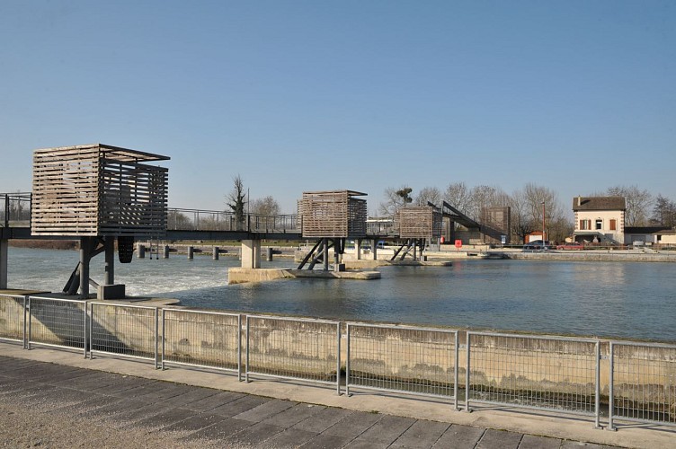
Detour by the Jaulnes Dam


Credit : ©ccbm
The Cirkwi brief
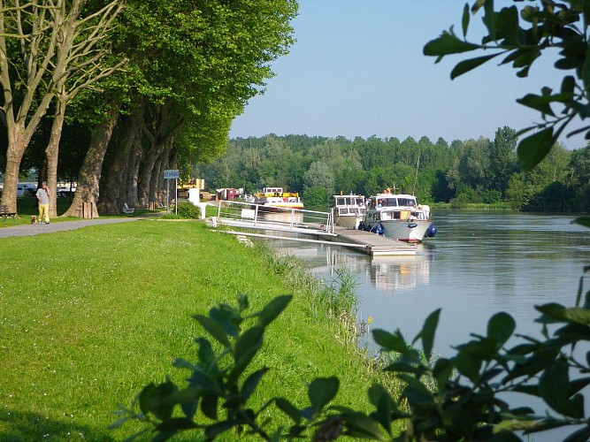
Explore the Historical Charm of Bray-sur-Seine: A Scenic Family Walk
Offered by the Communauté de communes Bassée-Montois, this journey starts from Bray-sur-Seine, taking you through a charming loop by the Seine, including a passage over the Jaulnes dam and through the old town center. This itinerary promises a relaxing outing enriched with picturesque sights that encapsulate the essence of rural France. Picture yourself ambling alongside the tranquil waters, the path unfolding history and natural beauty with every step. It's a serene escapade, perfect for families or anyone looking to immerse themselves in the gentle flow of countryside life.
Brief Technical Snapshot: Know Your Route
Stretching over 7.029 kilometers, this walking tour presents a minimal elevation variation, fluctuating between 54 and 60 meters above sea level. The route boasts a balanced elevation gain and loss of 50 meters, making it an accessible endeavor for walkers of all levels. Whether you're an avid hiker or someone enjoying a leisurely stroll, the technical profile of this route suggests a comfortable journey ahead, without the challenge of steep climbs or difficult terrain.
Seasonal Tips and Safety Guidelines
For an enjoyable experience, timing and preparation are key. Spring and autumn offer mild temperatures and scenic beauty, ideal for walking. Summers are pleasant but remember to carry water and sun protection. Winters, though cold, reveal a stark beauty of the landscape. Regardless of the season, sturdy walking shoes are recommended. Always check the weather before heading out, and note that the path by the dam can be slippery after rain. Respect the local wildlife and heed any safety signs along your way.
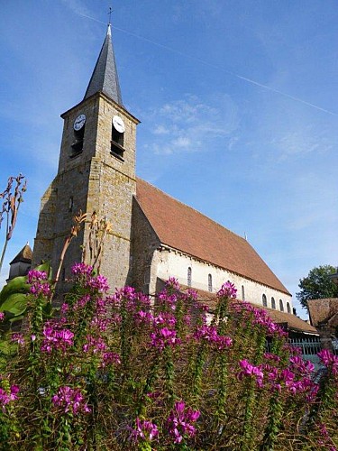
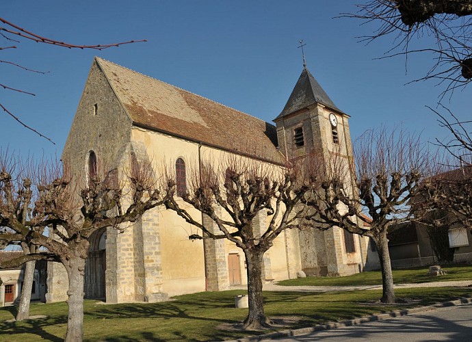
Bray-sur-Seine: A Glimpse into History
Nestled in the heart of the Commune of Bassée-Montois, Bray-sur-Seine boasts a rich tapestry of history and culture. This region, with its roots deeply embedded in the annals of French history, has witnessed the ebb and flow of countless generations. The old town center, through which this tranquil walk meanders, serves as a live museum, displaying architecture and historical landmarks that tell tales of the past. The nearby dam is not only a feat of engineering but also a marker of the community's harmony with the Seine's waters over centuries.
Climate Insights: Best Time for Your Visit
Bray-sur-Seine experiences a temperate climate, with mild differences between the seasons. Winters are chilly, making warm layers essential for those venturing outdoors. Spring sees the countryside bloom, offering cooler walks and vibrant scenes—arguably the most picturesque time to visit. Summer provides warm, but not overbearing, conditions, ideal for enjoying the full splendor of the Seine’s banks. Finally, autumn wraps the landscape in a cozy blanket of colors, offering a crisp ambiance for those seeking a serene escape. For optimal weather conditions, spring or early autumn visits are recommended.
Offered by the Communauté de communes Bassée-Montois, this journey starts from Bray-sur-Seine, taking you through a charming loop by the Seine, including a passage over the Jaulnes dam and through the old town center. This itinerary promises a relaxing outing enriched with picturesque sights that encapsulate the essence of rural France. Picture yourself ambling alongside the tranquil waters, the path unfolding history and natural beauty with every step. It's a serene escapade, perfect for families or anyone looking to immerse themselves in the gentle flow of countryside life.
Brief Technical Snapshot: Know Your Route
Stretching over 7.029 kilometers, this walking tour presents a minimal elevation variation, fluctuating between 54 and 60 meters above sea level. The route boasts a balanced elevation gain and loss of 50 meters, making it an accessible endeavor for walkers of all levels. Whether you're an avid hiker or someone enjoying a leisurely stroll, the technical profile of this route suggests a comfortable journey ahead, without the challenge of steep climbs or difficult terrain.
Seasonal Tips and Safety Guidelines
For an enjoyable experience, timing and preparation are key. Spring and autumn offer mild temperatures and scenic beauty, ideal for walking. Summers are pleasant but remember to carry water and sun protection. Winters, though cold, reveal a stark beauty of the landscape. Regardless of the season, sturdy walking shoes are recommended. Always check the weather before heading out, and note that the path by the dam can be slippery after rain. Respect the local wildlife and heed any safety signs along your way.
Bray-sur-Seine: A Glimpse into History
Nestled in the heart of the Commune of Bassée-Montois, Bray-sur-Seine boasts a rich tapestry of history and culture. This region, with its roots deeply embedded in the annals of French history, has witnessed the ebb and flow of countless generations. The old town center, through which this tranquil walk meanders, serves as a live museum, displaying architecture and historical landmarks that tell tales of the past. The nearby dam is not only a feat of engineering but also a marker of the community's harmony with the Seine's waters over centuries.
Climate Insights: Best Time for Your Visit
Bray-sur-Seine experiences a temperate climate, with mild differences between the seasons. Winters are chilly, making warm layers essential for those venturing outdoors. Spring sees the countryside bloom, offering cooler walks and vibrant scenes—arguably the most picturesque time to visit. Summer provides warm, but not overbearing, conditions, ideal for enjoying the full splendor of the Seine’s banks. Finally, autumn wraps the landscape in a cozy blanket of colors, offering a crisp ambiance for those seeking a serene escape. For optimal weather conditions, spring or early autumn visits are recommended.
Automatically generated.
Technical Information
Walking
Difficulty
Very easy
Dist.
7 km
Type of practice
Walking
Very easy
Show more
Altimetric profile
Starting point
22
Rue de l'Église
,
77480
Bray-sur-Seine
Lat : 48.41559Lng : 3.23687
Steps
Data author

Ratings and reviews
To see around