Alert
Alerts
From the Allier to the Cortal plateau

Description
An easy walk with three main themes
Pont-du-Château and its rich heritage, proudly overlooking the Allier, the Cortal plateau with its sweeping views over the Chaîne des Puys, the Limagne, the Comté and finally, the wild, mysterious Allier river, where you'll discover the remains of an ancient water mill, the Machal cliffs and the traces of an ancient port at Pont-du-Château.
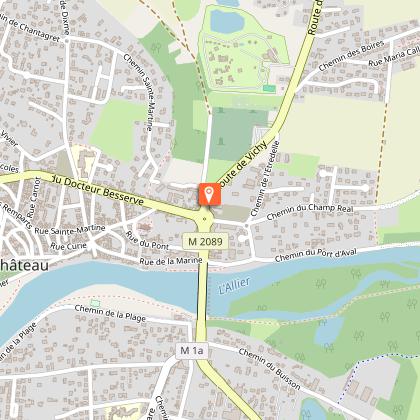
Departure point : - Aux Palisses", under the Pont d'Allier: take the bridge
to cross the town.
Technical Information
Altimetric profile
Starting point
Additional information
Updated by
Clermont Auvergne Volcans - 03/06/2026
www.clermontauvergnevolcans.com
Report a problem
Environments
Close to a public transportation
Bus stop < 500 m
TER stop (regional train) within 500 m
Less than 10 minutes from a bus stop on foot
Sustainable tourism
Access by bus: line E5 "Pont d'Allier". By train: from Clermont-Ferrand "Pont-du-Château"; join the route at "Chambussière" or "Rives d'Allier".
We recommend that you follow the route using the Mikhes app, which guides you step by step to simplify your discovery. Download the app at the bottom of the page and start your tour.
Open period
All year round daily.
Contact
Phone : 04 73 98 34 00
Website : https://www.clermontmetropole.eu/en/bouger-se-divertir/a-la-decouverte-de-lagglo/itineraires-de-randonnees/21-idees-de-circuits-dans-lagglomeration-clermontoise/
Location complements
Access by bus: line 36 "Pont d'Allier". By train: from Clermont-Ferrand "Pont-du-Château"; join the route at "Chambussière" or "Rives d'Allier".
Data author
