Alert
Alerts
Hiking - Col du Vallon du lac de la Muzelle to lac Lauvitel
1 alert on this circuit
Alerte visiteurs
Le site est sujet à de fortes affluences en juillet et en août.
Nous vous invitons à découvrir notre suggestion à proximité pour profiter pleinement de notre territoire.
Description
A pass between the 2 best hikes in the Vénéon Valley overlooking an unavoidable view over the valley! Hiking with some delicate and technical passages.
This site is located in the heart of the Écrins National Park and is subject to specific regulations. We invite you to adopt the right practices during your visit to help protect this natural heritage.
TECHNICAL INFORMATION :
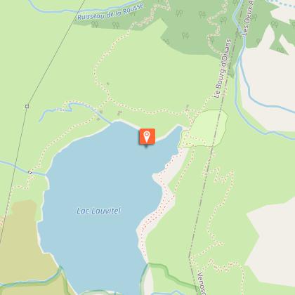
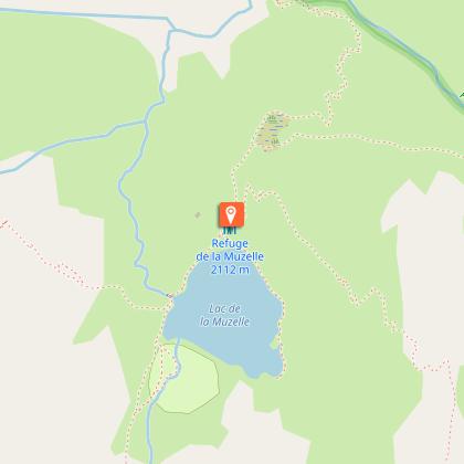
Start: Lake Muzelle
Difference in altitude: 500m
Duration: 3h30
Distance: 8 km
Level : Difficult
TOPO AND MAP :
OBP map n°5 (Oisans au Bout des Pieds)
IGN TOP 25 map n°3336 ET
ROUTE :
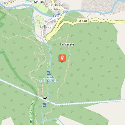
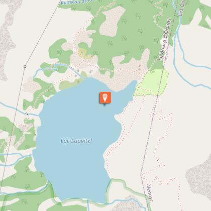
From "Lac de la Muzelle". To reach the fork leading to the pass, go around the lake to the right, cross the lawn and reach the start of the path in the scree (signposted Col du Vallon). The ascent path is nearby. [Allow 1h30 from the refuge de la Muzelle]. From the col, you'll have a magnificent view of the surrounding area. Start the descent towards Lac du Lauvitel, keeping to the left. After a long series of switchbacks, you'll reach a characteristic rocky crest, with a fine view over the lake. From here, you have to cross a large ravine on the right (in wet weather, crossing a slab can be dangerous, and crossing the béquet can be impressive). The path climbs up a little (10 mins) before leading to the mountain pastures above the lake (not recommended in wet weather) [allow around 2 hrs for the descent to the lake].
Please note: this description only covers the passage from one lake to the other! For a description of the complete loop, see the “Grand Tour des Lacs Muzelle et Lauvitel” page.
Technical Information
Altimetric profile
Starting point
Steps

Additional information
Updated by
Office de Tourisme des 2 Alpes - 30/05/2026
www.les2alpes.com/fr/
Report a problem
Environments
Mountain location
Open period
From 13/06 to 31/10/2026 daily.
Depending on weather conditions.
Subject to favorable snow and weather conditions.
Contact
Phone : 04 76 80 06 82
Email : info@les2alpes.com
Website : http://www.venosc.com
Type of land
Rock
Stone
Grit
Not suitable for strollers
Location complements
Hiking allows you to go to the hamlet of Danchère but also to continue to Lake Lauvitel
Animals
No
