Alert
Alerts
Bartou walking trail


IGN cards


Description
This trail departs from the village of Mieussy and leads to Jourdy cave, along a rocky ridge to Roche Pallud pastures and then back down via a spectacular spur overlooking Saix waterfall.
From the top of Mieussy, the path up to the Grotte du Jourdy is in fact a Way of the Cross. You'll have the opportunity to discover this geological curiosity steeped in history. The cave was used as a hiding place by the village's vicars during the Terror at the end of the French Revolution, in order to escape the radical revolutionaries who supported dechristianization. In 1881, it was erected as a sanctuary, as evidenced by the plaque on its wall.
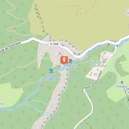
The route continues with a steep ascent aided by a handrail, before arriving at the hamlet of Roche Pallud. From this small alpine village, you can easily access a superb view of the Bornes massif, the Aravis range, Bargy and Môle. You can also wander through the beautiful pasture landscapes of the Sommand plateau, contemplating the surrounding peaks (Pointes de Rovagne, de Chalune, du Haut-Fleury).
You'll then reach the Saix waterfall, which you'll cross at the top via a footbridge and an impressive cliff face, before returning to your starting point along pleasant country lanes.
Technical Information
Altimetric profile
Starting point
Points of interest

Date and time
- From 15/05/2026 to 15/11/2026
Additional information
Contact
Phone : 04 50 34 25 05
Email : accueil@prazdelys-sommand.com
Website : https://www.prazdelys-sommand.com/
Facebook : https://www.facebook.com/prazdelyssommand.tourisme/
Open period
From 15/05 to 15/11.
Subject to favorable snow and weather conditions.
Updated by
Conseil Départemental de la Haute-Savoie - 12/06/2025
www.hautesavoiexperience.fr
Report a problem
Environments
Mountain view
Mountain location
Village centre
Type of land
Rock
Ground
Not suitable for strollers
Topo guides and map references
Topo guides references :
Carto-guide des Montagnes du Giffre on sale at tourist offices in the Vallée du Giffre.
Map references :
Map IGN 3429 ET (Bonneville / Cluses / Le Faucigny)
Location complements
Access (by car): From Cluses, join Taninges (D902), then Mieussy (D907). In Mieussy, turn right towards Sommand (D308). After 2 km, turn right towards Le Jourdy.
Reception complements
Adapt your equipment to your level and the weather. Stay on the marked trails.
Tricky passages
Overhead passages equipped with handrails before reaching the hamlet of Roche Pallud.
Guidebook with maps/step-by-step
From Jourdy car park, the path leads up to Jourdy cave, then a narrow path along the top of the cliff, with a handrail, to Roche Pallud. The itinerary crossed over Sommand plateau and then veers to the left at the residences, towards Mieussy. The path goes past the top of a waterfall along a walkway, crosses a cliff along a narrow spur with a handrail, and then leads back down along a scree path to Clos d’en Bas. You will then walk along some very pleasant country paths, until you reach Jourdy car park.
To see along this trail:
- The Way of the Cross
- Jourdy Cave, used as a hiding place by the vicars of Mieussy during the period of the terror from 1792 to 1796.
- Sommand pastures and plateau
- View over the Mont-Blanc mountains.
Animals
Yes. Pets allowed on leash only.
Data author
