Alert
Alerts
"La Haute Pointe" Hike


IGN cards


Description
The marmot area: hike in the heart of the hunting preserve, blooming with flowers with magnificent and varied scenery.
Nature and Heritage: the Alpine marmot comes from the same family as squirrels: the sciuridae. It lives at an altitude of between 1000m and 3000m in sun-soaked mountain pastures amongst the stones and scree. It mainly eats plants and drinks dew and water from plants. Listen out for its shrill cry to give the alarm when you’re approaching.
Route details: Soon after the Plan des Rasses (Alt. 1250), turn left to Chavan. A straight path takes you up to the forest, you go over a stream then continue through the clearing to Chavan chalet. Views of: Pointe de Chalune, Pointe de Chavasse and Haute-Pointe. From the chalet head towards Haute Pointe (sign) along a trail through the pastures which will lead you to a little watering hole. Follow the steep path slightly to your left up to Col de Chavan (alt. 1757m). Beneath you: Sommand. Opposite: Mont Blanc and the Aravis range. Then take the path on the right along the ridge to reach the summit of Haute Pointe.
Go back down the same route to Col de Chavan. Just before, go along the path on your left (not too sloped at the beginning) to the Combe de Chavannais then Col de Chavannais.
Go back down towards Charmettes chalets (steep slope). Before you reach the chalets, take a path on your right (barrier) to the foot of the stunning cliffs (Roc de la Tournette) then continue to Col des Follys. Go back to your starting point along the path opposite you and it will lead to Plan des Rasses in the Combe d'Herlionnaz.
Technical Information
Altimetric profile
Starting point
Points of interest
Additional information
Updated by
Office de Tourisme des Alpes du Léman - 07/08/2025
www.alpesduleman.com
Report a problem
Environments
Forest location
Mountain location
Open period
From 01/01 to 31/12.
Subject to favorable weather.
Contact
Phone : 04 50 73 71 53
Email : info@alpesduleman.com
Website : https://www.alpesduleman.com
Type of land
Stone
Ground
Not suitable for strollers
Location complements
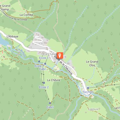
Starting point: Pont de la Joux car park.
Animals
No
Data author


