Traditional Villages Loop
![volet et banc village [640x480]](https://fichier0.cirkwi.com/image/photo/circuit/800x500/35323/en/0.jpg?1713927489)
Description
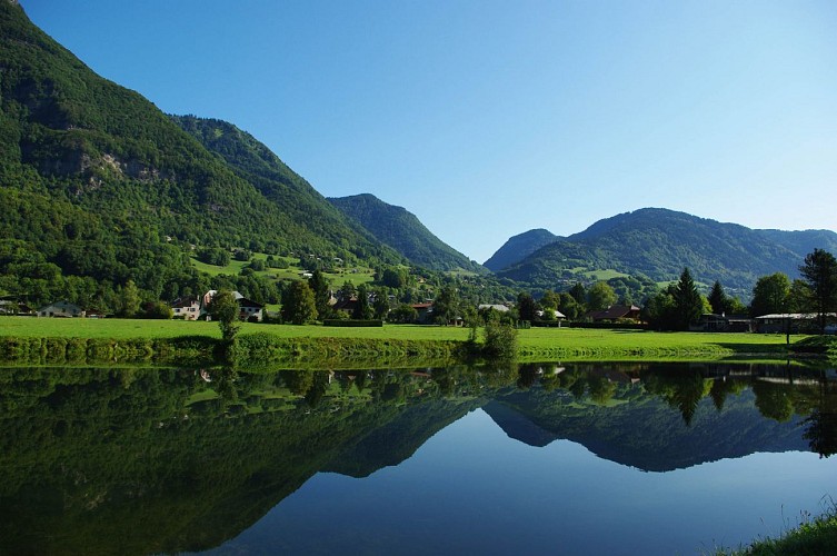
A hike to explore the villages in the south of Giffre Valley, where the traditional Savoyard dwellings have been preserved. On the way back you’ll walk along the Art and Nature Trail alongside the Giffre.
Technical informations
16 km
|
max. 938 m
min. 622 m
540 m
540 m
| |||
Altimetric profile
Starting point
Points of interest
Parc du Château
Au XVIIIème s. Joachim de la Grange, Comte de Taninges et de Flérier, fit construire un vaste château sur les hauteurs de Taninges.Un siècle plus tard, Laurent Marie Humbert, Jacquemard parti faire fortune à Paris, revient à ses origines et fait construire à l’image de sa fortune et de ses rêves, une bâtisse et ses dépendances regroupées sur 1400 m2 de terrain. On retrouve dans cette maison tout le confort possible de cette époque. Le «Clos du Chalet» est achevé en 1857 et dominera le chef lieu de Taninges jusqu’en 1995. De ce faste d’antant il ne reste que le souvenir.
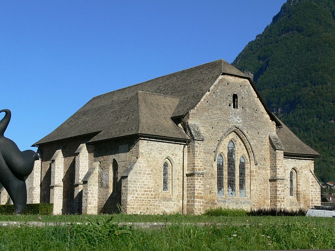
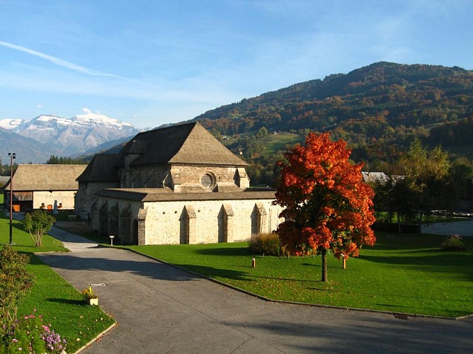
Chartreuse de Mélan
The site has been in existence for 700 years that has taken it from monastery and small seminary, via local orphanage to its current role as a renowned contemporary art centre and concert hall.Visit the Charteuse de Mélan! * Built in the 13th century, the Chartreuse de Mélan was a monastery for nuns of the Carthusian order until the French Revolution. It became a school in 1804. In 1906 it was acquired by the Department of Haute-Savoie and was converted into an orphanage in 1923. A fire in 1967 destroyed most of the buildings, taking 18 victims. Today, only the church, the cloister, and the old farm remain standing. A blend of medieval simplicity and contemporary art, the site pairs the austere architecture and partially preserved frescoes of the church with a sculpture park.
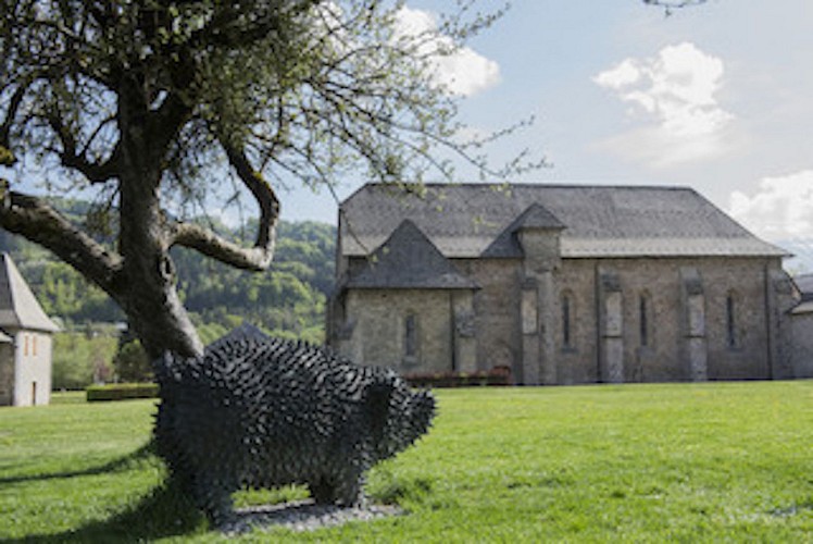
Parc départemental de sculptures monumentales d'art contemporain de la chartreuse de Mélan
Le parc départemental de sculptures monumentales développe un chemin de découverte artistique favorisant une approche progressive de l'art contemporain. Chaque oeuvre propose le regard de l'artiste sur le site et son environnement.Le parc départemental de sculptures monumentales d'art contemporain de la chartreuse de Mélan a pour but de rassembler en un même lieu quelques unes des tendances de l'expression contemporaine. L'originalité du programme réside dans la démarche créative demandée aux artistes qui doivent prendre en compte tous les aspects patrimoniaux du site : le paysage de la vallée du Giffre, l'architecture de l'église de la chartreuse, ainsi que l'histoire particulière du lieu. Ainsi un dialogue peut s'établir entre l'histoire ancienne et la sensibilité moderne. Découverte numérique du parc départemental de sculptures : www.thinglink.com/card/1317489720288083971
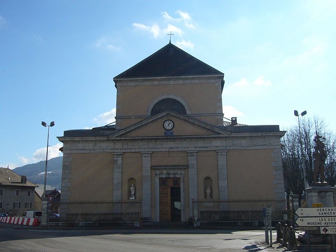
St Jean-Baptiste Church of Taninges
A monumental church by its size but also by its history !Built between 1824 and 1834 by the architect Prosper Dunant, the St Jean-Baptiste church is from the last architectural style of the States of Savoy : neo-classic Sardinian. Before, it was the biggest of the diocese of Annecy : 58 m length, 27 m wide and 18 m height. The facade of the building looks austere with few ornaments, but inside there is a profusion of decoration : paintings on the vault and pillars, stalls, carved wood and multicolored stained glasses. The visitor will visit a religious building and will discover how the jacquemarde population was decorating its churches there during the XIXth century.
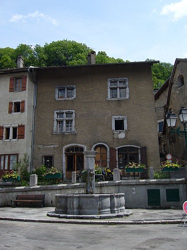
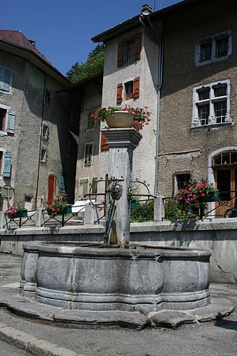
The old village of Taninges
Stroll in the old village of Taninges and discover a whole built heritage (XVIth - XIXth century) around the marketplace : fountain, old houses, arches, chapel and old bridge above Foron.Taninges, well situated between Annemasse & Sixt and Cluses & Thonon, knew for ages an intense business development. The village, formerly settled in the hamlet of Flérier, moved and got organized around the marketplace, it is unchanged since 1730. To discover : Saint Anne chapel, old houses, old bridge in hogback, and St Jean Baptiste church.
Additional information
Updated by
Praz de Lys Sommand Tourisme - 23/04/2024
www.prazdelys-sommand.com
Report a problem
Guidebook with maps/step-by-step
From the car park, go to the marketplace and then the Montée du Char (beginning with steps) towards the village of Avonnex. When you leave the village, cross the D902 and follow a small tarmac road for 100m, then go right on a footpath that leads to the highest point of this trail, the Suet (alt. 920m). From there, go down to the village of Le Mont, and then carry on to Verney. Cross through La Chavonette, then the villages of Verdevant, Etry and Petit Jutteninges. On the way back, cross the D907 and go along the right banks of the Giffre to Taninges.
Open period
All year round.
Subject to favorable snow and weather conditions.
Contact
Phone : 04 50 34 25 05
Email : accueil@prazdelys-sommand.com
