Alert
Alerts
3 day-hike in Jura: hiking trails through Plateau de Retord and Grand Colombier


Description
Southern crossing of the Grande Traversée du Jura on foot from Valserhône railway station to Culoz railway station in 3 days.
With a length of just over 50 km, this marked crossing on the southern end of the Grande traversée du Jura follows the crests and large expanses of the Jura Massif.
From Valserhône station to Culoz railway station, two towns on the banks of the Rhône river, this circuit in the middle of nature quickly gains altitude to first cross the Plateau de Retord, then the Massif du Grand Colombier.
In these landscapes of wide open spaces, far from roads and communication axes, it is a crossing of mountain pastures, valleys and forests with little or no habitation. Apart from the farms of Retord and their atypical architecture, places favored by the Resistance during the Second World War.
Many panoramas are to be discovered along the way with a series of balconies facing the chain of the Alps and Mont Blanc to the east.
Day 1: Valserhône (Bellegarde) > Les Plans d'Hotonnes (20 km)
Day 2: Les Plans d'Hotonnes > Arvières (17 km)
Day 3: Arvieres > Culoz (18 km)
Several accommodations offer overnight stays in the Plans d'Hotonnes resort, including the Hôtel Restaurant Berthet.
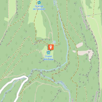
The next stage can be done up to the very popular Chalet d'Arvières located between the Col de la Biche and the Grand Colombier.
The circuit crosses the pastures of the Plateau de Retord, the greatest vigilance is recommended when you encounter a herd.
Some herds are accompanied by guard dogs, in which case it is strongly recommended that you do not cross it but walk around it. We thank you for keeping your dogs on a leash and systematically closing the enclosures behind your passage.
Technical Information
Altimetric profile
Starting point
Additional information
Environments
In the country
Forest location
Lake view
Mountain view
Mountain location
Station district
Close to a public transportation
Lake 5 km away
Close to GR footpath
Overview on river
Pond within 5 km
Panoramic view
Presence of livestock and guard dogs
Updated by
Aintourisme - 24/06/2025
www.ain-tourisme.com
Report a problem
Contact
Phone :
04 79 81 29 06
04 79 87 51 04
Email : contact@bugeysud-tourisme.fr
Website :
www.gtj.asso.fr/
www.bugeysud-tourisme.fr
Facebook : www.facebook.com/pages/belley-bugey-sud-tourisme/248956795173154
