Alert
Alerts
Type of practice
Walking
Very easy
Presentation
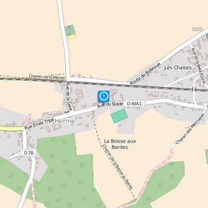
Map
Steps
Cirkwi brief's
Ratings and reviews
See around
Between Soline and Noues

Credit : ©ccbm
The Cirkwi brief
Discover Scenic Hermé: A Forested Path to Seine Valley
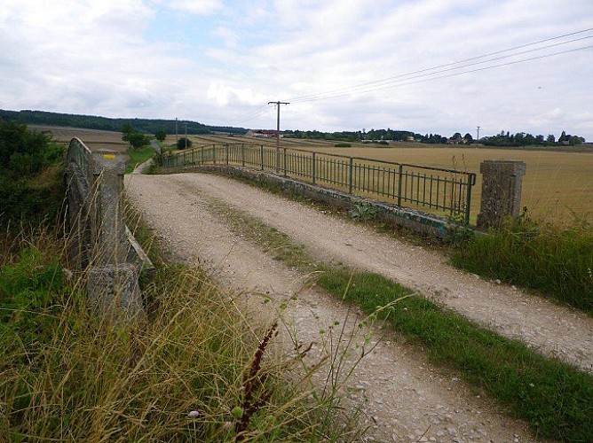
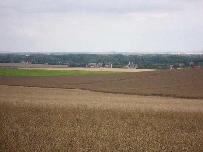
Set off from the quaint village of Hermé for a journey through shaded woodlands, ascending to a vantage point with a breathtaking view of the Seine valley. This nature trail, presented by the Communauté de communes Bassée-Montois, weaves through the essence of the French countryside, inviting walkers to immerse themselves in the tranquility of their surroundings. As you navigate through this picturesque route, let your senses be captivated by the earthy aroma of the forest floor and the gentle rustle of leaves, evoking a sense of peace and connection with nature.
Trail Specifics Unveiled
The Hermé trail extends over 11.7 kilometers, with an elevation range from 58 to 120 meters, featuring a total ascent and descent of 119 meters. This route tests one's stamina while providing gentle inclines for those looking to increase their endurance. The journey from the lowlands to the peak unveils the diverse landscape of the region, offering both novice and experienced hikers an engaging experience. Assessing its technical aspects, the trail presents a moderate challenge, suitable for individuals seeking to explore the natural beauty of Hermé without embarking on an overly strenuous hike.
Seasonal Insights for Hikers
To ensure a memorable visit, it's crucial to prepare according to the season. During spring and autumn, the trail reveals a vibrant palette of colors, making it an ideal time for photography enthusiasts. Summers are lush, but hydration is key, as the canopy provides limited shade. Winters, while stark, can be enchanting with frost but require caution for slippery paths. Regardless of the season, sturdy footwear and weather-appropriate clothing are essential. Always check weather forecasts before setting out and consider carrying a small backpack with water, snacks, and a basic first-aid kit.
Historical Echoes of Hermé
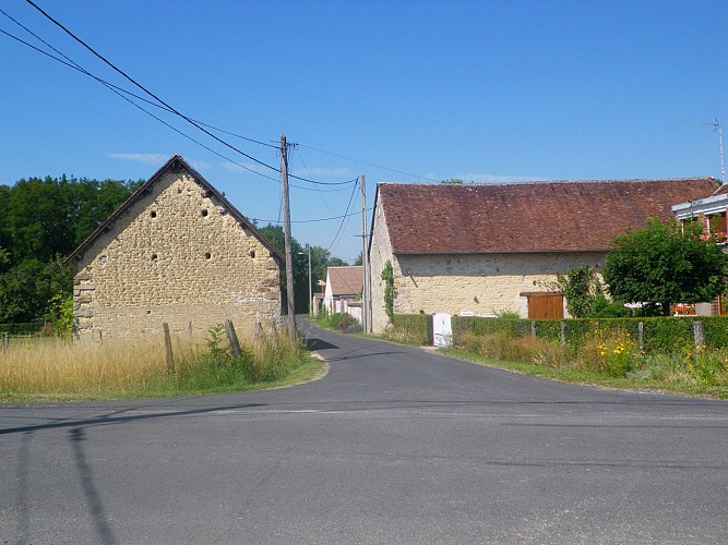
Hermé, nestled within the broader context of the Ile-de-France region, is more than just a starting point for a scenic trek. Its roots run deep within the fabric of French history, positioned in the Seine-et-Marne department, an area famed for its rich cultural heritage. The trails around Hermé not only offer natural beauty but also whisper tales of the past, where every footstep echoes through time. From ancient forest rights to its role in local commerce, exploring Hermé and its surroundings is akin to walking through a living museum, revealing stories of resilience, tradition, and evolution.
Weather Advisory for Hermé Visitors
The climate in Hermé is temperate and generally welcoming year-round, characterized by mild summers and cool winters. The most favorable time for trail exploration is from late spring to early autumn, where the weather conditions are optimal for outdoor activities. Rainfall is evenly distributed throughout the year, making it advisable to always prepare for potential showers. Winter walks can be uniquely serene if one is prepared for the colder temperatures. To fully enjoy the scenic route and its panoramic valley views, selecting a clear, mild day will enhance the overall experience, leaving visitors captivated by the natural splendor of the region.
Set off from the quaint village of Hermé for a journey through shaded woodlands, ascending to a vantage point with a breathtaking view of the Seine valley. This nature trail, presented by the Communauté de communes Bassée-Montois, weaves through the essence of the French countryside, inviting walkers to immerse themselves in the tranquility of their surroundings. As you navigate through this picturesque route, let your senses be captivated by the earthy aroma of the forest floor and the gentle rustle of leaves, evoking a sense of peace and connection with nature.
Trail Specifics Unveiled
The Hermé trail extends over 11.7 kilometers, with an elevation range from 58 to 120 meters, featuring a total ascent and descent of 119 meters. This route tests one's stamina while providing gentle inclines for those looking to increase their endurance. The journey from the lowlands to the peak unveils the diverse landscape of the region, offering both novice and experienced hikers an engaging experience. Assessing its technical aspects, the trail presents a moderate challenge, suitable for individuals seeking to explore the natural beauty of Hermé without embarking on an overly strenuous hike.
Seasonal Insights for Hikers
To ensure a memorable visit, it's crucial to prepare according to the season. During spring and autumn, the trail reveals a vibrant palette of colors, making it an ideal time for photography enthusiasts. Summers are lush, but hydration is key, as the canopy provides limited shade. Winters, while stark, can be enchanting with frost but require caution for slippery paths. Regardless of the season, sturdy footwear and weather-appropriate clothing are essential. Always check weather forecasts before setting out and consider carrying a small backpack with water, snacks, and a basic first-aid kit.
Historical Echoes of Hermé
Hermé, nestled within the broader context of the Ile-de-France region, is more than just a starting point for a scenic trek. Its roots run deep within the fabric of French history, positioned in the Seine-et-Marne department, an area famed for its rich cultural heritage. The trails around Hermé not only offer natural beauty but also whisper tales of the past, where every footstep echoes through time. From ancient forest rights to its role in local commerce, exploring Hermé and its surroundings is akin to walking through a living museum, revealing stories of resilience, tradition, and evolution.
Weather Advisory for Hermé Visitors
The climate in Hermé is temperate and generally welcoming year-round, characterized by mild summers and cool winters. The most favorable time for trail exploration is from late spring to early autumn, where the weather conditions are optimal for outdoor activities. Rainfall is evenly distributed throughout the year, making it advisable to always prepare for potential showers. Winter walks can be uniquely serene if one is prepared for the colder temperatures. To fully enjoy the scenic route and its panoramic valley views, selecting a clear, mild day will enhance the overall experience, leaving visitors captivated by the natural splendor of the region.
Automatically generated.
Technical Information
Walking
Difficulty
Very easy
Dist.
12 km
Type of practice
Walking
Very easy
Show more
Altimetric profile
Starting point
10
Place de la Mairie
,
77114
Hermé
Lat : 48.48335Lng : 3.34945
Steps
Data author

Ratings and reviews
To see around