Alert
Alerts
Les Deux Sommets
IGN cards


Description
Departing from the Tourist Office in Flumet or the village of St Nicolas la Chapelle, this route will allow you to discover its exceptional panorama of Mont-Blanc and Val d'Arly in sports version !
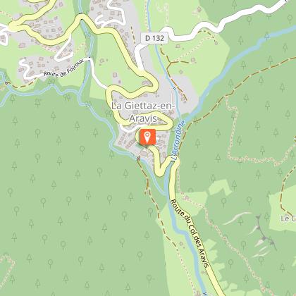
After leaving from the Tourist Office, go down towards the PLAN D'EAU then take the PONT DE CHAUCISSE, LA LANDELIÈRE, LE PRAZ, and the VILLAGE. From there, continue the track in the direction of COMBES, MARCINELLE, LES CRÊTS, TRÉ LE SEZ, BOIS DES AVENIÈRES, to reach the panorama LE TREU (1835m). Then, climb to LES STALLETS, LES HAUTS DE BOGNEUVE and descend to BOGNEUVE. Again, climb towards PELOSET, and the CROIX STATA where a magnificent panorama awaits you!
Continue to arrive at SOUS LA CROIX, then attack the descent to CARRÉS. From there, take the path for CHAUCISSE, passing through LES ROZETS. Once there, head towards LES CHOZALETS, NANCHARD, L'ARRONDINE, PONT DE MANANT, STIAZIEUX, BELLAVARDE, LES RECOURBES, LE CHAR, CHEZ CAHOT then get off at L'ÉGLISE, CHEMIN DE L'ÉGLISE to get to the office car park. of tourism.
Technical Information
Altimetric profile
Starting point
Date and time
- From 01/06/2026 to 31/10/2026
Additional information
Open period
From 01/06 to 31/10.
Updated by
Office de Tourisme du Val d'Arly - 09/09/2025
www.valdarly-montblanc.com
Report a problem
Contact
Phone : 04 79 31 61 08
Email : info@flumet-montblanc.com
Website : www.flumet-montblanc.com
Facebook : www.facebook.com/flumet.stnicolaslachapelletourisme
Type of land
Stone
Ground
Topo guides and map references
Topo guides references :
Topoguide "Itinéraires Trail Val d'Arly / Beaufortain" on sale in tourist offices.
Reception complements
Duration: between 3h and 6h.
Animals
Yes. Pets allowed on a leash only.
