Alert
Alerts
Tour of the Etang Prêle sensitive natural area in Chaneins
1 alert on this circuit
Alerte visiteurs
Balisage défectueux, incidents / sécurité, conflits d'usage, dépôts sauvages ? : localisez et partagez le problème rencontré sur le dispositif d'alerte national depuis l'appli SURICATE ou via le site sentinelles.sportsdenature.fr/
Description
From the village of Chaneins, discover the Etang Prêle sensitive natural area and its ecosystem. Several castles, including Chaillouvres on the edge of its pond, can be seen, and you'll have a panoramic view of the Beaujolais region.
Close to the ViaRhôna and the Voie Bleue, the Dombes is also a great area for cycling, walking and horse-riding! It's up to you to choose your itinerary and means of transport...
Breathe in, breathe out, you're in the Dombes.
Imagine the Dombes, land of a thousand ponds, as a festival of colors, scents and sounds. The deep blue of the water contrasts with the many greens of the vegetation. The intermittent concert of frogs is accompanied by the songs of wild birds. Sit back for a moment and watch the ballets on the calm waters of the ponds. The grey heron, master of the area, may even grace you with its presence!
So, what could be better than a stroll to visit and discover the Dombes in slow motion?
Technical Information
Altimetric profile
Starting point
Steps
Points of interest


Additional information
Environments
In the country
Lakeside or by stretch of water
Updated by
Dombes Tourisme - 21/07/2026
www.dombes-tourisme.com/fr/
Report a problem
Open period
All year round daily.
Contact
Phone : 04 74 55 02 27
Email : contact@dombes-tourisme.com
Website : http://www.dombes-tourisme.com/fr/
Type of land
Ground
Hard coating (tar, cement, flooring)
Guidebook with maps/step-by-step
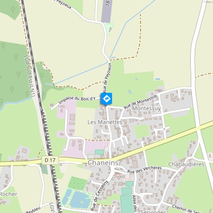
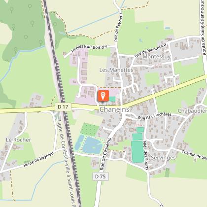
The starting point is the Place de la Bascule in Chaneins.
1. Exit the parking lot and head towards Chaneins (church). When you reach the town hall, turn right onto Rue Cesseins. At the Chaneins (church) signpost, follow signs for Champ Famin until you reach the intersection with Rue du Chabian. Follow this street, which becomes Allée des Sports. At the intersection, turn left onto Chemin de Servinges. At the next intersection, continue along this street to the right and straight ahead. Cross the Saint-Trivier road (D66B) and continue on the dirt track.
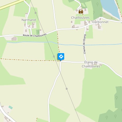
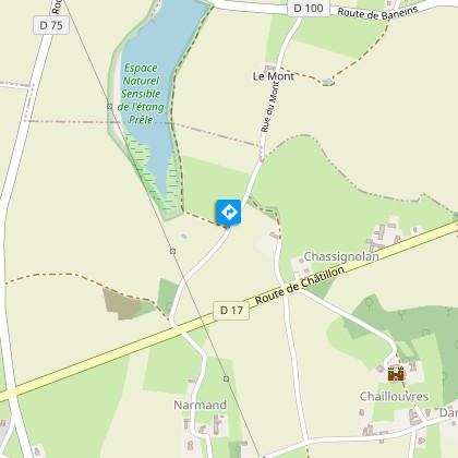
2. At the Champ Famin signpost, head towards Château de Chaillouvres, then at the next intersection, turn left onto Chemin de l'Étang. Cross through the hamlet of Chaillouvres and follow the dirt track on the left.
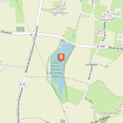
3. Walk alongside the pond with its view of the Château. Continue straight ahead until you reach the main road.
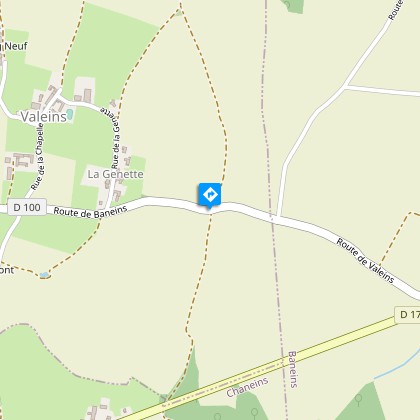
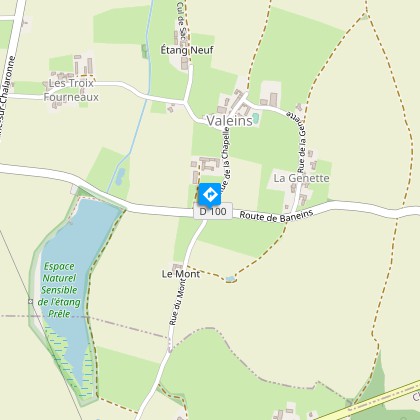
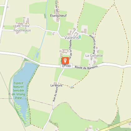
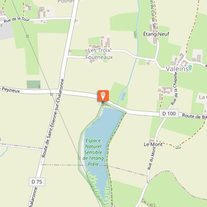
4. Cross the D17 and take the dirt track on the right. Continue on this track until you reach the Baneins road (D100).
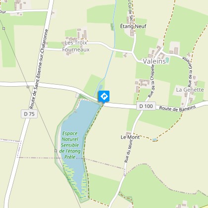
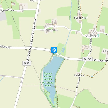
5. Turn left at the signpost for Etang Prêle. Continue straight ahead to the Etang Prêle signpost, then turn left towards Etang Prêle queue. The observation point is open to the public.
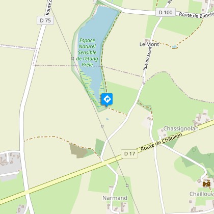
6. At the Etang Prêle queue signpost, follow the signs for Les Manettes. At the next intersection, take the dirt track on the right and follow it. This track offers another view of the Etang Prêle Sensitive Natural Area.
7. When you reach the Saint-Etienne-sur-Chalaronne road (D75), turn left, then immediately right onto Rue de Montessuy and continue to the Les Manettes signpost.
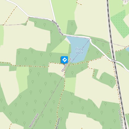
8. At the Les Manettes signpost, turn right towards Bois des Vavres and continue along this road (Rue de Peyzieux). Cross the TGV line on the bridge, then take the dirt track on the left, towards Bois de Vavres. Continue to the Bois des Vavres signpost.
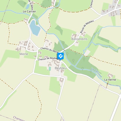
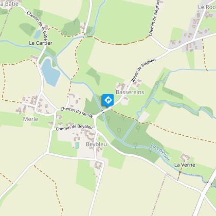
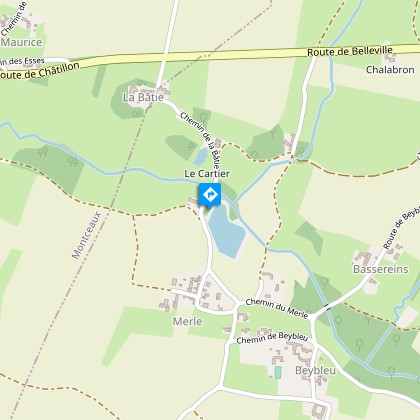
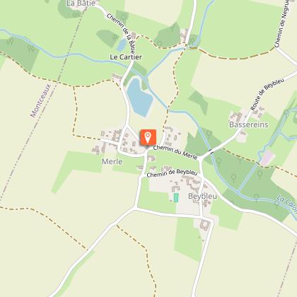
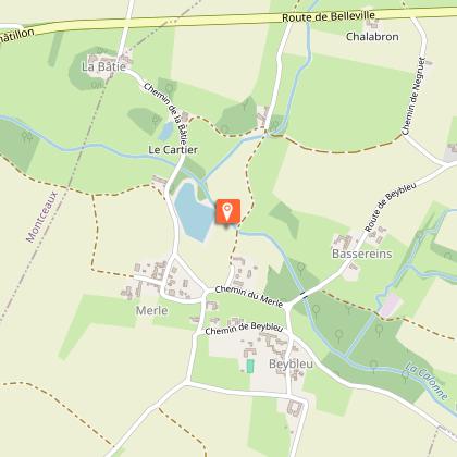
9. At the signpost, turn left towards Etang de Beybleu. Continue to the D17, cross it, and continue. Cross the Calonne River and arrive at the Beybleu signpost.
10. Turn left towards Chaniens (church) until the next intersection. Turn left onto the Route de Beybleu for approximately 1.5 km, ignoring the various dirt tracks branching off to the left or right. Go under the TGV line through the tunnel.
11. Then take the path that goes around the pond and arrive at Rue de Cesseins. Follow it uphill to reach the Chaniens (church) signpost and return to the starting point.
Animals
Yes
Data author
