Alert
Alerts
The small Seine

The Cirkwi brief
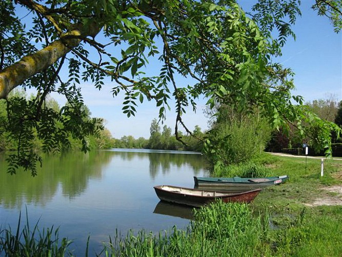
Imagine wandering along a serene river path, where old Seine meets its canal and the calm ponds cradle a diverse ecosystem. This picturesque ramble promises encounters with elusive gray herons or the fascinating tree-climbing frogs, showcasing nature's wonders in the heart of Bassée. Offered by the Community of Communes of Bassée-Montois, this scenic trek is a journey through tranquil waters and lush landscapes. The ambiance here whispers tales of nature, compelling every traveler to pause and admire the inherent beauty surrounding them. Let's embark on this delightful leisure walk and embrace the charm of Bassée-Montois.
Key Trek Specs Explained
The trail stretches almost 9.9 kilometers, starting from Balloy, with minimal elevation gain, peaking at 58 meters and dipping to 50 meters, crafting a nearly level path suitable for walkers of all abilities. The positive elevation change is virtually negligible, fluctuating between 183 to 182 meters. These specifications imply a comfortable and accessible trek for enthusiasts, highlighting its suitability for both seasoned hikers seeking a gentle stroll and families looking for a peaceful day out in nature.
Tips for Every Season
Winter brings a calm solitude, with frost highlighting the landscape's beauty, though paths may be slippery. Spring transforms the trail into a vibrant tableau, perfect for bird-watchers. Summer offers lush foliage and active wildlife, yet remember to stay hydrated and protected from the sun. Autumn casts a golden hue, ideal for photographers. Regardless of the season, appropriate footwear is a must, and always check weather forecasts before departing to ensure a safe and enjoyable journey.
A Glimpse into Bassée-Montois
Balloy, a quaint village within the Bassée-Montois region, serves as the gateway to this mesmerizing trek. Situated in the broader context of France's historical Seine-et-Marne department, the area boasts a rich tapestry of cultural and historical significance. Once a vital trade and transport route, the Seine River and its environs have evolved, now offering a tranquil escape into nature, while still echoing the vibrant history that shaped this region into a haven of biodiversity and heritage.
Climate Insights for Visitors
The Bassée-Montois region experiences a temperate climate, with distinct seasonal changes. Spring and Autumn are particularly pleasant, offering moderate temperatures and a kaleidoscope of nature's colors, making these periods ideal for exploring. Summer can be warm, so early morning or late evening walks are recommended to avoid midday heat. Winter, though cooler, has its own charm, especially on clear, frosty days. Utilizing local weather forecasts is crucial for planning the perfect visitation time.