Beyond the water
Description
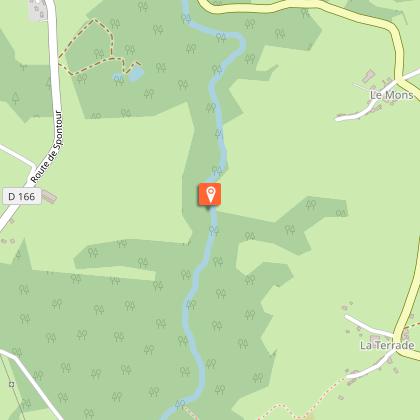
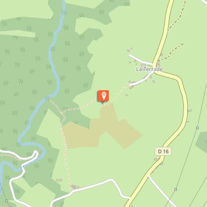
Follow the Pont-Aubert and plunge into the wooded undergrowth of Soursac.Park at the seasonal tourist information point.ake the D16 on the left towards the town hall. At the end of the village, take the road on the right towards Spontour. Follow it for 800 m.Take the track on the left at a cross. Continue straight ahead. On the descent, take a path to the right and then a trail to the left that follows the Pont-Aubert stream, sometimes going away from it. Cross it by the footbridge and go up to La Terrade.Straight on past the first houses. Join the departmental road which you take to the right; fork right immediately; as you leave the village, the road becomes a track and then a path. It goes down to a stream. On the way back up, at the T-junction, turn left and go to Freyssinet.Take the road to the right. Turn right at the next crossroads towards Le Moulin de Puy Long. Go over the bridge and past the houses on the bend.On the way up, leave the road and follow a track to the left for 300 m. Turn right on a trail that goes up and joins a road.Follow it to the right for 100 m, then take the track to the left. At 200 m, when you reach the forest, take a trail on the right, go on alongside a meadow and go down to the stream (follow the markings carefully). You will find a portion of the road that you used at the beginning. Go up the stream as far as the crossroads and turn right. A footbridge crosses the stream. Go back up to the road.Follow it to the left for 50 m and take a trail to the left. Cross the bridge and go up towards Soursac. Go left at the road to return to the starting point.
Technical informations
10 km
|
max. 552 m
min. 469 m
| |||
Altimetric profile
Starting point
Steps
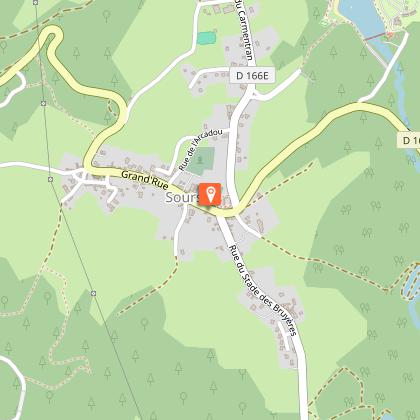
Bourg de Soursac
Soursac (506 habitants au dernier recensement) mérite le détour ; le fleurissement du bourg met élégamment en valeur le patrimoine local. La commune compte deux ouvrages majeurs : le viaduc des Rochers Noirs (ancienne voie ferrée empruntée par le Tacot pour relier Ussel à Tulle en tramway) ainsi que le barrage de L’Aigle (barrage hydroélectrique). Bordée par la Dordogne, ne manquez pas une balade en gabare au départ du village de Spontour, pour découvrir l’histoire de la navigation dans les gorges de la Dordogne.
Ruisseau du Pont Aubert
D’une longueur de 17 km, le Pont-Aubert prend sa source à près de 600 mètres d’altitude, sur la commune de Neuvic. Il est répertorié dans le Réseau Natura 2000 comme site important pour la loutre et l’écrevisse à pattes blanches. Il offre un plan d'eau de 8 ha, permettant baignade surveillée en juillet et août, pêche, jeux d'enfants et toboggan aquatique.
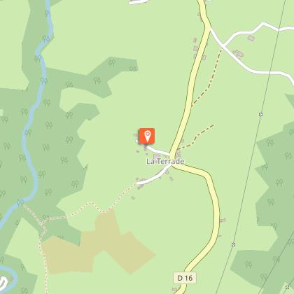
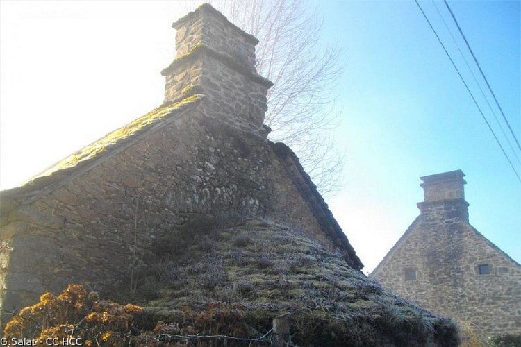
Four à pain de la Terrade
Les villages du Limousin avaient tous une vocation agricole. La traversée de ces hameaux constitue toujours un moment de découverte unique lors d’une randonnée : granges, maisons de maître, croix, petit patrimoine... Ne manquez pas le puits et le four à la Terrade.
La Dordogne de Villages en Barrages
Vous empruntez une section de « l’itinérêve », l’itinéraire de grande randonnée valorisé par l’Association « La Dordogne de Villages en Barrages ». Avec ses 200 km, ce sentier relie Confolent-Port-Dieu et Argentat-sur-Dordogne et permet de découvrir les beautés des gorges de la Haute Dordogne.
Additional information
Advised parking
Tourist information office car park, Soursac
Advice
Departure point in common with the trail "from Pont-Aubert to the Viaduct of the Rochers Noirs". Follow the signs carefully as you leave the village.
Access
40 km from Meymac, follow the D 171 and then the D 166.
Ambiance
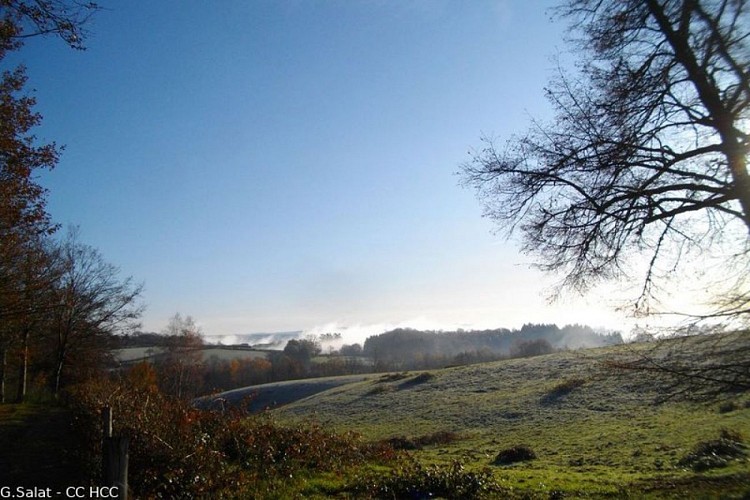
This fairly challenging walk "navigates" through the undergrowth of the gorges bordering the Pont-Aubert stream before it joins the Dordogne river at the Aigle dam. From La Terrade, you will follow part of the long-distance hiking route "from Villages to Dams" (yellow and white markings) which covers 200 km and allows you to discover the Dordogne gorges.
Arrival
Tourist information office car park, Soursac
Departure
Tourist information office car park, Soursac
