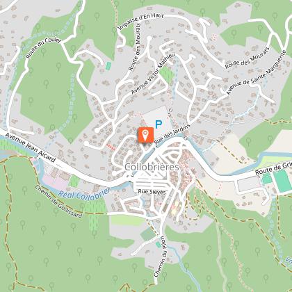
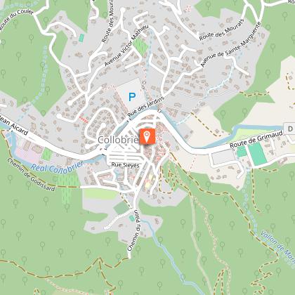
Alert

Alerts

To see around
See more
Open
Close
Show
Show
Show
Show
Show
Show
Show
Show
Show
Show
Show

Oups... It would appear that Cirkwi does not have permission to use your location.

Presentation
Description
Map
Steps
Points of interest
Ratings and reviews
See around

The Baudisson Hut

Description

Come and ride in the heart of the Massif des Maures, between the oak and chestnut forests, to admire the breathtaking landscapes of the Var.

COMMUNITIES CROSSED: Pierrefeu-du-Var, Puget-Ville, Collobrières, La Londe-les-Maures

START OF THE ROUTE
The hike starts from the car park behind the archery park.

SIGNAGE: ORANGE

To get to the car park, take the D14 towards Collobrières. Turn right coming from Pierrefeu, direction Tir à l'Arc. The car park is located just behind the archery.

Start by taking the small winding path on the right of the car park to join the RD and head for the hamlet of La Portanière. After crossing the RD 14, take the Chemin de Maraval for 1.4 km, then follow the arrow post n°49B, direction Collobrières Village.

Your journey begins with the discovery of small typically Provençal hamlets, before leading you to the Peyriers track and its oak forest. At the arrow post n°51B, follow Collobrières Village.
After passing in front of the Plaine Longue reservoir, get your calves ready because it starts to climb for about 4 km. You then arrive at the Baudisson hunters' hut where you can take a well-deserved break.
Follow the arrow post n°55 "Cabane Baudisson" towards Collobrières Village. Downhill enthusiasts will appreciate the next 5 km which will provide them with great sensations, on a partly stony track, with a ford crossing, to arrive at the entrance of Collobrières village. Don't forget to taste the famous marrons glacés and other chestnut-based delicacies!

After your gourmet break, retrace your steps towards the firemen's car park and follow the arrow post n°40C "La Capelle", towards Pierrefeu la Portanière, by "le grand Gageai".

After the second arrow post, always follow Pierrefeu la Portanière by "le grand Gageai".

Then go up the Rieille track for 5.5 km passing by the lake of Camp Bourjas, rich in various species of fish such as perch, roach, pike-perch...

Come on, courage! At the arrow post n°39 "Valcros d'Aumeran", direction Baisse du Castellas, there are only 12 km left before the return journey. Enjoy riding on this great track with a breathtaking view of the coastline and the forest of the Massif des Maures.

The last kilometre will be the opportunity to accelerate and to jump a few small bumps on the edge of the Issemble track, at about 650 m from the arrow post n°47 "Issemble Beaussenas", direction Pierrefeu la Portanière

Technical Information

Mountainbiking
Difficulty
Medium
Duration
4h
Dist.
36 km
Show more

Altimetric profile

Starting point

161 Départ / arrivée : parking derrière tir à l'arc , 83390   Pierrefeu-du-Var
Lat : 43.231688Lng : 6.165098

Steps

image du object
3

Tour des Templiers

Le site d’Hyères est occupé depuis plus de 2300 ans. Dans l’Antiquité, les Grecs puis les Romains ont surtout valorisé la côte, notamment le port d’Olbia (« la bienheureuse », site archéologique grec visitable) et Pomponiana. Au début du Moyen-Âge, l’insécurité liée aux invasions pousse les populations à abandonner le rivage pour se réfugier au sommet de la colline du Castéou. Une petite ville, nommée Castrum Aracarum, se masse avant l’an Mil près d’un château dont on peut toujours admirer les ruines. Aux XIe-XIIe siècles, la ville prospère, qui dispute un moment le siège de l’évêché local à Toulon, descend peu à peu les pentes vers le sud. C’est ainsi qu’à la fin du XIIe siècle, les Templiers, ordre religieux militaire créé pendant les Croisades, installent une importante commanderie en contrebas de la collégiale Saint-Paul, sur la colline du Piol, dans un espace encore largement agricole. La hauteur impressionnante de la tour en calcaire blanc (17 mètres) témoigne de la puissance de l’ordre. Elle est le seul vestige d’un ensemble plus grand aujourd’hui disparu, qui comprenait des terres, un grenier, un four, une écurie, une forge et un hospice ; une voie du quartier a d’ailleurs gardé le nom de rue du Temple. Au rez-de-chaussée de la tour est édifié un lieu de culte voûté, la chapelle Saint-Blaise, dont le chœur est tourné vers l’Orient comme dans les autres fondations templières. Elle est accessible, côté sud, par un portail roman à longs claveaux étroits. La façade sud montre également une ancienne porte transformée en fenêtre, une fenêtre géminée et, en hauteur, une discrète gargouille. La chapelle restaurée présente un vitrail montrant une belle croix des Templiers. Côté nord, une autre porte romane fait accéder au premier étage, une salle des gardes qui concentrait des fonctions administratives et militaires. La façade nord comprend elle aussi de belles baies en plein-cintre. Un escalier taillé dans l’épaisseur du mur permet d’accéder au sommet de la tour, terrasse fortifiée qui servait de lieu de guet et d’où on peut admirer une vue imprenable sur la ville d’Hyères. Quelques vieilles meurtrières subsistant sur l’édifice rappellent d’ailleurs l’ancienne fonction militaire du lieu. Lorsque le roi saint Louis visite Hyères en 1254 à son départ pour la croisade, le quartier est déjà rattrapé par l’urbanisation. À la dissolution des Templiers en 1312, la tour devient la propriété des chevaliers de Saint-Jean de Jérusalem (le futur Ordre de Malte), qui la louèrent à différents particuliers. C’est depuis 1673 que l’immeuble appartient à la municipalité d’Hyères, qui l’a d’abord prêté à la confrérie des pénitents bleus jusqu’en 1765, puis en a fait son hôtel de ville entre 1770 et 1914. Après une profonde restauration de 1985 à 1992, la Tour des Templiers abrite désormais une salle d’expositions temporaires.

- OFFICE DE TOURISME INTERCOMMUNAL Cuers, Collobrières, Pierrefeu du Var, La Londe les Maures -
Consulter

Points of interest

image du object

Chartreuse de la Verne

Nestling in the heart of the Maures massif, the Chartreuse de la Verne offers a haven of silence, nature and ancient history.In the heart of the Maures massif, shrouded in forest and silence, the Chartreuse de la Verne emerges like a well-kept secret. Founded in 1170 on the ruins of an ancient priory, it has always borne the name Notre-Dame de la Verne. Its stones have withstood fire, pillage, war and the Revolution. Three fires in the Middle Ages reduced it to ashes. Each time, the monks rebuilt. Until 1792, when, forced to flee, they left behind an empty sanctuary, sold as national property. Nature then took over. Wind, rain, oblivion... Until, in 1968, a handful of enthusiasts founded the association Les Amis de la Verne. In 1986, around thirty nuns from the Bethlehem family revived the spiritual vocation of the site. Each of them lives in a hermitage, in silence, prayer and work. Their presence transforms the Carthusian monastery into a place of profound peace, which you feel as soon as you take your first steps. Today, part of the monastery is open to the public. Here you can discover the gatehouse, the bakery, a monk's cell and the 12th-century Romanesque church, the only place where visitors and nuns share a mutual respect and silence. Coming to La Verne is more than just visiting a monument. It's a moment of suspension, a break from the hustle and bustle. It's hearing the murmur of the centuries, feeling the strength of a place that has never ceased to be reborn. - How do you visit the Chartreuse de la Verne? The Monastery can be visited freely and independently. When you arrive, you will be given a tour booklet to guide you along the route. This booklet presents the main areas accessible to the public and guides you through the monument, following a defined route, for a calm and rewarding exploration. The visit takes place in a way that respects the silence and the monastic life that is still present here. - How much does it cost to visit the Chartreuse de la Verne? Adults: €7 Students: €5 Young people (aged 12 to 18): €3 Groups (10 people or more): €5 - How to get to the Chartreuse de la Verne The Chartreuse is accessible via the Route de la Verne, a narrow, winding road that crosses the Maures massif. Free parking is available at the end of the road. Access to the site is on foot along a dirt track about 700 metres long, with no difference in height, which takes about 10 minutes. Access not recommended for vehicles over 3.5 tonnes and coaches are not allowed. - Parking for vehicles and minibuses Limited number of parking spaces. For minibuses: parking can be reserved by calling 04 94 43 48 28. - Shop The monastic craft shop is open at the same times as the tour and is closed every Sunday. - Other practical information The monastery is closed in January, on religious holidays and every Tuesday after the All Saints' holiday until 31 March. Closed on days when the massifs are closed due to severe fire risks. Further information: www.risque-prevention-incendie.fr/83

Corniche des Maures RD 214 83610 Collobrières
- OFFICE DE TOURISME INTERCOMMUNAL Cuers, Collobrières, Pierrefeu du Var, La Londe les Maures -
Consulter

Additional information

Updated by

Office de tourisme intercommunal La Londe les Maures, Cuers, Collobrières, Pierrefeu du Var - 27/11/2025
www.mpmtourisme.com
Report a problem

Open period

All year round.

Type of land

Not suitable for strollers
Stone
Hard coating (tar, cement, flooring)
Ground

Location complements

Start / Finish: parking behind archery

Animals

No

Ratings and reviews

To see around
See more
Open
Close
Show
Show
Show
Show
Show
Show
Show
Show
Show
Show
Show
Caution!
We have no information on the difficulty of this circuit. You may encounter some surprises along the way. Before you go, please feel free to inquire more and take all necessary precautions. Have a good trip! 🌳🥾