Alert
Alerts
The watershed - Beaujolais Vert - Poule-les-Écharmeaux
Description
A route through the heart of the mid-mountains, between climbs, ridges, and stony descents. Far from everything, it reveals panoramas, forests, and wild nature, with a glimpse of the GR®7 and the Santiago de Compostela trails.
You'll love:
• The combination of length and elevation gain, ideal for varied approaches to hiking.
• Adventurers who enjoy physical exertion: climbs, ridge paths, descents on stony terrain... are there to stimulate endorphins and dopamine.
• A one-day trek, far from everything, to walk mindfully in mid-mountain landscapes alternating between panoramas, forests, wild vegetation...
• A glimpse of the Santiago de Compostela trails and the GR®7 on the ridge line between the Rhône and the Loire.
You'll enjoy it better:
• With good shoes, binoculars, a camera, and a good snack.
• By enjoying a snack overlooking the Poule lake on your return from the hike.
• In spring, to take a forest bath with the scent of wild plants. • At the beginning of winter, for the pleasure of concluding your hike in a cozy atmosphere with a delicious hot chocolate or fragrant tea.
A bit of culture:
A poetic journey along the watershed
The border is invisible, yet here the destiny of an infinite number of raindrops is at stake. When they hit the ground, the precipitation tumbles to either side of the mountain. On the right slope, it reaches the Atlantic Ocean; on the left slope, the Rhône carries it to the Mediterranean. This hydrographic network runs through the Rhône department from north to south.
Technical Information
Altimetric profile
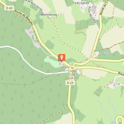
Starting point
Additional information
Environments
Panoramic view
Forest location
Updated by
Rhône Tourisme - 24/11/2025
www.rhonetourisme.com
Report a problem
Open period
All year round daily.
Subject to favorable weather.
Contact
Phone : 04 74 89 58 03
Email : accueil@beaujolaisvert.com
Website :
https://out.ac/LGHSK
https://www.rhone-outdoor.com/fr/
Facebook : https://www.facebook.com/beaujolaisverttourisme/
Type of land
Ground
Hard coating (tar, cement, flooring)
Stone
Data author
