Alert
Alerts
MTB track 2 blue - At the foot of the three mountains - Espace Revermont FFvélo base
Description
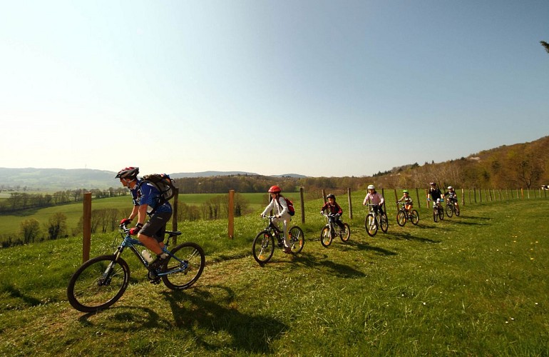
Two landscapes, two moods for this loop. A hilly setting with the last Bresse plains at the foot of the Revermont, and an undergrowth setting with a mix of deciduous and coniferous trees.
Leaving the banks of the pond and its natural setting, we attack the rolling plains of the Revermont coastline, offering splendid scenery over the three mountains. The return journey takes you into the Motte forest, with its fine singles.
The start of the circuit is the same as n°1: in the forest, turn left in the direction of Revermont. At the end of the forest, a remarkable panorama: Mont Myon (662 m) with its neighbors to the south, Mont-Châtel (610m) and Montfort (576 m). Return to the leisure center via the Buclets forest.
Technical Information
Altimetric profile
Starting point
Points of interest


Additional information
Distinctions
Listed PDIPR
Label VTT - FFCT
Updated by
Bourg-en-Bresse Destinations - Office de tourisme - 27/05/2026
www.bourgenbressedestinations.fr
Report a problem
Environments
In the country
Lakeside or by stretch of water
Forest location
Lakeside or by stretch of water
Mountain view
Lake -5km away
Village -2 km away
Close to GR footpath
Waterside
Beach within 300 m
Open period
All year round daily.
Contact
Phone : 04 74 22 49 40
Email : accueil@bourgenbressedestinations.fr
Website : https://www.bourgenbressedestinations.fr
Facebook : https://www.facebook.com/BourgenBresseTourisme
Topo guides and map references
Topo guides references :
Topoguide: Base VTT FF Vélo - Espace Revermont / Grand Bourg Agglomération
Type of land
Ground
Hard coating (tar, cement, flooring)
Location complements
Parking
Parking lot at La Grange du Pin leisure park.
Departure sign in front of the entrance
Access to the base :
D.52 from Treffort, Cuisiat or Coligny
D.18 or D.3 from St-Etienne-du-Bois
Exit A40 n°6 Bourg Est - Viriat
By public transport
Access by public transport
Find out more about how to get to us at www.grandbourg.fr/42-transports-mobilites.htm
Tricky passages
Safety instructions
No technical passages to report. Please respect the mountain biker's charter.
The Revermont routes may cross pastures, so please close the gates and respect the peace and quiet of the herds.
If you'd like to go mountain biking or gravel biking in the area, take advantage of the signposting dedicated to this activity. A large number of itineraries are available in the mountains, and you're likely to cross estives or alpine pastures with herds of sheep/goats or cows, and sometimes herds of horses.
Don't panic when encountering domestic animals or even herdsmen such as guard dogs ("Patou") or driving dogs ("border collie"):
● Initially remain calm,
● Slow down, put your foot down and stay close to your bike, holding it between you and the herd or dogs.
● Don't irritate the animals, avoid shouting or making big gestures and keep moving forward quietly until you're away from the herd and the dogs.
● Once you're far enough away from the herd, you can get back in the saddle.
Let's respect each other's activities: in the mountains, there's room for everyone!
www.pasto-kezako.fr/
Some areas may be affected by protected sites: Natura 2000, ENS, classified sites... let's respect nature, stay on the trails, be discreet in our attitudes and tracks...
The routes include hiking, trail and horse-riding circuits, as well as certain hunting areas. Please respect other users of the land.
Best periods: February / March / April / May / June / July / August / September / October
Report a problem
Damaged markers, safety incident, conflict of use or illegal dumping?
Locate and report the situation via the national SURICATE system, from the application or online: sentinelles.sportsdenature.fr/
Equip yourself
We strongly recommend that you bring a bottle of water, a helmet, a cell phone, a route map and a repair kit.
Colorful clothing is also recommended, so as to be clearly visible to other trail users.
Animals
No. Pets not allowed
