Alert
Alerts
Alpage de Loriaz from Le Couteray
Description
Typical Alpine pasture landscape below the Perrons mountain chain and the Aiguille de Loriaz. When you get there, mountain refuge with restaurant and dormitories.
Take the forest track at the top right in the village: follow it for a few hundred metres and after the third bend, take the path that goes up on the right.
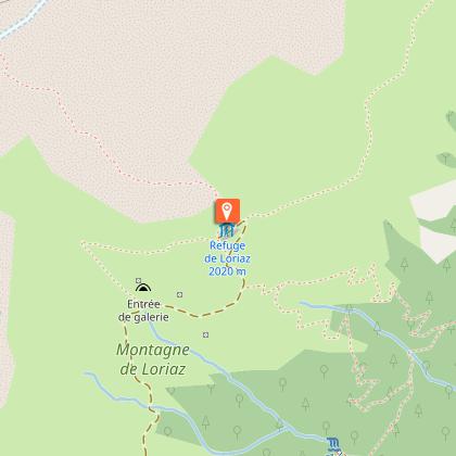
and after the third bend, use the path that goes up on the right. It is joined by the one coming from the Nant. Continue to find the track that you follow for about 200 m. When you leave it, go right into the forest, cross the Nant de Loriaz (1652 m). Continue by a few hairpin bends to the plateau above the vegetation. At the Croix de Loriaz, we find on the right the path coming from Le Crot and after some efforts, the refuge is reached in the mountain pasture.
Other itineraries are possible from Le Nant, Le Sizeray.
More information is available at the Tourist Office or the Office de Haute-Montagne and in our trail guide.
Attention : The conditions of the trails are likely to change, think to inform you before leaving.
Technical Information
Altimetric profile
Starting point
Points of interest
Date and time
- From 04/05/2026 to 31/10/2026
- From 04/05/2027 to 31/10/2027
Additional information
Updated by
Office de Tourisme de la Vallée de Chamonix-Mont-Blanc - 04/03/2026
www.chamonix.com
Report a problem
Environments
Riverside
Mountain location
Station district
Close to a public transportation
Open period
From 04/05 to 31/10.
Subject to favorable snow and weather conditions.
Contact
Phone :
04 50 53 22 08
04 50 54 60 71
Email : ohm-info@chamoniarde.com
Website : http://www.chamoniarde.com/
Facebook : https://www.facebook.com/chamoniarde/
Type of land
Rock
Stone
Ground
Not suitable for strollers
Location complements
Closest train stop : Le Buet train stop
Closest parking : Le Buet / Le Couteray car parks
Animals
Yes
Data author
