Alert
Alerts
The Priory II (shorter version)

IGN cards


Description
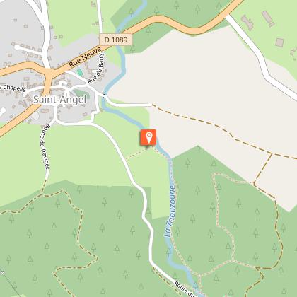
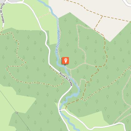
This trail offers a beautiful insight into the Haute-Corrèze. Its history and heritage, forests, and landscapes are our invitation to get away from it all.Cross the bridge over the Augières stream and go up the Pradal road (view of the priory and its terraces). Leave the road to enter the meadow on the left. Follow the fence on the right and go down to the footbridge, which you have to cross. Follow the Triouzoune along the path on the right.Take the second footbridge and as you leave it, take a right turn to the road. At the road, go left to the bridge.At the bridge, cross the Triouzoune and then go through the farm and stables. At the first crossroads, turn right. In La Boëtie, take the track on the left at the corner of the old farm and pass the bread oven. Follow the path between the spruce trees.Take the path on the left. Continue for 150 m and take the next on the left (view over the Massif of Sancy and the Monts du Cantal).Cut across the D 108 and continue on the opposite side of the road. Continue through the woods. At the crossroads, take the left-hand path and go through the village of Lannet. Leave the road and take the left-hand path to the road.When you reach the D 108, cross the road and continue straight ahead for 200 m, then take the path opposite, which passes in front of the water reservoir and continue straight ahead until you reach the village of Saint-Angel.Take the wooden staircase that leads to the priory terraces. Pass through the cemetery and take the Rue du Fort to reach the starting point of the hike.
Technical Information
Altimetric profile
Starting point
Steps


Additional information
Departure
Place de la Mairie, Saint-Angel
Arrival
Place de la Mairie, Saint-Angel
Ambiance
Standing on its promontory since the 12th century, the imposing priory of Saint-Michel des Anges takes hikers under its protection before they escape towards the Triouzoune valley, then walk up through woods and hamlets to find an old 'chapoule' or watering place while they admire the diversity of the landscape. Two variants allow you to shorten the main route.
Access
From Meymac, take the D 979 road towards the A 89 motorway. When you reach the D 1089, in the centre of Saint-Angel, turn right towards Tulle, then 100 m further on, turn left at the post office and the town hall. Park in the car park.
Advised parking
Place de la Mairie, Saint-Angel
Advice
This route is a shortcut to a longer 12 km route and also includes a 6 km shortcut. These circuits are described in a separate description sheet.
