Alert
Alerts
CHEMIN D'EN BASTIDE


Description
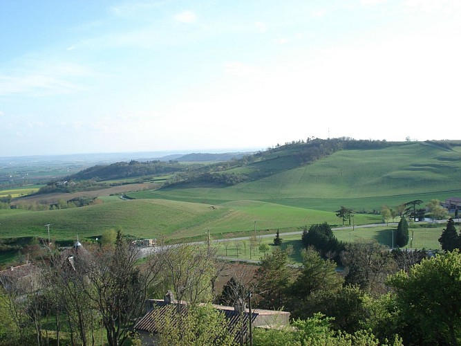
In the heart of Lauragais, from the small village of Saint-Félix-Lauragais, 5.2 km of trails through fields once used to grow woad. You'll see plenty of reminders of this glorious past along the way!
This walk takes you over the hills and the valley north Saint-Félix-Lauragais.
You can view or download this walking map from our website by clicking on the link in the contact details.
It is also available from the tourist information offices in Revel, Sorèze, Saint-Félix Lauragais, Saint-Ferréol and Les Cammazes.
Technical Information
Altimetric profile
Starting point
Points of interest


Additional information
Signage
Yellow
Detailed stages
1st step Departure - From Place Guillaume de Nogaret corner, walk down Rue des Nobles.
Step 2 - At Porte des Escudiés, turn left. After 60 metres, turn right into Rue des Pénitents. Then continue straight ahead on a dirt track for a good while.
Step 3 - At the junction with the small road, turn right. In the shallows, turn right again. After the small willow-lined reservoir, turn left towards En Marret.
Step 4 - On the ridge, turn right onto the road, route départementale (with views of La Lande wind farm, Revel plain and Montagne Noire). After the last houses and under the mills, turn right. 50m further on, go left up the dirt track and then left again on a narrow grassy path.
Step 5 - Cross the road and go up into the park. Once you reach the 2 columns, the remains of a gateway, go up towards the castle wall and turn left along the esplanade.
Step 6: arrival - After Déodat de Séverac statue, continue straight ahead on Promenade du Midi and after 150m turn right into the passageway under the houses that leads to Place Guillaume de Nogaret.
Elevation gain
114 (Low)
Services at the starting point
Car parking
Public toilets
Contact
Tel : 05 62 18 96 99
Website : www.auxsourcesducanaldumidi.com/brochure/fiches-rando/
Email : contact@auxsourcesducanaldumidi.com
Start and end town
SAINT-FELIX-LAURAGAIS
Data producer
Contact : HAUTE-GARONNE TOURISME / OFFICE DE TOURISME INTERCOMMUNAL AUX SOURCES DU CANAL DU MIDI LAURAGAIS REVEL SOREZOIS
Phone : 05 62 18 96 99
This information comes from the Haute-Garonne Departmental Tourism Network and is synchronized as part of the partnership between Cirkwi and Haute-Garonne Tourisme.
Data author
