Alert
Alerts
Sentier des Muletiers
Description
A walk on old mule trails that takes you from the edge of Lake Sainte-Croix to the plateau to enjoy a breathtaking view of the lake and the lavender fields.
From the car park, follow the road along the lake towards the water sports centre and the campsite (Chemin de Paraloup), on the left. Follow the small road for 800 m along the edge of the lake. Go along some terraces (dry stone walls), olive trees and picnic areas.
At the intersection, continue straight on the small road. Continue for 800 m to the path of Muleteers going up to the plateau. Climb the path on the left along a ridge. Higher up (109 m difference in altitude), at the intersection, go up the path on the left, crossing. At the end of the climb, follow the path on the left for 150 m along the plateau, at the edge of the field. Go down to the left on the marked route (PR). Join the road at the point and return to the starting point by the route taken on the way there.
Technical Information
Altimetric profile
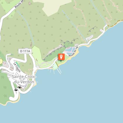
Starting point
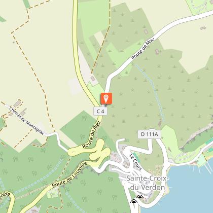
Points of interest

Additional information
Environments
Panoramic view
Waterside
Lake view
In the country
Updated by
Office de Tourisme Provence Alpes Digne les Bains - 02/06/2026
www.dignelesbains-tourisme.com
Report a problem
Distinctions
Listed PDIPR
