Alert
Alerts
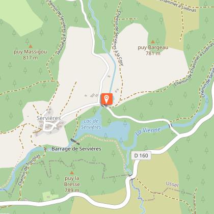
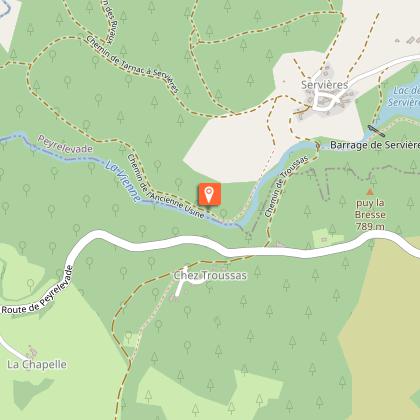
The Servières Rocks

Description
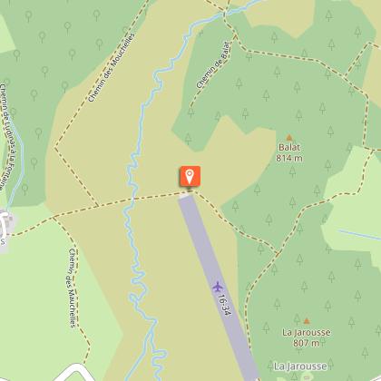
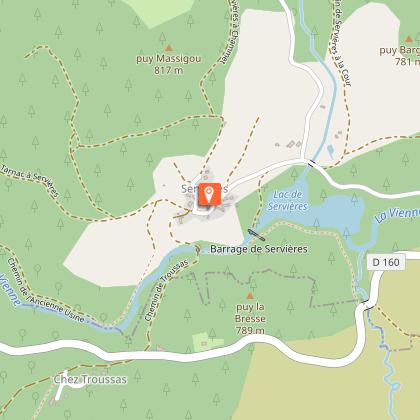
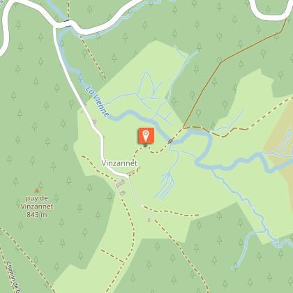
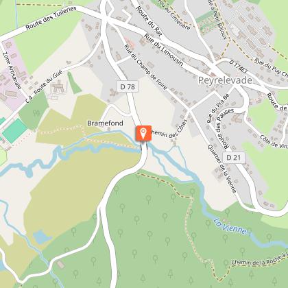
A beautiful route where the Vienne river guides you through a variety of landscapes.Depart from Pra Bé. Go up to the Place de la Fontaine. Head towards Gentioux. At the church, on the right, go towards St-Setiers, then left towards the cemeteryAt the cemetery, the track on the left leads to Chez Le Prou.In the village, turn left and then immediately right. At the last house, take the track to the right. At the first crossroads, turn left. Next, go right to the end of the airfield runway; go up to Ludinas.In the village, turn left. At the departmental road, turn right for 20 m. then left onto the track. At the next crossroads, take the track on the left. It joins a road that you take on the left towards Lake Servières.At the lake, turn right then left to go into Servières. Go straight through the village.Continue along the path, which will describe a loop, ignoring several tracks on the left. Go past the site of the rocks and return to point 5. Take the path to the right: go past the bakery and down towards the Vienne.After the bridge, turn left onto the path that runs alongside the river. Pass to the right of the embankment; go on alongside the lake to reach the road.Turn left and, after the bridge, follow the track on the right that rises into the Chamboux forest. On the flat, the track on the left leads to Vinzannet.In the village, at the crossroads, go straight ahead. The road becomes a track leading down to the Vienne. After the bridge, go straight on to join the road.Follow it to the right for 300 m. At the crossroads with the Ludinas road, follow the track to the right. Cross the Vienne. At the next crossroads, turn left; join the road and follow it to the left. Descend to a wetland.Go along beside it, passing below the gîtes and the campsite. Pass below the play area and cross the Rebière Nègre peat bog by the decking; straight on to join the road and the Croix du Mouton, the sheep cross.Follow the road to the left, then the right. keep going straight ahead: the Chemin des Côtes returns to the start.
Technical Information
Altimetric profile
Starting point
Steps
Points of interest


Additional information
Advice
At the Servières site, this route crosses another route starting from Tarnac. Follow the route markings carefully.
Is in the midst of the park
The national park is an unrestricted natural area but subjected to regulations which must be known by all visitors.
Advised parking
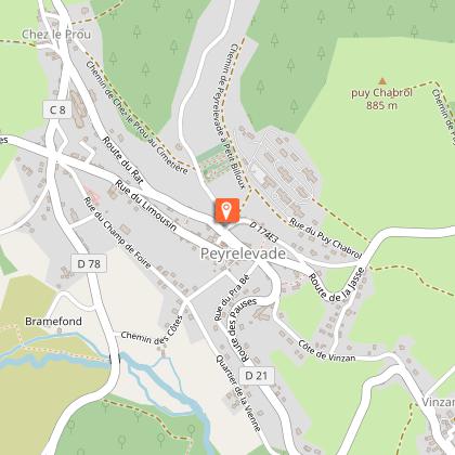
Pra Bé Square, Peyrelevade
Access
From Meymac, follow the D36 towards the town centre. Millevaches. 4 km after Millevaches, take the D21 towards Peyrelevade.
Arrival
Pra Bé Square, Peyrelevade
Ambiance
A circuit marked by water and granite: after exploring Lake Servières and going through the village of the same name, the walk leads to the Rocks of Servières. Erosion has sculpted these strange blocks of granite, where the River Vienne flows through the gorges. You then follow a Roman road alongside the lake and go up into the Chamboux state forest. On the way back, you can admire the Vinzannet bridge, the Luguet mill, the Rebière Nègre peat bog and the Mouton cross.
Departure
Pra Bé Square, Peyrelevade
