Alert
Alerts
Rif Bruyant lakes
Description
A challenging and fairly demanding hike that will take you from the Roizonne Valley up to the high-altitude lake of Rif Bruyant. Along the way, you’ll pass through the hamlet and the Rif Bruyant refuge, following the course of this mountain stream.
A challenging hike through stunning landscapes, from the Roizonne Valley to the high-altitude lake of Rif Bruyant
Accompanied by the stream all along the way, you’ll cross a surprisingly diverse range of landscapes as you ascend: The hamlet of Rif Bruyant, with architecture typical of the valley and meadows bordered by “clapiers” (stone piles from field clearing), Then the cirque where the lake lies nestled, And finally, breathtaking views on the way back.
Route:
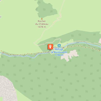
Start from the Mollard parking area.
Follow the small road to the heart of the hamlet, then continue on the path toward the Rif Bruyant valley.
Ignore the path on your right heading to La Rochette and continue straight until you reach the Rif Bruyant farms. Walk through them; the path narrows into a trail between two dry-stone walls.
Continue uphill through the woods and into the cirque, just after crossing a dry streambed—take care not to lose the trail here.
Cross the meadows (abundant orange lilies and martagon lilies), then rejoin the path that winds through the forest in several switchbacks. Cross the stream once more and enter the woods where you'll find a charming forest cabin.
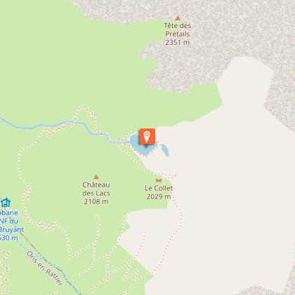
At the signpost indicating the lake, take the left-hand trail, which follows a forest balcony path leading up to the lake's outlet. As you climb among the rocks, don’t miss the bridal veil waterfall on your right.
Return:
You can return via the same route or continue up to the col (mountain pass) by following the trail on the right. The descent is via long switchbacks.
Important!
You are in a protected natural area. Please:
- Stay on the marked trails
- Keep your dog on a leash
- Do not light fires
- Take your trash with you or dispose of it in the nearest bins
- Preserving this environment is vital!
- For swimming, please use the designated lake at the Alpe du Grand Serre resort.
Technical Information
Altimetric profile
Starting point
Points of interest
Additional information
Updated by
Matheysine Tourisme - 24/11/2025
www.matheysine-tourisme.com/
Report a problem
Environments
In the country
Lake view
Mountain view
Mountain location
Lake 5 km away
Close to GR footpath
Overview on river
Waterfall view
Open period
From 15/06 to 15/10 daily.
Subject to favorable weather.
Contact
Phone :
04 76 56 24 72
04 76 56 24 72
Email : ags@matheysine-tourisme.com
Website : https://www.matheysine-tourisme.com/fr/alpedugrandserre/
Facebook : https://www.facebook.com/alpedugrandserre/
Type of land
Stone
Ground
Not suitable for strollers
Topo guides and map references
Topo guides references :
Carto-Guide La Matheysine
Animals
Yes. In this protected natural area, dogs must be kept on a leash.
Data author
