Alert
Alerts
Hiking: in the footsteps of the smugglers


Description
This hike for experienced walkers leads to majestic peaks steeped in history. A true immersion in unspoilt wilderness, via ancient hidden paths...
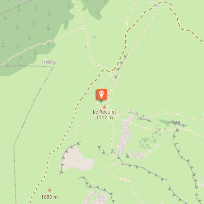
A demanding hike between deep forests and verdant alpine pastures, following in the footsteps of smugglers who, in the 18th century, used these discreet paths to transport their clandestine goods. Departing from Chézery-Forens, the route follows the wild Valserine river, before beginning the ascent to Le Reculet, culminating at 1719m. Capped by its famous cross, erected in 1892, this summit offers breathtaking views of the Lake Geneva basin and Mont Blanc on a clear day. The descent to the alpine chalets (La Polvette and La Capitaine) leads to the Passage des Chézerands and the hamlet of Rosset.
The Reculet cross, weighing 1600 kg, was carried to the summit on the backs of four Thoiry residents.
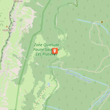
Good to know - Protected area
Part of the route passes through the Haute Chaîne du Jura National Nature Reserve, which is subject to special regulations:
Dogs are not allowed, even on a lead.
Please respect these rules to preserve the richness of this exceptional environment.
Technical Information
Altimetric profile
Starting point
Points of interest
Date and time
- From 01/04/2026 to 30/11/2036
- From 01/04/2027 to 30/11/2037
Additional information
Contact
Phone : 04 50 28 09 16
Email : contact@paysdegex-tourisme.com
Website : https://www.paysdegex-montsjura.com
Open period
From 01/04 to 30/11 daily.
Subject to there being no snow.
Subject to favorable snow and weather conditions.
Environments
Mountain view
Panoramic view
Mountain location
In a nature reserve
River -5 km away
Type of land
Ground
Topo guides and map references
Topo guides references :
Hiking in Pays de Gex and the Haute Chaine du Jura: on sale at Pays de Gex tourist agencies: 9€.
Map references :
3328OT - CRÊT DE LA NEIGE
Updated by
Office de Tourisme du Pays de Gex - 16/04/2026
www.paysdegex-montsjura.com
Report a problem
Reception complements
▶ Before setting off:
Check the general and local weather forecast to ensure there will be no precipitation.
Find out about the approach walk, the altitude of the route, the walking time, and possible escape routes (IGN map, GPS, guidebook, etc.).
Assess the possible risks by consulting mountain professionals, mountain huts, and lodges.
Inform a friend or family member of your destination and contact them again in case of any changes: departure and return times, number of participants with each person's telephone number, vehicle(s), parking.
Avoid setting off alone. Use equipment that is suitable for the activity, properly adjusted and in good condition, including a head torch, a complete first aid kit, a survival blanket, etc.
In case of an emergency, call 112 (European emergency number).
Guidebook with maps/step-by-step
(1) From Chézery-Forens, follow the yellow signs along the main street. Pass the gendarmerie, go straight on, then leave the village and head upstream. The path winds through a pretty combe before reaching the first intersection on the right.
(2) Continue as far as Fontaine Bénite, then take the path that gradually rises towards Les Platelets, before reaching the peaceful hamlet of Rivière.
(3) Cross the main road and start climbing towards Le Vernay.
(4) On the way, a bridge spans the Troubléry stream. After crossing the stream, continue uphill as the path becomes more deeply entrenched in nature.
(5) At Vernay du Dessus, turn left around the house. The narrower path winds through the forest, crossing several times a white track leading to Chalet de Lachat.
(6) Shortly afterwards, Chalet de Lachat appears below. Ignore the descent and continue left towards Le Reculet. You then reach the edge of the forest, where the high alpine pastures open up beneath you. The view opens up over the Haut Jura with the Crêt de Chalam in the background. Continue up to the next junction.
(7) A few more steps and the Chalet de Thoiry comes into view accompanied by the Reculet cross. Continue for several hundred metres to reach the highest point of the hike: Le Reculet (1718 m).
(8) The summit offers a 360° panoramic view: to the south, Geneva, the Lake Geneva basin, the Alps and the spectacular Mont Blanc; to the west, the Jura massif, Crêt de Chalam, Crêt aux Merles and the Valserine valley. From the crossroads turn right and follow the ridge south along the GR (red and white markings). The landscape is grandiose, punctuated by the sound of bells.
(9) Cross the Plovette and Capitaine mountain pastures and skirt the Roche Franche. The path oscillates between gentle ascents and descents.
(10) The ridge continues for a while before plunging into the forest. The path crosses several attractive combes and reaches the Chézerands pass, just before the Gralet chalet.
(11) Turn right and begin the descent into the valley. The yellow markings reappear to guide to the end of the route.
(12) The path winds through the woods crossing the forest road several times. The descent is rapid to the village of Le Rosset.
(13) Cross the hamlet and continue to the right. The path skirts a field, bordered by a hedge, before joining an alsphalt road. Continue along this road.
(14) At the first intersection, turn left onto a white track. Pass the Grande Bossonaz farm, then follow the path along the field to Bellaigue.
(15) Finally, turn right and stay on the white track which leads straight back to Chézery-Forens.
Animals
No. Dogs strictly forbidden in the Nature Reserve
Data author
