Alert
Alerts
Hiking : Lélex - The Valserine, a wild river
Description
Accessible to all, this beautiful walk alongside the Valserine river whose cool, clear waters meander through lush greenery.
This pleasant riverside walk is open from April to November. It runs alongside the first classified wild river in France, which gives its name to the valley. The Valserine has shaped both the landscape with its floods and the lives of its inhabitants as can be seen by the ruins of several mills and the region's lapidary tradition. The route takes in wild paths, meadows and board walks and is partly accessible for handicapped access.
Technical Information
Altimetric profile
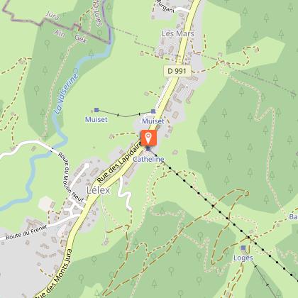
Starting point
Date and time
- From 01/04/2026 to 30/11/2036
- From 01/04/2027 to 30/11/2037
Additional information
Contact
Phone : 04 50 28 09 16
Email : contact@paysdegex-tourisme.com
Website : https://www.paysdegex-montsjura.com
Open period
From 01/04 to 30/11 daily.
Subject to there being no snow.
Subject to favorable weather.
Environments
Riverside
Waterside
Close to GR footpath
Forest location
In the country
Mountain location
Village centre
Resort centre
Type of land
Ground
Hard coating (tar, cement, flooring)
Topo guides and map references
Topo guides references :
Hiking in Pays de Gex and the Haute Chaine du Jura: on sale at Pays de Gex tourist agencies: 9€.
Map references :
3328OT - CRÊT DE LA NEIGE
Updated by
Office de Tourisme du Pays de Gex - 09/07/2026
www.paysdegex-montsjura.com
Report a problem
Reception complements
▶ Before setting off :
Check the general and local weather forecast, and make sure there's no precipitation.
Find out about the approach route, the height of the itinerary, the time it will take to complete the climb, and any possible escapes (IGN map, GPS, topo-guide, etc.).
Evaluate possible risks by asking mountain professionals, mountain huts and gîtes.
Inform someone close to you of your objective, and contact them again in the event of any changes: departure and return times, number of participants with telephone numbers for each, vehicle(s), parking, etc.
Avoid setting off alone, and use equipment that is suitable for the activity, adjusted and in good condition: headlamp, complete first-aid kit, survival blanket, etc.
In the event of a problem, call 112 (European emergency number).
Guidebook with maps/step-by-step
(1) Take the small road below the tourist information office towards the village center.
(2) It passes the bakery, the town hall and the post office before rejoining the road.
(3) At the Chapelle bar, turn right down a small road, then right again, leaving the asphalt for a path through a meadow.
(4) Follow the path which weaves its way through grasses and copses, before reaching a pretty stretch on the banks of the Valserine on a board walk which facilitates progress over this damp, natural terrain.
(5) The path leads to the Moulin Pierre-Louis bridge. Cross it, then immediately turn left towards Les Calamettes, then Moulin Neuf.
(6) At the end of the path, turn right along the Valserine, until you reach the Fruitière bridge.
(7) All that is left to do is climb back up to the village and return to the starting point, with a light heart and your mind full of nature and culture.
Animals
Yes
Data author
