Alert
Alerts
Cap N'Dua Trail
Description
Pleasant itinerary that links the Cap N'Dua parking to Anse Majic (Bonne Anse), passing by the top of the cape where the lighthouse regulating the navigation in the Havannah Channel is located.
• You are in a nature reserve and near customary lands, please respect these places.
• Dogs are prohibited, even on a leash.
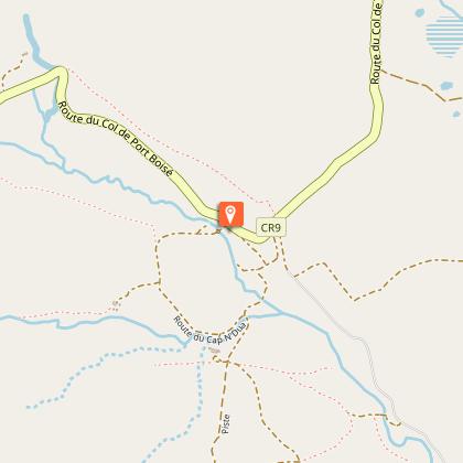
D Car park (GPS: 698 432 – 7 522 793; alt. 132m): go west on the good track which continues beyond the barrier. Gradually, the bay of Prony is revealed in the axis of the walk (the track, on the right, goes down directly to Anse Majic).
1 Fork (GPS: 698 139 – 7 522 832; alt. 145m): turn left towards the south to climb to the top of the cape where the white turret of the lighthouse sits (in the hairpin to the left, a small orientation table makes it possible to identify the main points of the landscape). Reach the top of the red earth cone.
2 Cap N’Dua Lighthouse (GPS: 698 130 – 7 522 632; alt. 182m): (from this viewpoint, you can see the entire large southern lagoon and, in the distance, on a clear day, the Isle of Pines with, on the right of the plateau, clearly visible, the N'Ga peak; alt. 253m; observation table). Then take the short path that plunges towards the sea, due south. It winds between the blocks of cuirass on a very eroded ground and joins an observation faré as well as ruins (these are those of the old building of the post office and the telegraph of Cap N'Dua, opened to the public on 17 April 1891.
This building also housed, for a short time, the two lighthouse keepers, before they moved to the better protected site of Anse Majic).
3 Whale Observatory (GPS: 698 107 – 7 522 527; alt. 170m): immediately after the ruins, turn right, towards the west, to follow a red earth path (> slippery in wet weather). It gradually loses altitude and joins the track that climbs from Anse Majic.
4 Intersection (GPS: 697 777 – 7 523 024; alt. 108m): turn left and descend towards the seaside for about 60m.
5 Intersection (GPS: 697 740 – 7 523 063; alt. 105m): leave the track to take the path which goes right to the north. It descends into the bush and follows, at a distance, the left bank of a small thalweg. Follow it to the ramp to a lookout.
6 Lookout access (GPS: 697 667 – 7 523 334; alt. 59m): continue straight ahead to reach the small natural balcony overlooking the bay, then turn back to return to the main route. At the intersection, turn left. The trail descends and plunges into a beautiful dry forest. It meanders between the trees
following a trickle of water (most often dry), then reaches an old track that runs along the seaside, between mangroves and forest, at the bottom of Anse Majic.
7 Seaside (GPS: 697 319 – 7 523 452; alt. 2m): turn right and join the old wharf along the coast to the north-west.
8 Former wharf (GPS: 697 324 – 7 523 444; alt. 2m): (The rip-rap is still visible. It made it possible to supply the lighthouse keepers who were staying there. The small bay lined with mangroves often welcomes boaters who come to anchor there to find a sheltered and peaceful spot. Formerly, the camp of the lighthouse keepers was nestled near the information panel, located a few meters south of point n° 7).
For the return, there are two possibilities:
• go up the same path to reach points 7, 6, 5, 4, 1 and reach car park D.
• take the old track to shorten the route a little (> slippery in wet weather).
© Text by Jean Francis Clair
Technical Information
Altimetric profile
Starting point
Additional information
Contact
Phone : +687 20 30 40
Website : https://www.province-sud.nc
Facebook : https://www.facebook.com/provincesud/
Open period
All year round on Tuesday, Wednesday, Thursday, Friday and weekends.
Updated by
Sud Tourisme Nouvelle-Calédonie - 19/01/2026
Report a problem
Type of land
Rock
Stone
Ground
Grit
Not suitable for strollers
Topo guides and map references
Topo guides references :
Description sheet available for download (province-sud.nc) or in paper version in tourist organizations.
Map references :
Map DITTT n°25 Prony
Location complements
Location: Port-Boisé, 80 km from Nouméa, by the R.P. 3, C.R. 7 and R.M. 14.
Parking: located just at the foot of the small summit that bears the lighthouse.
Reception complements
FFrandonnée® grading
* Effort: IBP 35 Fairly easy (light blue)
* Technical difficulty: easy (green)
* Risk: low (green)
* Overall grading: Fairly easy (light blue)
Tricky passages
Sometimes slippery in wet weather. No water (a random creek runs at Anse Majic).
Be careful! Many heavy trucks travel at high speed on the southern roads leading to Port-Boisé.
Animals
No. Protected area where pets are not permitted.
