Alert
Alerts
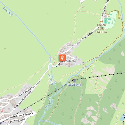
Summer hike : La Villette
IGN cards


Description
This easy hike introduces you to Vaujany and its highest hamlet: La Villette. A journey to the heart of rural life in the past, a time not so long ago, will be told to you with anecdotes.
Technical Information
Altimetric profile
Starting point
Additional information
Environments
Mountain location
Updated by
Office de Tourisme de Vaujany - 22/12/2025
www.vaujany.com/fr/
Report a problem
Open period
From 01/05 to 31/10/2025.
Subject to favorable weather.
Contact
Phone : 04 76 80 72 37
Email : info@vaujany.com
Website : https://www.vaujany.com/fr/
Reception complements
Advice :
- Check the weather conditions before you leave.
- In case of emergency call 112.
- Adapt your clothing to the activity: bring good walking shoes, a windbreaker and a cap ....
- Bring snacks and water.
Guidebook with maps/step-by-step
From the tourist office square, head towards the road, in the direction of the bakery. Before the bakery on the right there is a small alleyway leading upwards. Take it. Always take the uphill path on the left. At the top, you will see the sign for Chemin de l'étendard. Turn right and you will reach the road. Continue uphill. Leave the road to Rochas and in the bend an alley goes straight on, called the "grand chemin", follow the yellow markings. Follow the main road again, up to the top. There, in front of you, a path in the grass goes ahead of you, yellow signs indicate the beginning of the path towards La Villette. Follow this well-marked path through the fields. Continue straight ahead, you arrive at the top of the hamlet of La Villette. You continue following the wooden signs, indicating the Collet. When you arrive at the Collet, you will find a restaurant, and behind a pump track, you follow the road behind, downhill. The road continues, and go straight downhill, you always follow this road track, until the intersection where you find yellow signs indicating Vaujany, La Villette and plan du moulin. You take this direction, on the right. You enter the hamlet of La Villette by the mill. Then you continue, to arrive in the heart of the village, the common oven on the right. The centre of Cote Belle is on the left, at the entrance to the village. Take the time to walk through the hamlet via these small streets. To return to Vaujany, take the road, and at the end of the hairpin bend take the path down to the left. It takes you back to the bottom of the resort. To return to the tourist office, turn right, the loop is complete!
Animals
Yes
Data author
