Alert
Alerts
Summer hike : Couard Cavalles
IGN cards


Description
A beautiful technical itinerary will take you on a journey between glacial lakes and snowy peaks. An incursion into the world of high mountains and its history during the Second World War.
Technical Information
Altimetric profile
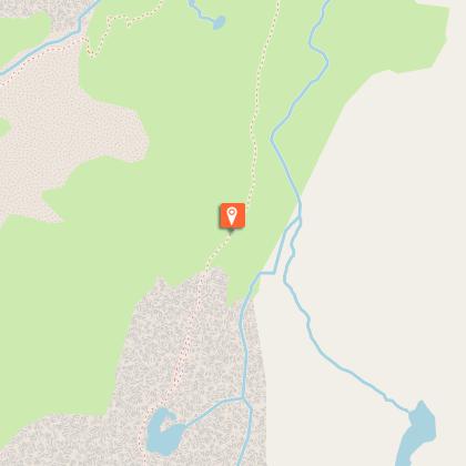
Starting point
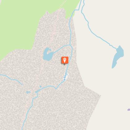
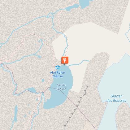
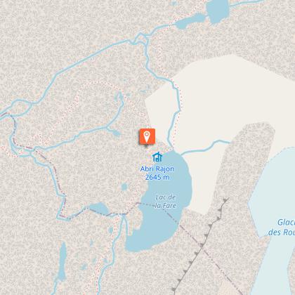
Points of interest

Additional information
Environments
Mountain location
Updated by
Office de Tourisme de Vaujany - 22/12/2025
www.vaujany.com/fr/
Report a problem
Open period
From 01/06 to 31/10/2025.
Subject to favorable weather.
Contact
Phone : 04 76 80 72 37
Email : info@vaujany.com
Website : https://www.vaujany.com/fr/
Reception complements
Advice :
- Check the weather conditions before you leave.
- In case of emergency call 112.
- Adapt your clothing to the activity: bring good walking shoes, windbreaker, cap, etc.
- Bring snacks and water.
Tricky passages
Stormy day to be avoided, technical hike with tricky passages: handrail. Respect the loop in the proposed direction.
Guidebook with maps/step-by-step
From the Tourist Office, take the road down to the left, in the bend, turn left to take the path going up towards the hamlet of La Villette, you go up until you reach the road you are following. You enter the hamlet, and follow the direction of the road to the mill, indicated in yellow sign Col du Couard. Always follow the yellow signposted Col du Couard. From the Col du Couard follow the route towards the Lac de la Fare. You walk between lakes and glacial plateau. At the Lac de la Fare you will find the Rajon shelter, and the sign for the descent to the Refuge de la Fare which you will follow. You arrive at the refuge of La Fare, be careful after the refuge technical passage; remain attentive. You reach the cable car arrival station. From the arrival station, go down the track in the direction of Clos Giraud, a track located to the north. This section is on a ski run. You arrive at the lac de retenue, and find the yellow signs on your left indicating Vaujany, la Villette. This downhill route takes you back to la Villette and you return to the hamlet via the route du moulin, and continue by the uphill route taken at the beginning of the hike.
Animals
No
Data author
